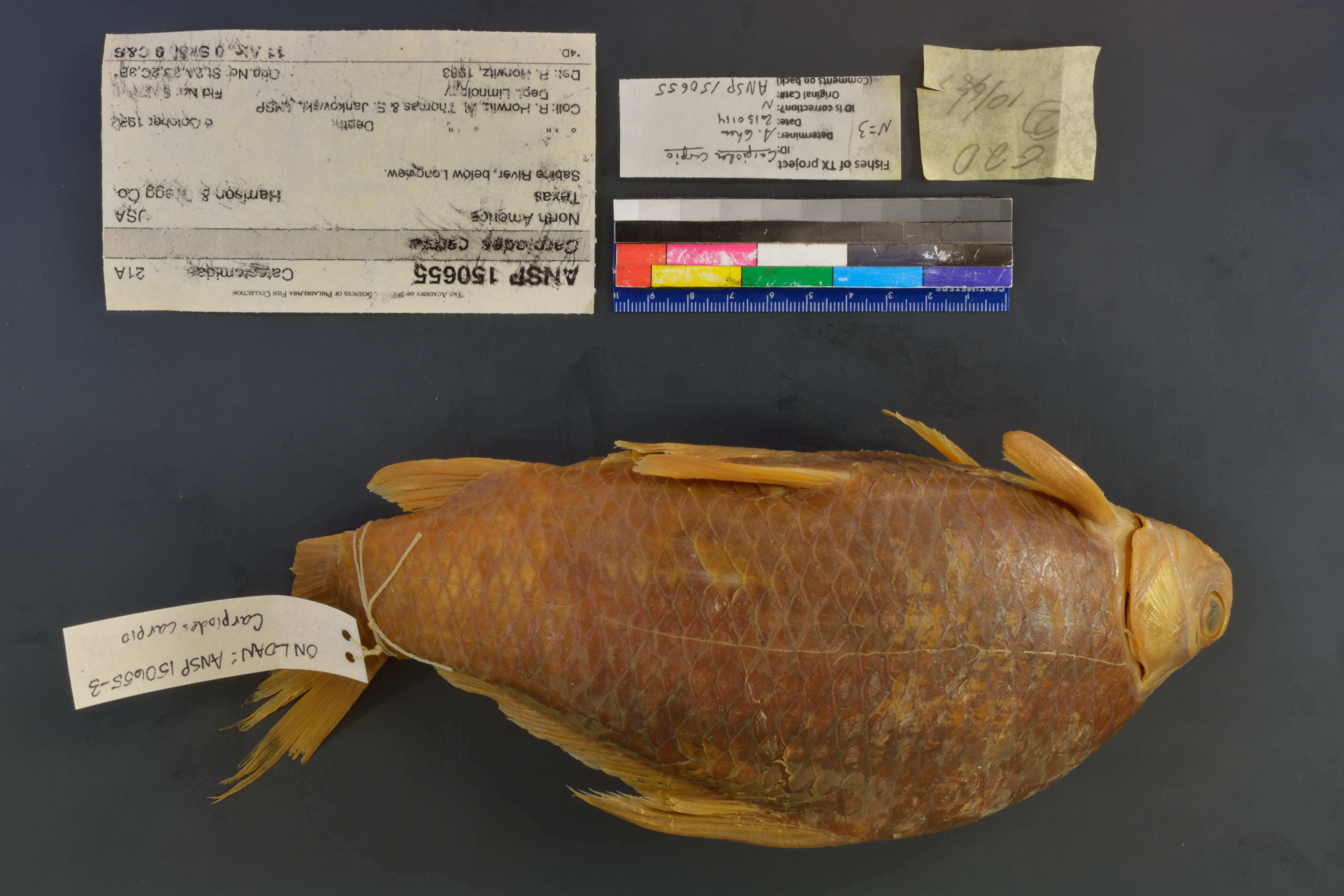
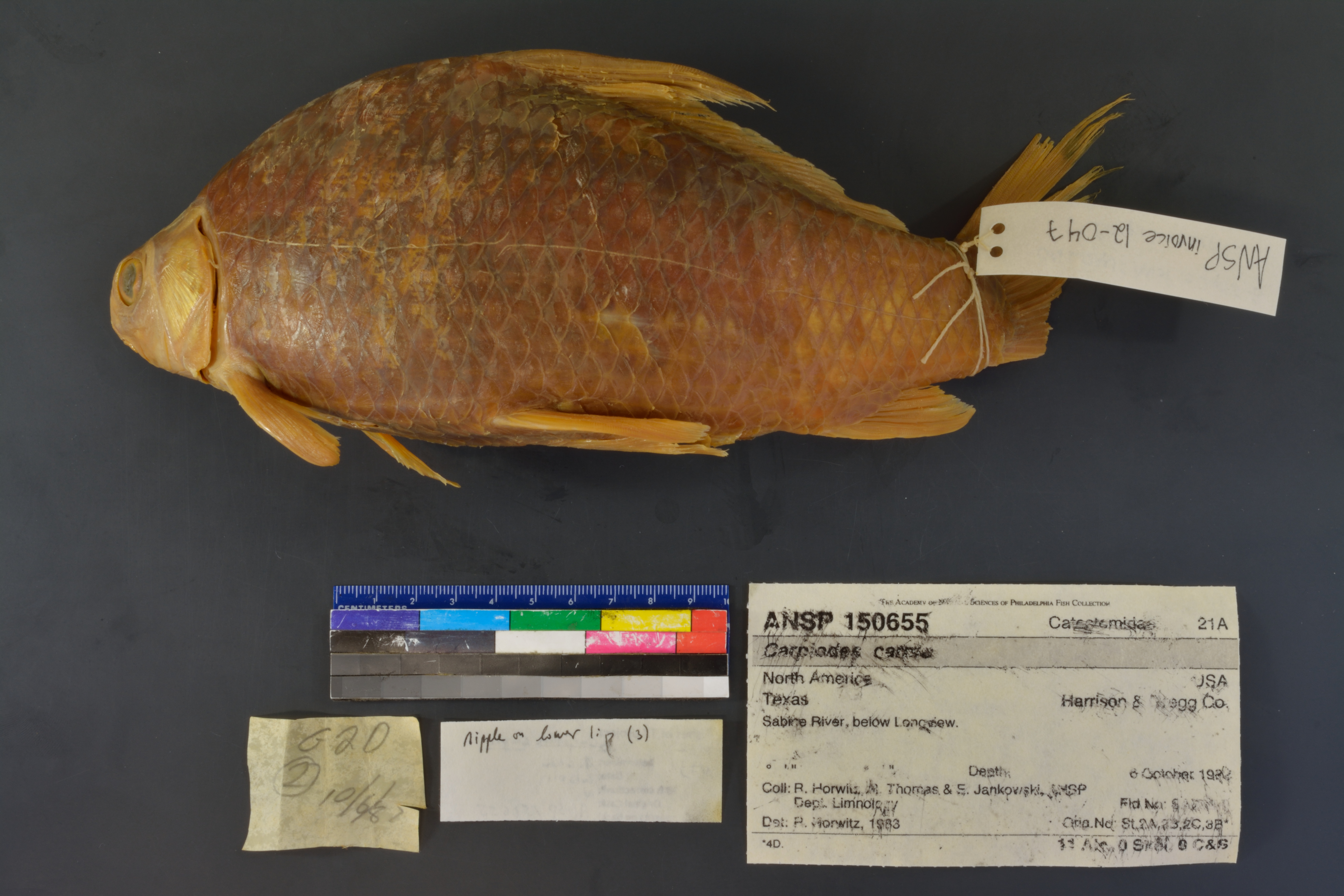
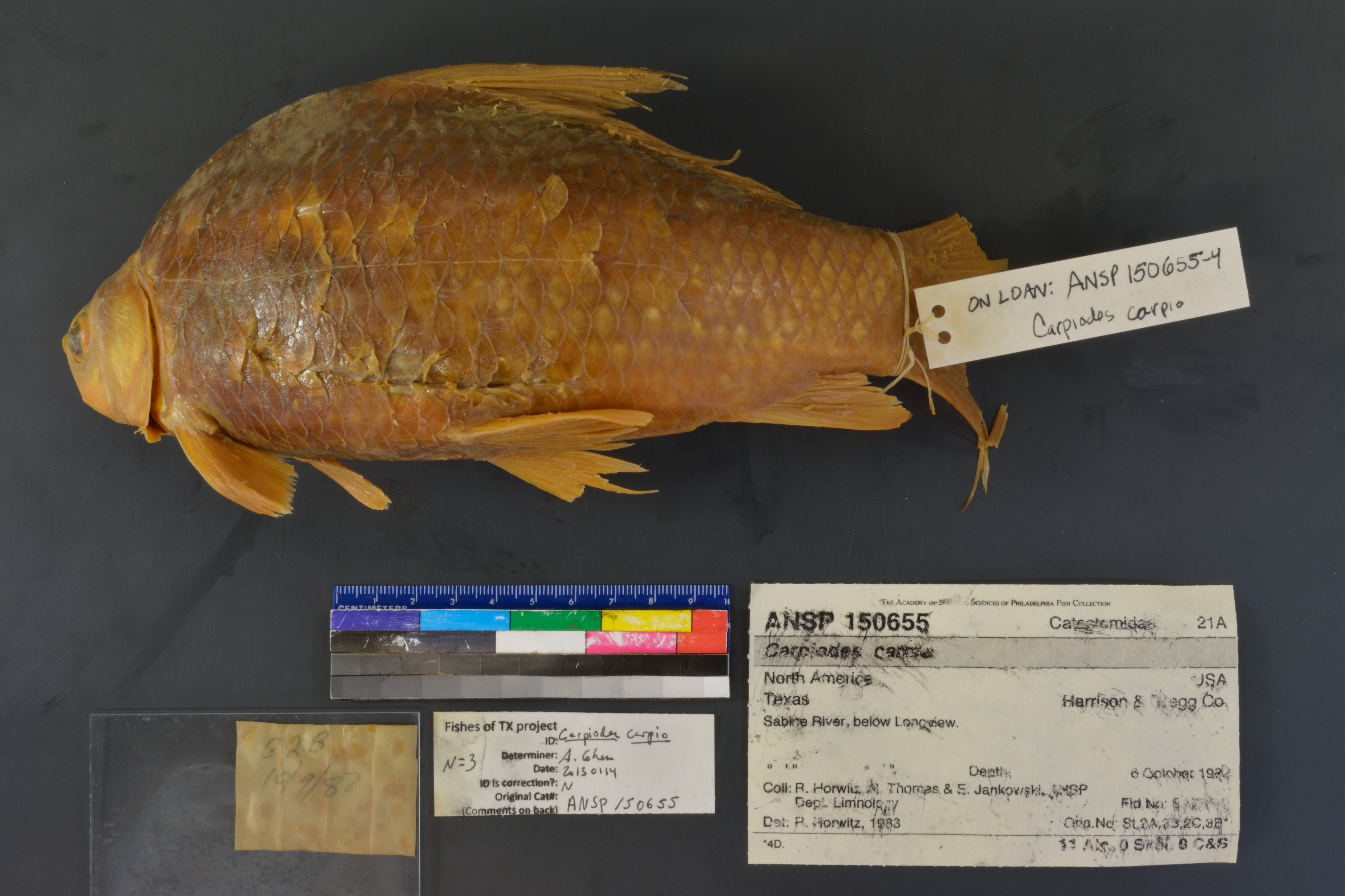
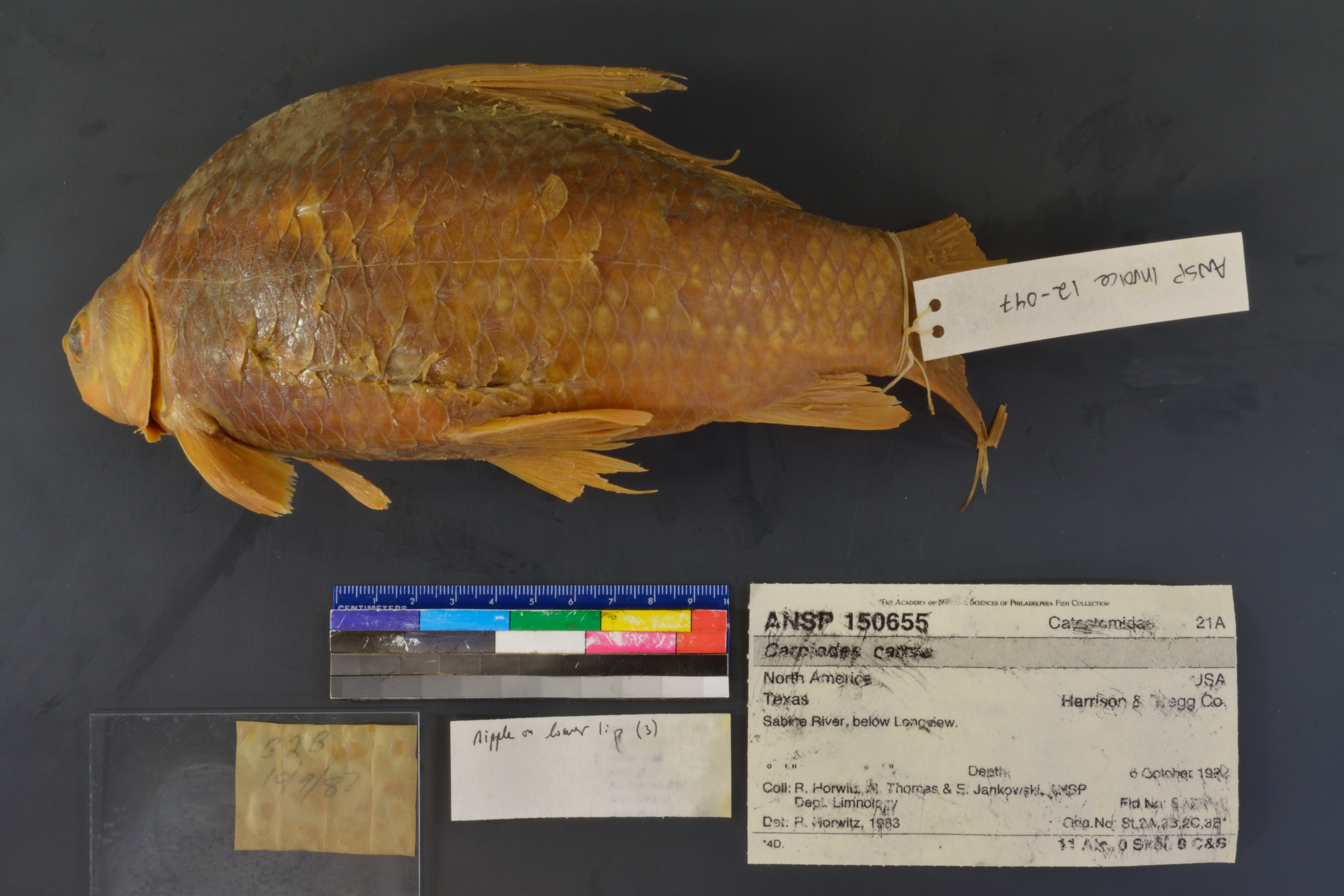
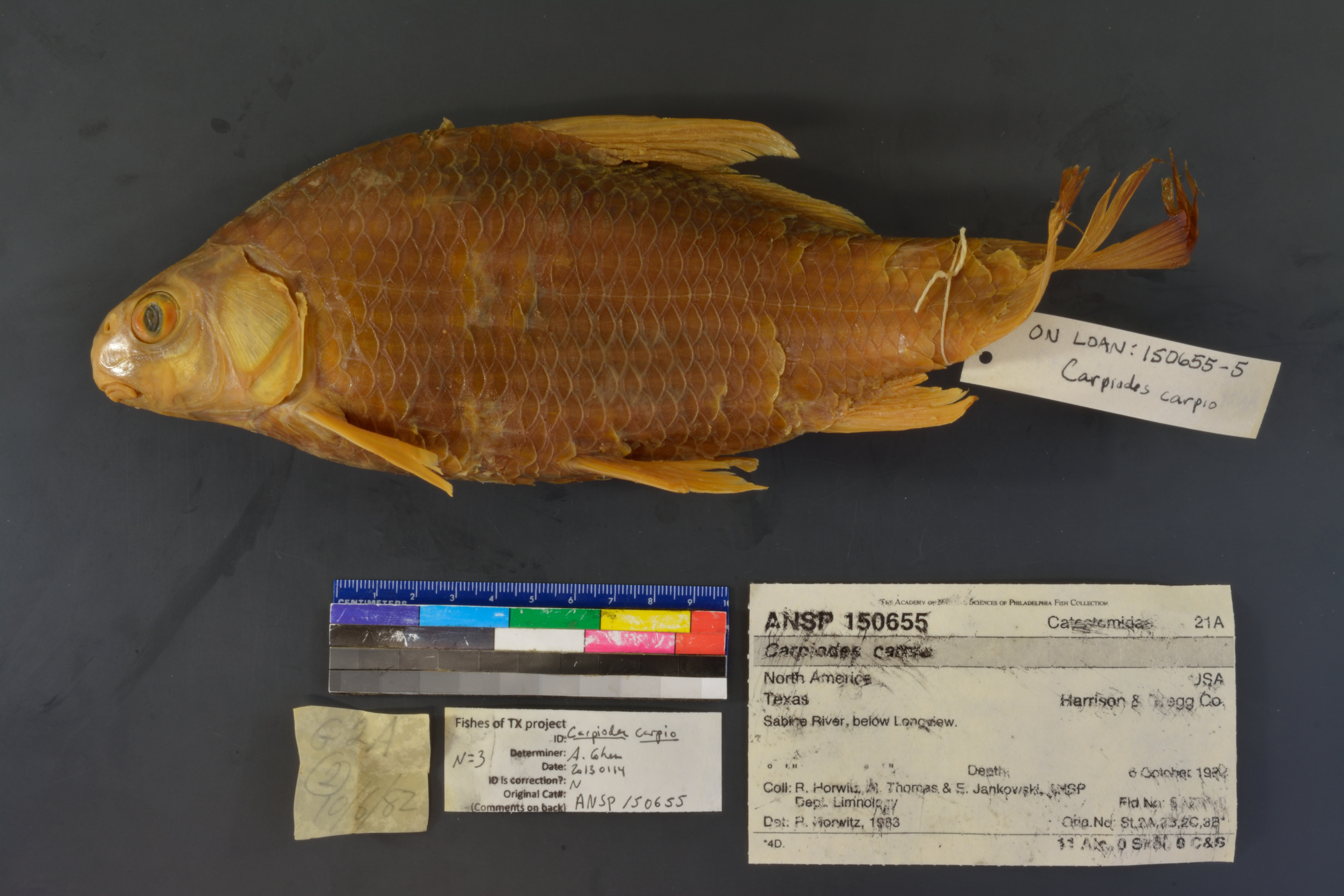
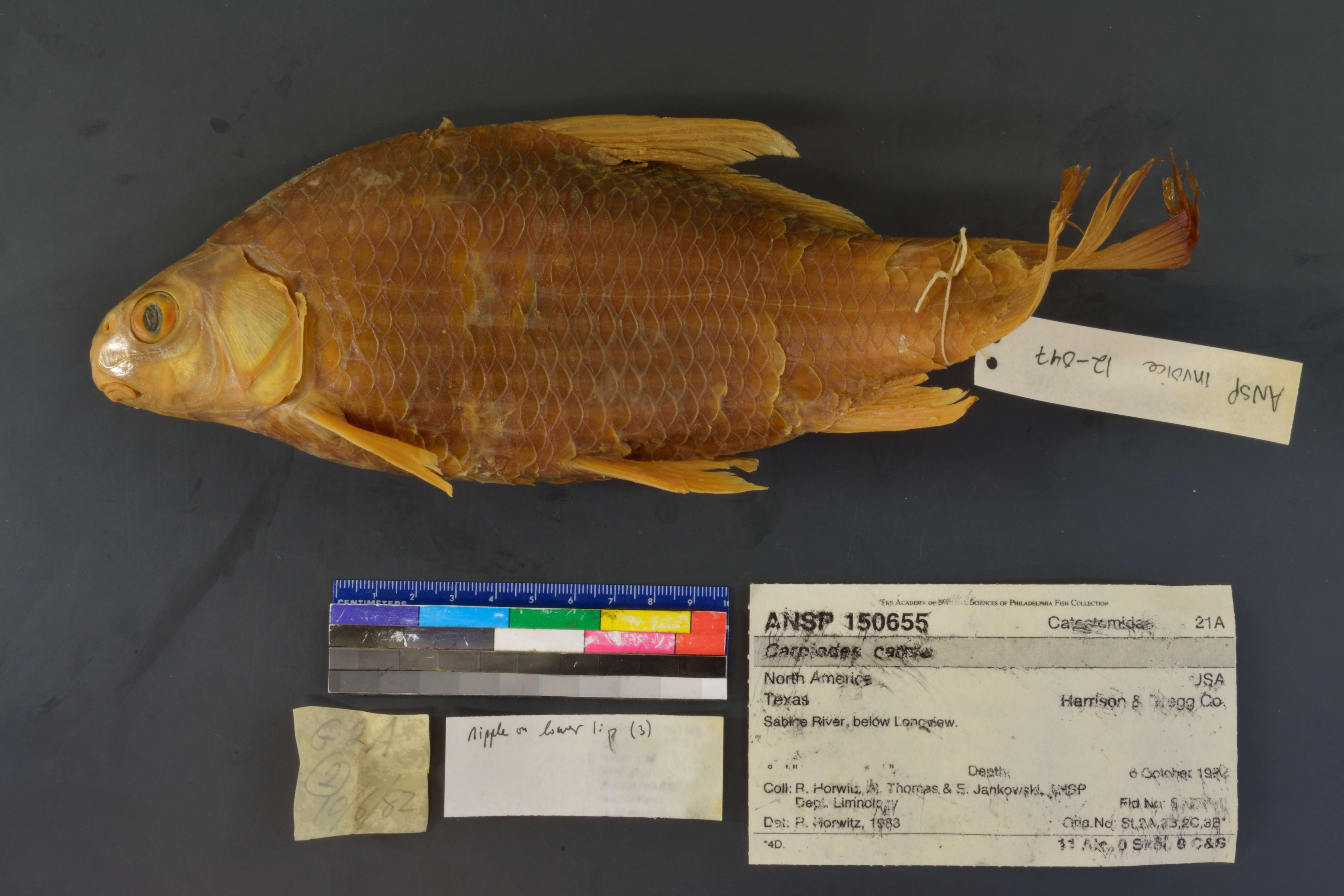
ANSP_150655
Not suspect, examinedPhotos
Map
Location
32.50601° N, 94.67944° W
(± 2266.0
m)
Taxonomy
GenusCarpiodes
Speciescarpio
Specimen
Num Specimens11
Preparation11 alcohol; 0 skeleton: 0 clr&stained
Identification
DeterminerR.Horwitz, 1983
Collection Event
CollectorANSP Dept. Limnology
Collected Date1982.October.6-1982.October.9
Field NumberSAB82-0
Geography
CountryUSA
StateTexas
CountyHarrison & Gregg Co.
LocalityBelow Longview.
Latitude DMS° ' ''
Longitude DMS° ' ''
Other
Group Number21A
Storage21J39
Previous NumberSt.2A,2B,2C,3B*
Primary Remarks*4D.
SalinityF
RemarksR.Horwitz,R.Thomas & E.Jankowski. Sabine sta.
Record Source
Source
Academy of Natural Sciences
(type: specimens)
Institution
Academy of Natural Sciences
(type: museum)
Curator
John G. Lundberg (but transitioning out)
Record Added
April 23, 2015
Record Last Modified
June 22, 2022
Data Processing Track
Track 2
From Data Set Received
04/2009 to 10/2010
Identification
Suspect Notes
None
Count
11
Current Determination
Determiner
Adam Cohen
Determination Date
Jan. 14, 2013
Determination Type
specimen examination
Identification Comments
Specimen examined and Id'ed for FoTX project. | nipple on lower lip is apparent and subopercle is triangular
Identification Confidence
High
Collecting Event
Collected
Oct. 6, 1982
– Oct. 9, 1982
Collecting Event ID
22146
Field Notes
There are no field notes available.
Locality
Region
Piney Woods
Jurisdiction
Harrison, Texas
Name
South of Longview, TX
Hydrography
Texas-Gulf Region
Sabine
Sabine
Middle Sabine
Cherokee Bayou-Sabine River
Mason Creek
Captive
no
Locality Photos
No locality photos available.
HUC 12
120100020602
Georeferencing Remarks
—
Georeferencing Annotation
It is unclear which body of water the original record refers to below Longview. Extent includes area half way to nearest named place of similar size, Gum Springs, TX.
Has not been Georeferenced because
—
Comments On ANSP_150655