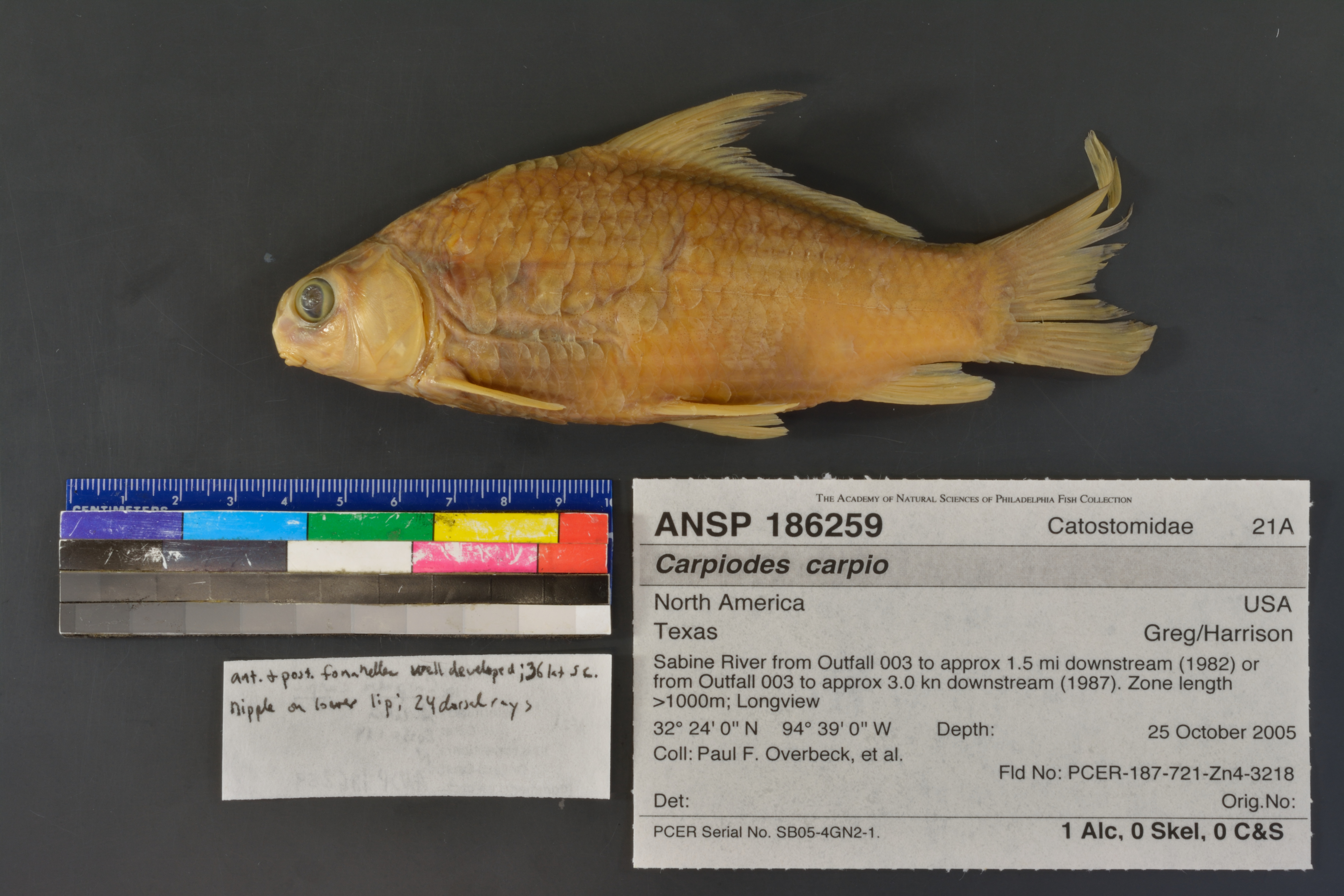
ANSP_186259
Not suspect, examinedPhotos

Map
Location
32.40014° N, 94.65024° W
(± 528.5
m)
Taxonomy
GenusCarpiodes
Speciescarpio
Specimen
Num Specimens1
Preparation1 alcohol; 0 skeleton: 0 clr&stained
Collection Event
CollectorOverbeck, Paul, et al.
Collected Date2005.October.25-2005.October.28
Field NumberPCER-187-721-Zn4-3218
Geography
CountryUSA
StateTexas
CountyGreg/Harrison
LocalitySabine River from Outfall 003 to approx 1.5 mi downstream (1982) or from Outfall 003 to approx 3.0 kn downstream (1987). Zone length >1000m; Longview
Latitude DMS32° 24' 0'' N
Longitude DMS94° 39' 0'' W
Other
Group Number21A
Primary RemarksPCER Serial No. SB05-4GN2-1.
SalinityF
Record Source
Source
Academy of Natural Sciences
(type: specimens)
Institution
Academy of Natural Sciences
(type: museum)
Curator
John G. Lundberg (but transitioning out)
Record Added
April 23, 2015
Record Last Modified
June 22, 2022
Data Processing Track
Track 2
From Data Set Received
04/2009 to 10/2010
Identification
Suspect Notes
None
Count
1
Current Determination
Determiner
Adam Cohen
Determination Date
Jan. 14, 2013
Determination Type
specimen examination
Identification Comments
Specimen examined and Id'ed for FoTX project. | anterior and posterior fontanelles well developed; 36 lat scales; nipple on lower lip; 24 dorsal rays
Identification Confidence
High
Collecting Event
Collected
Oct. 25, 2005
– Oct. 28, 2005
Collector(s)
Collecting Event ID
15981
Field Notes
There are no field notes available.
Locality
Region
Piney Woods
Jurisdiction
Gregg, Texas
Name
Sabine River at given coordinates
Hydrography
Texas-Gulf Region
Sabine
Sabine
Middle Sabine
Cherokee Bayou-Sabine River
Clarks Creek-Sabine River
Captive
no
Locality Photos
No locality photos available.
Comments On ANSP_186259