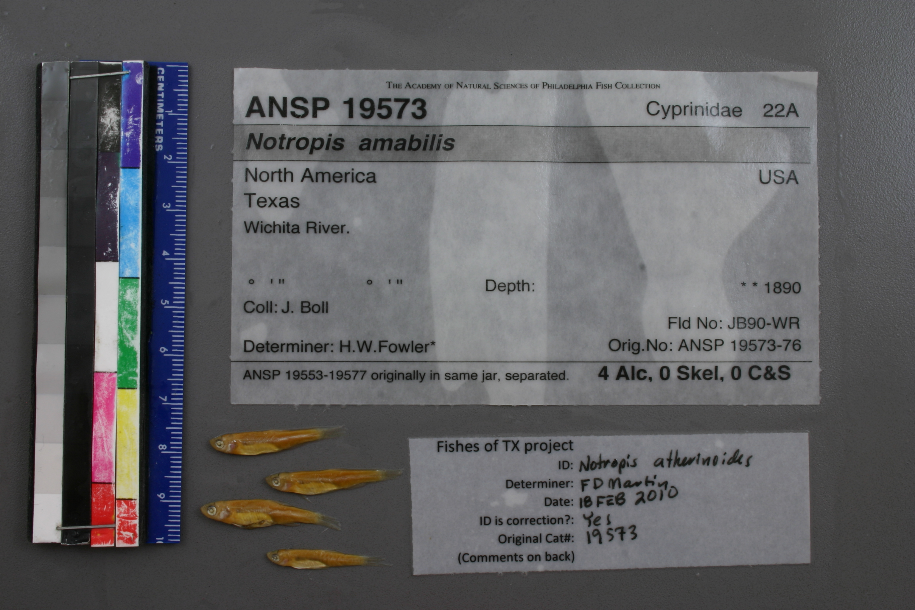
ANSP_19573
Not suspect, examinedPhotos
Map
Location
33.88553° N, 98.82063° W
(± 65231.5
m)
Taxonomy
GenusNotropis
Speciesamabilis
Identification
DeterminerH.W.Fowler*
Collection Event
CollectorJ.Boll
Collected Datenone
Geography
CountryUnknown
StateUnknown
CountyUnknown
LocalityWichita River.
Record Source
Source
Academy of Natural Sciences
(type: specimens)
Institution
Academy of Natural Sciences
(type: museum)
Curator
John G. Lundberg (but transitioning out)
Record Added
May 13, 2010
Record Last Modified
July 27, 2022
Data Processing Track
Track 2
From Data Set Received
04/2009 to 10/2010
Identification
Suspect Notes
None
Count
No data
Current Determination
Determiner
Floyd Douglas Martin
Determination Date
Feb. 18, 2010
Determination Type
specimen examination
Identification Comments
ID complete
Identification Confidence
High
Collecting Event
Collected
Jan. 1, 1869
– Dec. 31, 1880
Collector(s)
Collecting Event ID
18007
Field Notes
There are no field notes available.
Locality
Region
Rolling Plains
Jurisdiction
Wichita, Texas
Name
Wichita River, entire length
Hydrography
Arkansas-White-Red Region
Red-Washita
Red-Lake Texoma
Wichita
Lake Diversion-Wichita River
Camp Creek-Wichita River
Captive
no
Locality Photos
No locality photos available.
flag (suspect/examine)
suspect: FALSE
flag (suspect/examine)
suspect: noexamination: yes
date
date_range: 1/1/1869-12/31/1880
collectors
collectors: Boll, Jacob
staff comment
ID Status: Specimen examined and ID'ed for FoTX projectID Confidence: high
collectors
collectors: Jacob Boll
date
date_range: 1/1/1830-12/31/1880
georeference
Error: 65231.5403517201Locality: Wichita River, entire lengthCoordinates: 33.885529661;-98.820627418Georeferencer: AECGeographic note: Inland USA Texas
Comments On ANSP_19573