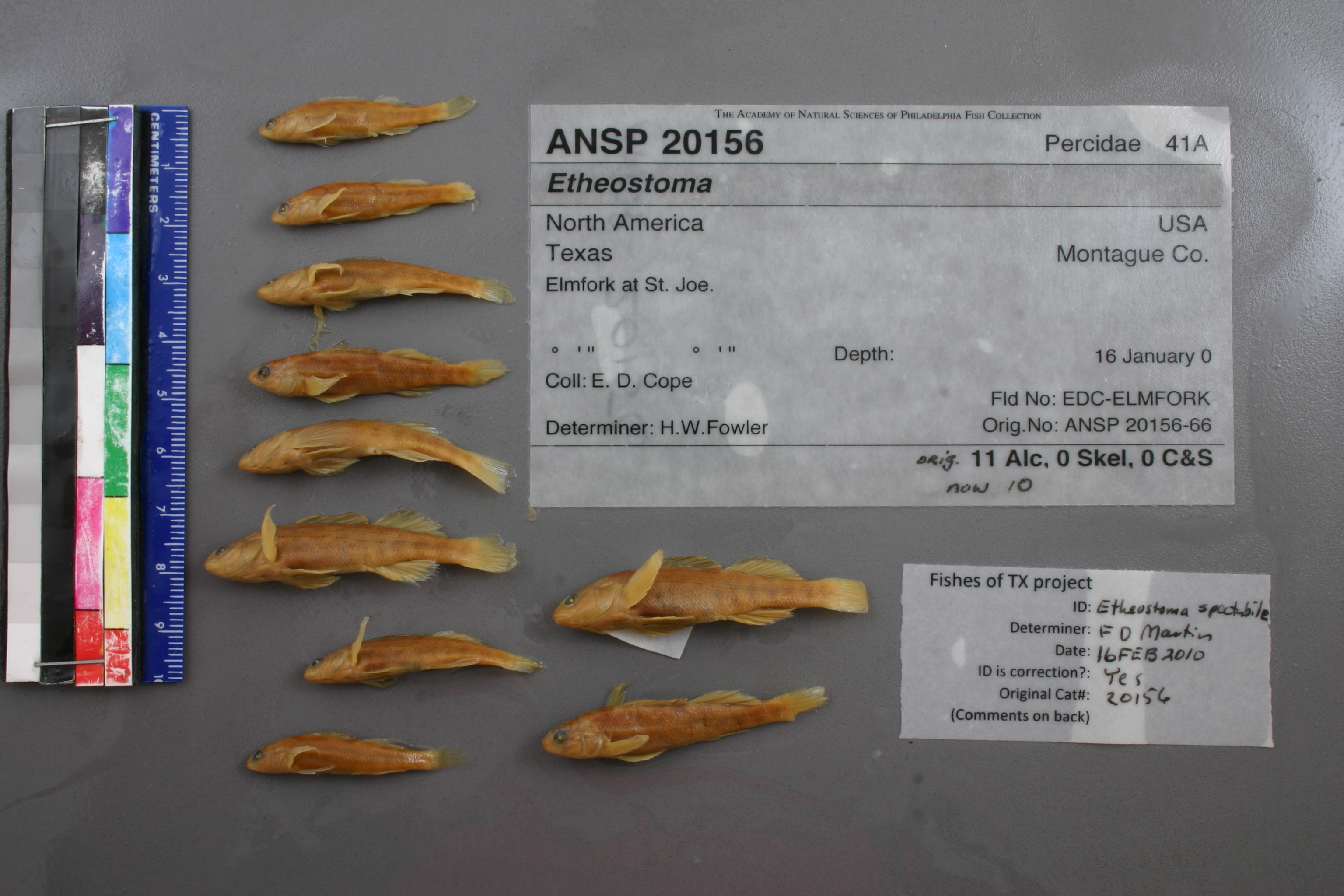
ANSP_20156
Not suspect, examinedPhotos
Map
Location
33.69202° N, 97.52679° W
(± 1301.1
m)
Taxonomy
GenusEtheostoma
Speciessp.
Identification
DeterminerH.W.Fowler
Collection Event
CollectorE.D.Cope
Collected Date1900.1.16
Geography
CountryUnited States
StateTexas
CountyMontague
LocalityElmfork at St. Joe.
Record Source
Source
Academy of Natural Sciences
(type: specimens)
Institution
Academy of Natural Sciences
(type: museum)
Curator
John G. Lundberg (but transitioning out)
Record Added
May 13, 2010
Record Last Modified
July 27, 2022
Data Processing Track
Track 2
From Data Set Received
04/2009 to 10/2010
Identification
Suspect Notes
None
Count
No data
Current Determination
Determiner
Unknown
Determination Date
July 11, 2022
Determination Type
taxonomic adjustment
Identification Comments
Determination found in FoTX database and determined to be the most recent determination. However, since the date of determination is not recorded in the database we hereby assign the date of our determination reconciliation effort, which makes it the most recent determination for this record.
Identification Confidence
Unknown
Previous Determination
Determiner
Floyd Douglas Martin
Determination Date
Feb. 16, 2010
Determination Type
specimen examination
Identification Comments
ID complete
Identification Confidence
High
Collecting Event
Collected
Jan. 1, 1877
– Dec. 31, 1893
Collector(s)
Collecting Event ID
18887
Collecting Event Notes This map represents Cope's Texas trips (see map: https://bioone.org/journals/transactions-of-the-kansas-academy-of-science/volume-119/issue-3-4/062.119.0409/The-Last-Time--Edward-Drinker-Copes-Last-Trip-to/10.1660/062.119.0409.full?tab=ArticleLinkFigureTable). He was in TX on at least 1892/93 and 1877 and 1874. His Rio Grande and NM collections are from 1874 (based o this map and records from the RG with 1874 date).
Field Notes
There are no field notes available.
Locality
Region
Oak Woods & Prairies
Jurisdiction
Montague, Texas
Name
Elm Fork Trinity River at Saint Jo
Hydrography
Texas-Gulf Region
Trinity
Upper Trinity
Elm Fork Trinity
Headwaters Elm Fork Trinity River
Gibbons Branch-Elm Fork Trinity River
Captive
no
Locality Photos
No locality photos available.
Comments On ANSP_20156