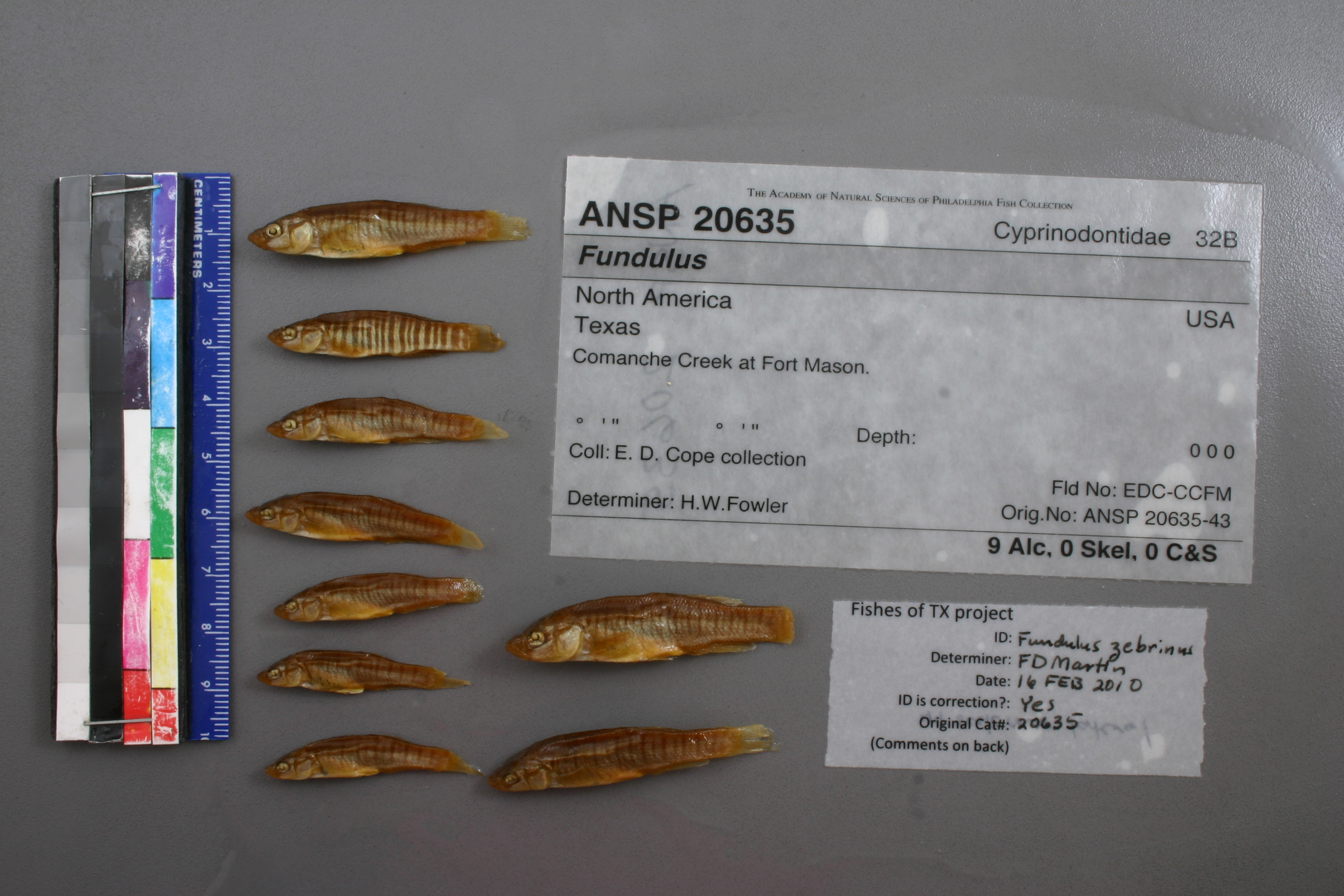
ANSP_20635
Not suspect, examinedPhotos
Map
Location
30.75080° N, 99.22940° W
(± 1944.1
m)
Taxonomy
GenusFundulus
Speciessp.
Identification
DeterminerH.W.Fowler
Collection Event
CollectorE.D.Cope collection
Collected Datenone
Geography
CountryUnknown
StateUnknown
CountyUnknown
LocalityComanche Creek at Fort Mason.
Record Source
Source
Academy of Natural Sciences
(type: specimens)
Institution
Academy of Natural Sciences
(type: museum)
Curator
John G. Lundberg (but transitioning out)
Record Added
May 13, 2010
Record Last Modified
July 27, 2022
Data Processing Track
Track 2
From Data Set Received
04/2009 to 10/2010
Identification
Suspect Notes
None
Count
No data
Current Determination
Determiner
Floyd Douglas Martin
Determination Date
Feb. 16, 2010
Determination Type
specimen examination
Identification Comments
ID complete | 44 lateral scale rows
Identification Confidence
High
Collecting Event
Collected
Jan. 1, 1877
– Dec. 31, 1877
Collector(s)
Collecting Event ID
7440
Collecting Event Notes This map represents Cope's Texas trips (see map: https://bioone.org/journals/transactions-of-the-kansas-academy-of-science/volume-119/issue-3-4/062.119.0409/The-Last-Time--Edward-Drinker-Copes-Last-Trip-to/10.1660/062.119.0409.full?tab=ArticleLinkFigureTable). He was in TX on at least 1892/93 and 1877 and 1874. His Rio Grande and NM collections are from 1874 (based o this map and records from the RG with 1874 date).
Field Notes
There are no field notes available.
Locality
Region
Llano Uplift
Jurisdiction
Mason, Texas
Name
Comanche Creek at Mason
Hydrography
Texas-Gulf Region
Lower Colorado-San Bernard Coastal
Middle Colorado-Llano
Llano
Comanche Creek-Llano River
Lower Comanche Creek
Captive
no
Locality Photos
No locality photos available.
Comments On ANSP_20635