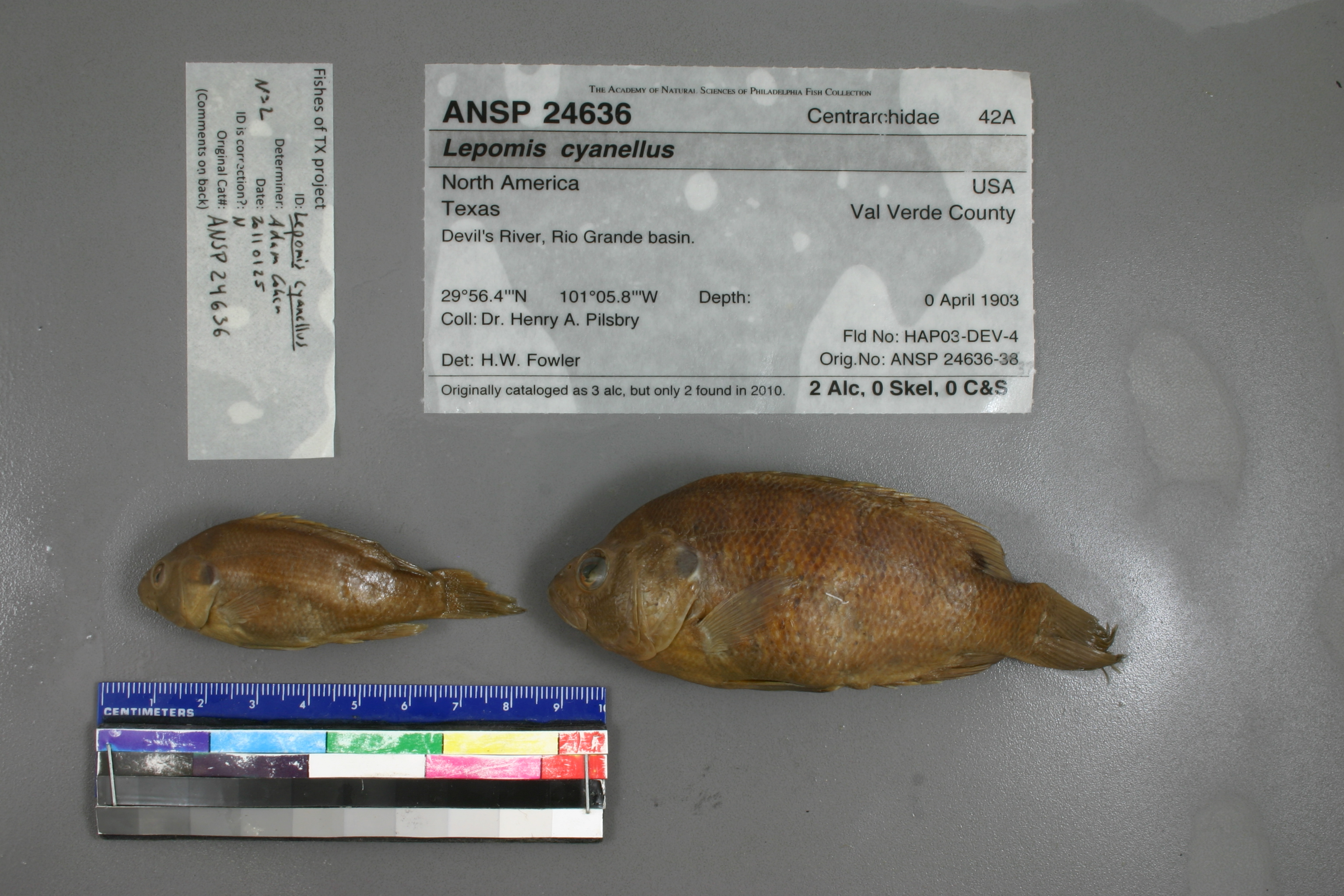
ANSP_24636
Not suspect, examinedPhotos
Map
Location
29.93918° N, 101.09619° W
(± 53121.2
m)
Taxonomy
GenusLepomis
Speciescyanellus
Identification
DeterminerH.W.Fowler*
Collection Event
CollectorDr.H.A.Pilsbry
Collected Datenone
Geography
DrainageRio Grande
CountryUnited States
StateTexas
CountyUnknown
LocalityDevil's River, Rio Grande basin.
Record Source
Source
Academy of Natural Sciences
(type: specimens)
Institution
Academy of Natural Sciences
(type: museum)
Curator
John G. Lundberg (but transitioning out)
Record Added
May 13, 2010
Record Last Modified
July 27, 2022
Data Processing Track
Track 2
From Data Set Received
04/2009 to 10/2010
Identification
Suspect Notes
None
Count
No data
Current Determination
Determiner
Adam Cohen
Determination Date
Jan. 25, 2011
Determination Type
specimen examination
Identification Comments
ID complete
Identification Confidence
High
Collecting Event
Collected
April 1, 1903
– April 30, 1903
Collector(s)
Collecting Event ID
6829
Field Notes
There are no field notes available.
Locality
Region
Edwards Plateau
Jurisdiction
Val Verde, Texas
Name
Devils River, entire length
Hydrography
Rio Grande Region
Rio Grande-Amistad
Devils
Lower Devils
Deaton Draw-Devils River
Cedar Mott Draw-Devils River
Captive
no
Locality Photos
No locality photos available.
flag (suspect/examine)
suspect: FALSE
flag (suspect/examine)
suspect: noexamination: yes
date
date_range: 4/1/1903-4/30/1903
collectors
collectors: Pilsbry, Henry A. Dr.
staff comment
ID Status: Specimen examined and ID'ed for FoTX projectID Confidence: high
collectors
collectors: Henry A. Pilsbry
date
date_range: 4/1/1903-4/31/1903
georeference
Error: 53121.2267517721Locality: Devils River, entire lengthCoordinates: 29.939182066;-101.096193554Georeferencer: AECGeographic note: Inland USA Texas
Comments On ANSP_24636