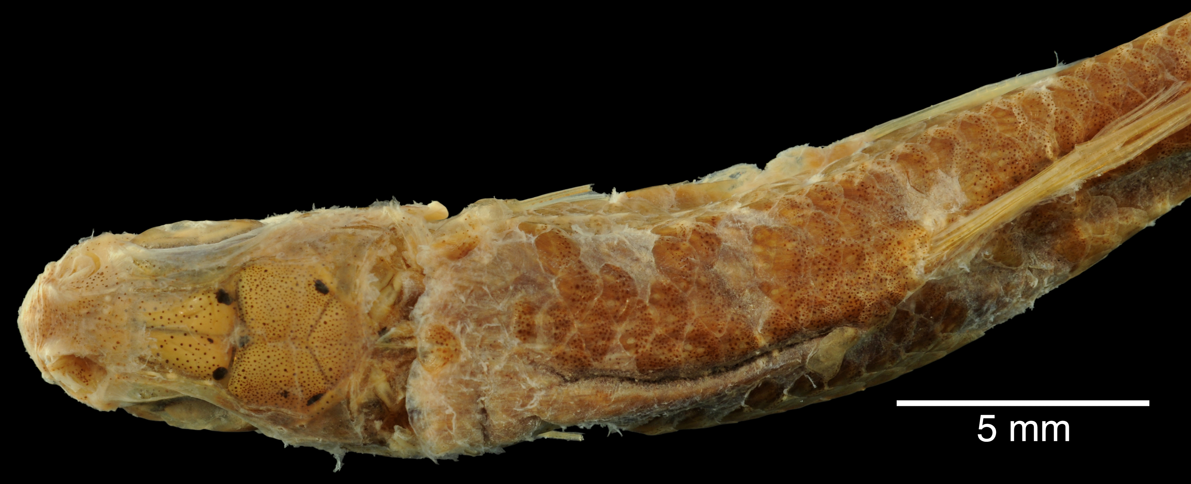
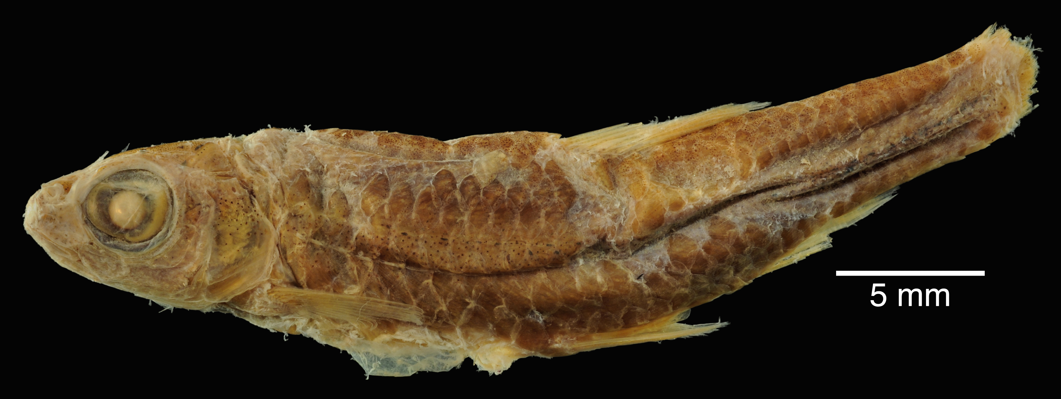
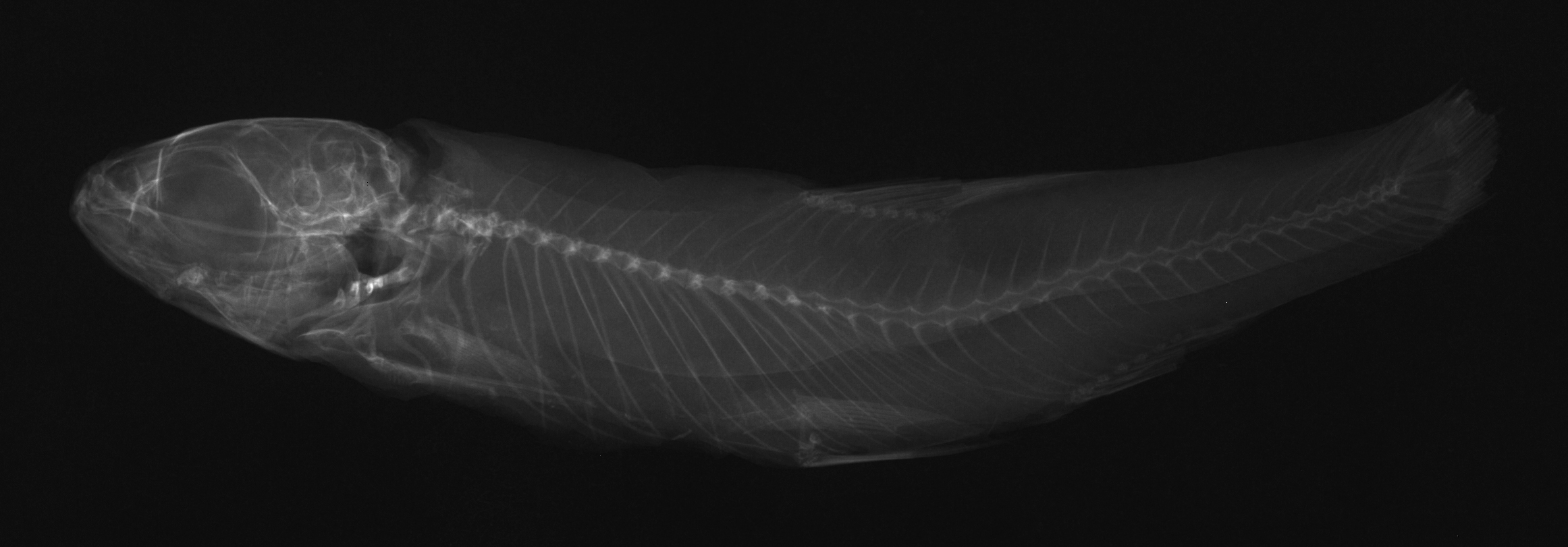
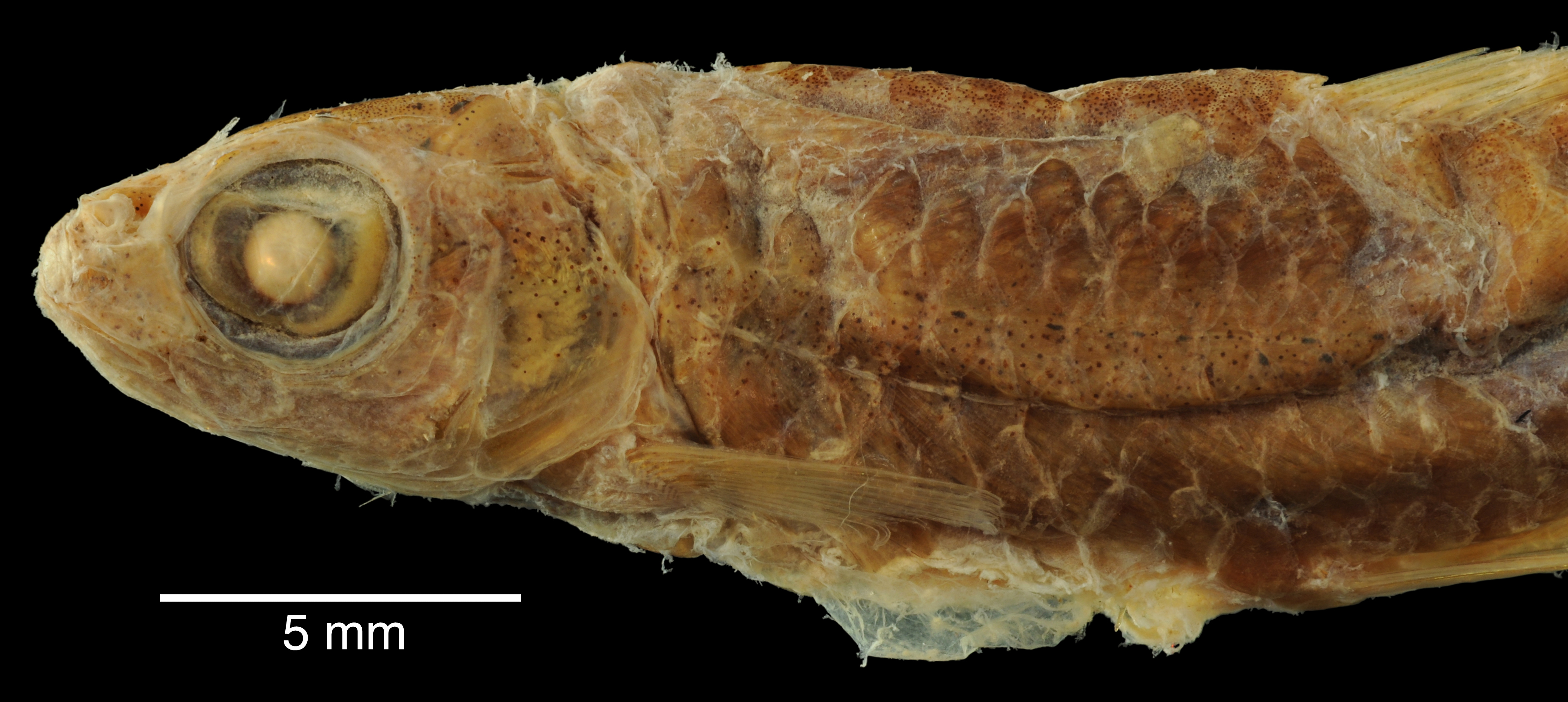
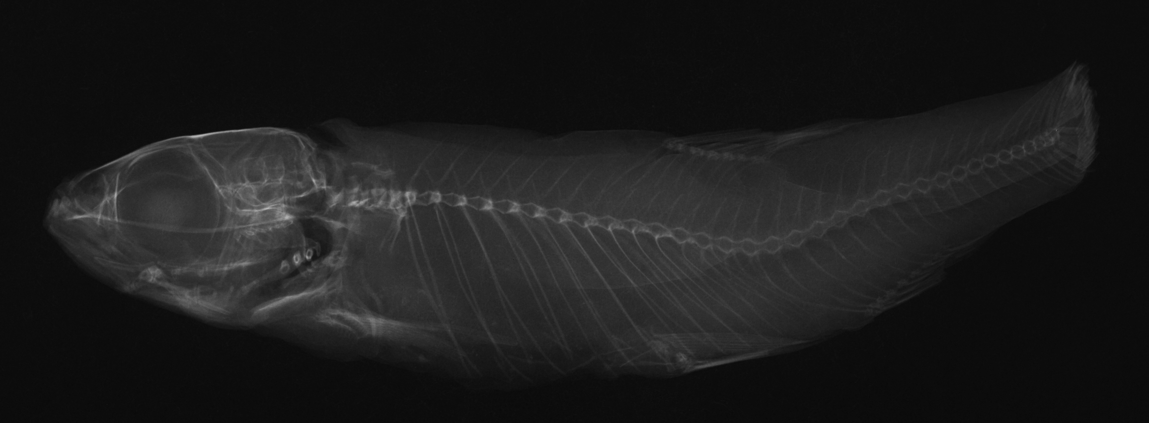
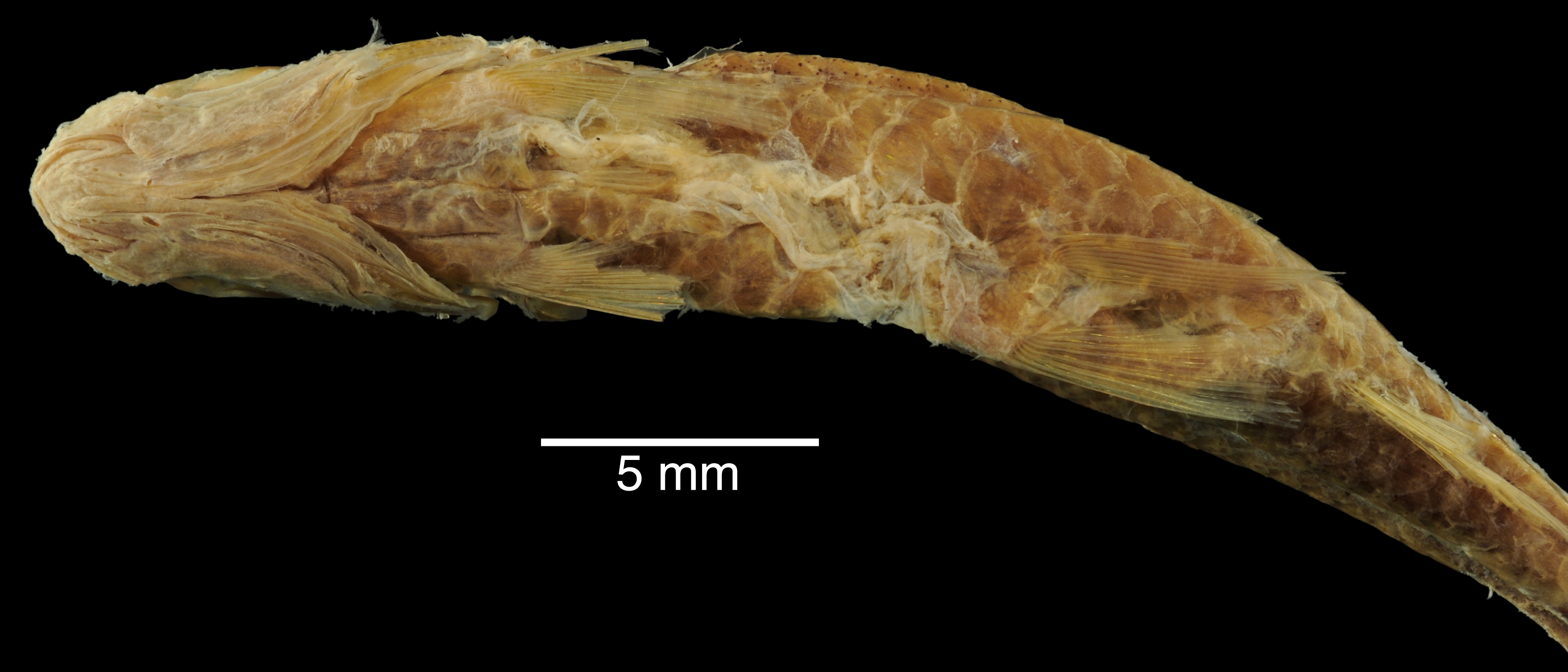
ANSP_4170
Not suspect, examinedPhotos
Map
Location
29.45416° N, 98.63250° W
(± 25749
m)
Taxonomy
GenusMoniana
Speciesdeliciosa
Identification
DeterminerC.Girard, 1856:199
Collection Event
CollectorDr. C.B.Kennerly
Collected Datenone
Geography
DrainageSan Antonio
CountryUnited States
StateTexas
CountyUnknown
LocalityLeon River, a tributary of the Rio San Antonio.
Record Source
Source
Academy of Natural Sciences
(type: specimens)
Institution
Academy of Natural Sciences
(type: museum)
Curator
John G. Lundberg (but transitioning out)
Record Added
May 13, 2010
Record Last Modified
July 27, 2022
Data Processing Track
Track 2
From Data Set Received
04/2009 to 10/2010
Identification
Suspect Notes
None
Count
No data
Current Determination
Determiner
Fishes of Texas staff
Determination Date
Unknown
Determination Type
Unspecified
Identification Comments
Image of degraded specimen provided by donor thought likely to be N. stramineus as previously determined by donor. Specimen not examined in hand. Anal ray count difficult (not possible). Somewhat elevated anterior lateral scales. Cannot enirely rule out N. volucellus, but maintain current ID of N. stramineus with insufficient data to justify change.
Identification Confidence
Medium
Collecting Event
Collected
Jan. 1, 1853
– Dec. 31, 1853
Collector(s)
Collecting Event ID
11519
Collecting Event Notes For collection information see: Girard 1858 Part Four: Fishes. Explorations and surveys for a railroad route from the Mississippi River to the Pacific Ocean. Made under the direction of the Secretary of War in 1853-6, Volume X
Field Notes
There are no field notes available.
Locality
Region
Edwards Plateau
Jurisdiction
Bexar, Texas
Name
Leon Creek, entire length
Hydrography
Texas-Gulf Region
Central Texas Coastal
San Antonio
Medina
Leon Creek
Middle Leon Creek
Captive
no
Locality Photos
No locality photos available.
flag (suspect/examine)
suspect: FALSE
date
note: For collection information see: Girard 1858 Part Four: Fishes. Explorations and surveys for a railroad route from the Mississippi River to the Pacific Ocean. Made under the direction of the Secretary of War in 1853-6, Volume X
date_range: 1/1/1853-12/31/1853
flag (suspect/examine)
suspect: noexamination: yes
flag (suspect/examine) note
This lot in need of examination, but not yet examined. Work in progress.
staff comment
not available or not found
date
date_range: 1/1/1853-12/31/1856
collectors
collectors: Kennerly, C.B. Dr.
collectors
collectors: C.B. Kennerly
staff comment
ID Status: This lot in need of examination, but we have not been able to find this specimen at the donor institution. Specimen is likely either on loan, mis-shelved, permanently lost or in rare cases destroyed. Work in progress.
flag (suspect/examine)
suspect flag — We wish to examine this specimen
date
date_range: 1/1/1853-12/31/1856
staff comment
not available or not found
georeference
Error: 104620.234751551Locality: Leon River, entire lengthCoordinates: 31.735411834;-98.033400753Georeferencer: AECGeographic note: Inland USA Texas
Comments On ANSP_4170