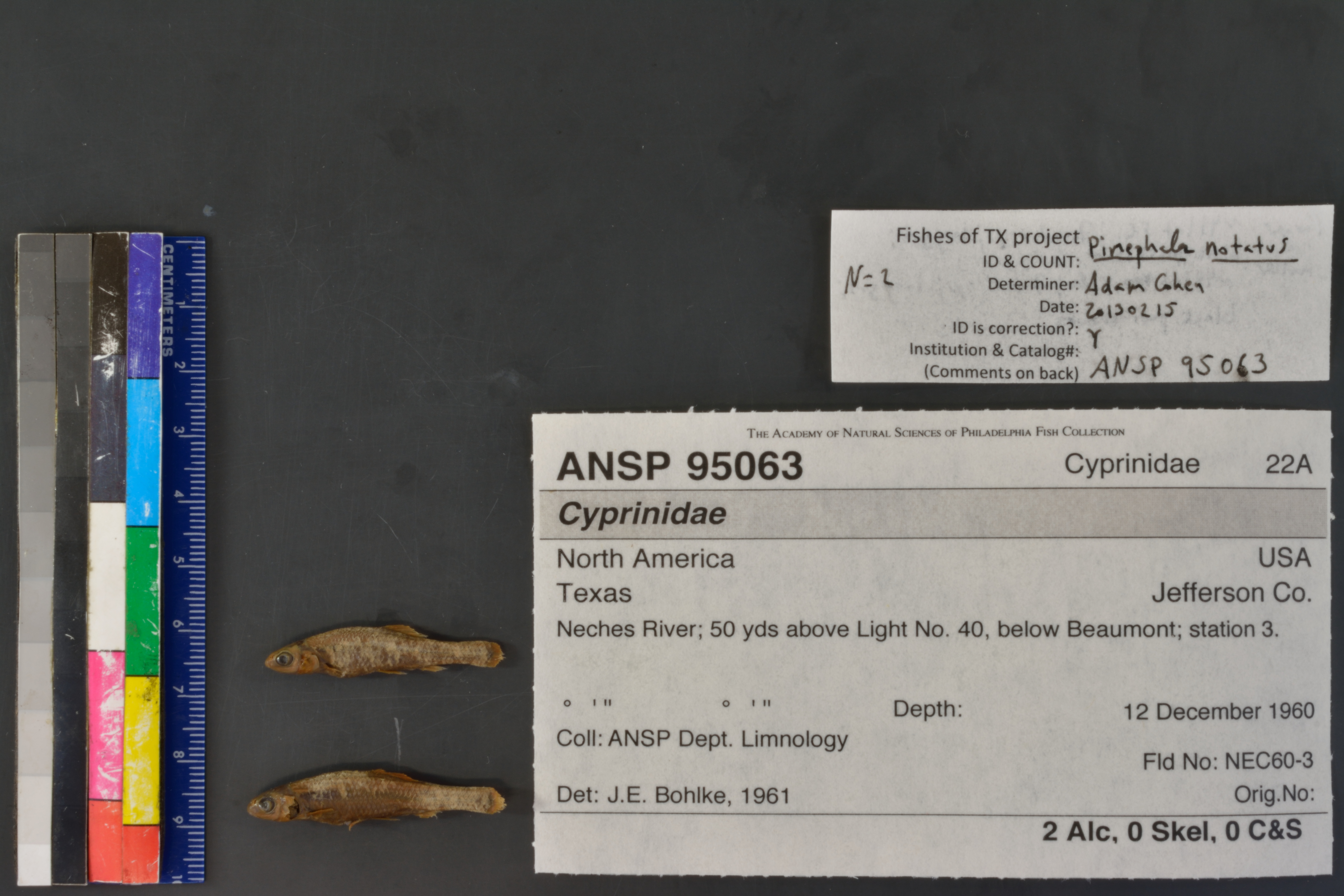
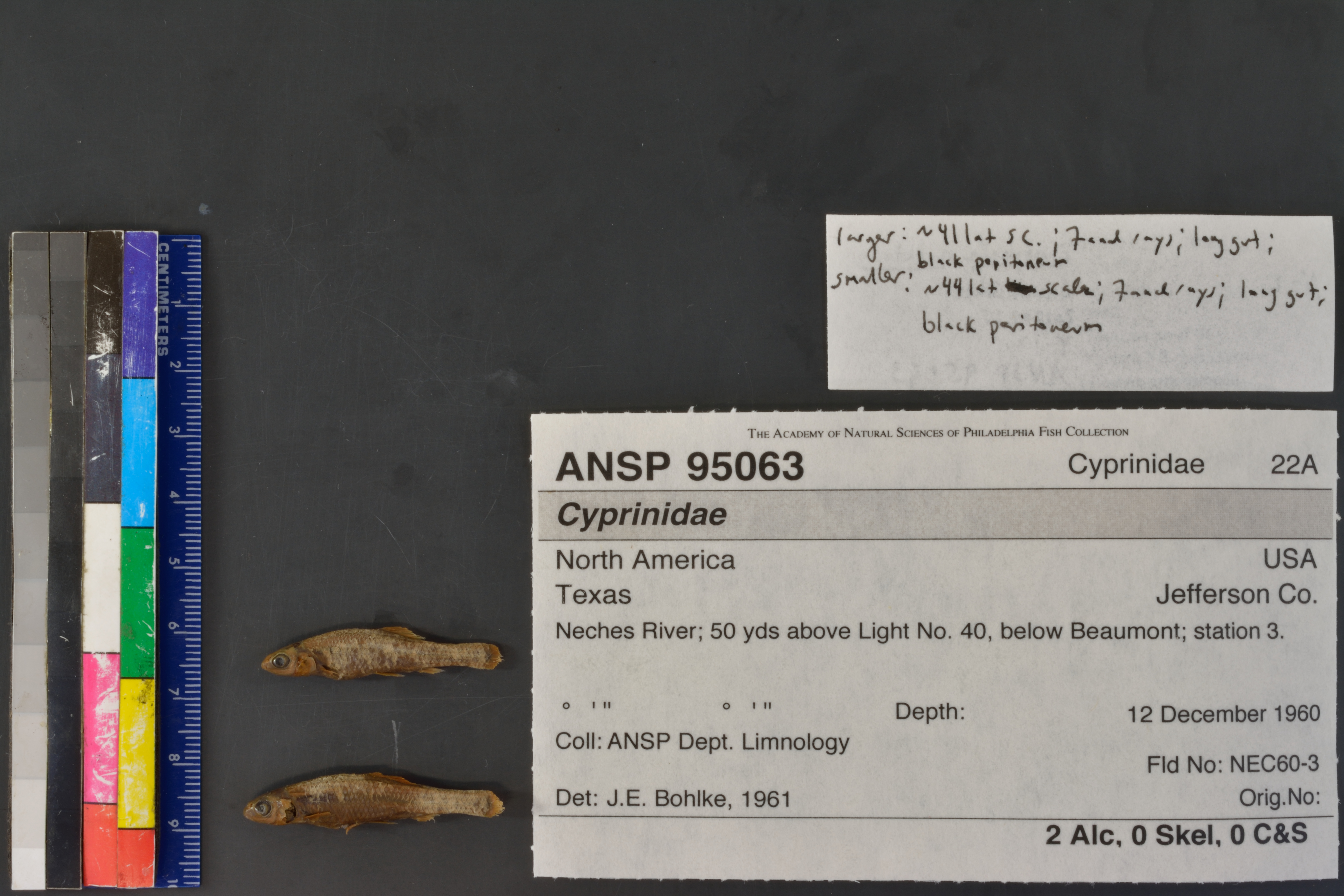
ANSP_95063
Suspect, pending examinationPhotos
Map
Location
30.02613° N, 94.02927° W
(± 9234.4
m)
Taxonomy
GenusCyprinidae
Specimen
Num Specimens2
Preparation2 alcohol; 0 skeleton: 0 clr&stained
Identification
DeterminerJ.E.Bohlke, 1961
Collection Event
CollectorANSP Dept. Limnology
Collected Date1960.December.12-1960.December.18
Field NumberNEC60-3
Geography
CountryUSA
StateTexas
CountyJefferson Co.
LocalityNeches River; 50 yds above Light No.40, below Beaumont.
Latitude DMS° ' ''
Longitude DMS° ' ''
Other
Group Number22A
SalinityF
RemarksNeches River sta.3.
Record Source
Source
Academy of Natural Sciences
(type: specimens)
Institution
Academy of Natural Sciences
(type: museum)
Curator
John G. Lundberg (but transitioning out)
Record Added
April 23, 2015
Record Last Modified
June 22, 2022
Data Processing Track
Track 2
From Data Set Received
04/2009 to 10/2010
Identification
Suspect Notes
None
Count
2
Current Determination
Determiner
Adam Cohen
Determination Date
Feb. 15, 2013
Determination Type
specimen examination
Identification Comments
Specimen examined and Id'ed for FoTX project. | Two specimens in poor condition (dark, soft body, most fin rays broken); Larger specimen: ~41 lat line scales; 7 anal rays; both opercles damaged previously presumably while taking p-teeth; left teeth found under opercle are extremely damaged and count not possible; gut found previously cut open and intestine long and black peritoneum (although some worn away due to handling and not black there). Smaller specimen: ~44 lat line scales; 7 anal rays; left arch found under opercle is in half and damaged and count not possible, but appears to be one row; right arch also previously pulled and is clearly ?,?-4,0; I cut belly to find long intestine and black peritoneum much like the larger; species not currently verified as being in Texas and thus some doubt remains despite a fairly high level of confidence in this identification.
Identification Confidence
High
Collecting Event
Collected
Dec. 12, 1960
– Dec. 18, 1960
Collecting Event ID
22296
Field Notes
There are no field notes available.
Locality
Region
Gulf Coast Prairies & Marshes
Jurisdiction
Jefferson, Texas
Name
Neches River between Beaumont and Port Neches.
Hydrography
Texas-Gulf Region
Neches
Neches
Lower Neches
Tenmile Creek-Neches River
Grays Bayou-Neches River
Captive
no
Locality Photos
No locality photos available.
flag (suspect/examine)
suspect: TRUE
flag (suspect/examine)
note: suspect record needs to be examinedExamination: Pending
flag (suspect/examine)
suspect: yesexamination: pending
flag (suspect/examine)
mark for examination, but not suspect
date
date_range: 12/12/1960-12/18/1960
date
date_range: 12\12\1960-12\18\1960
collectors
collectors: Academy of Natural Science Philadelphia Department of Limnology
Comments On ANSP_95063