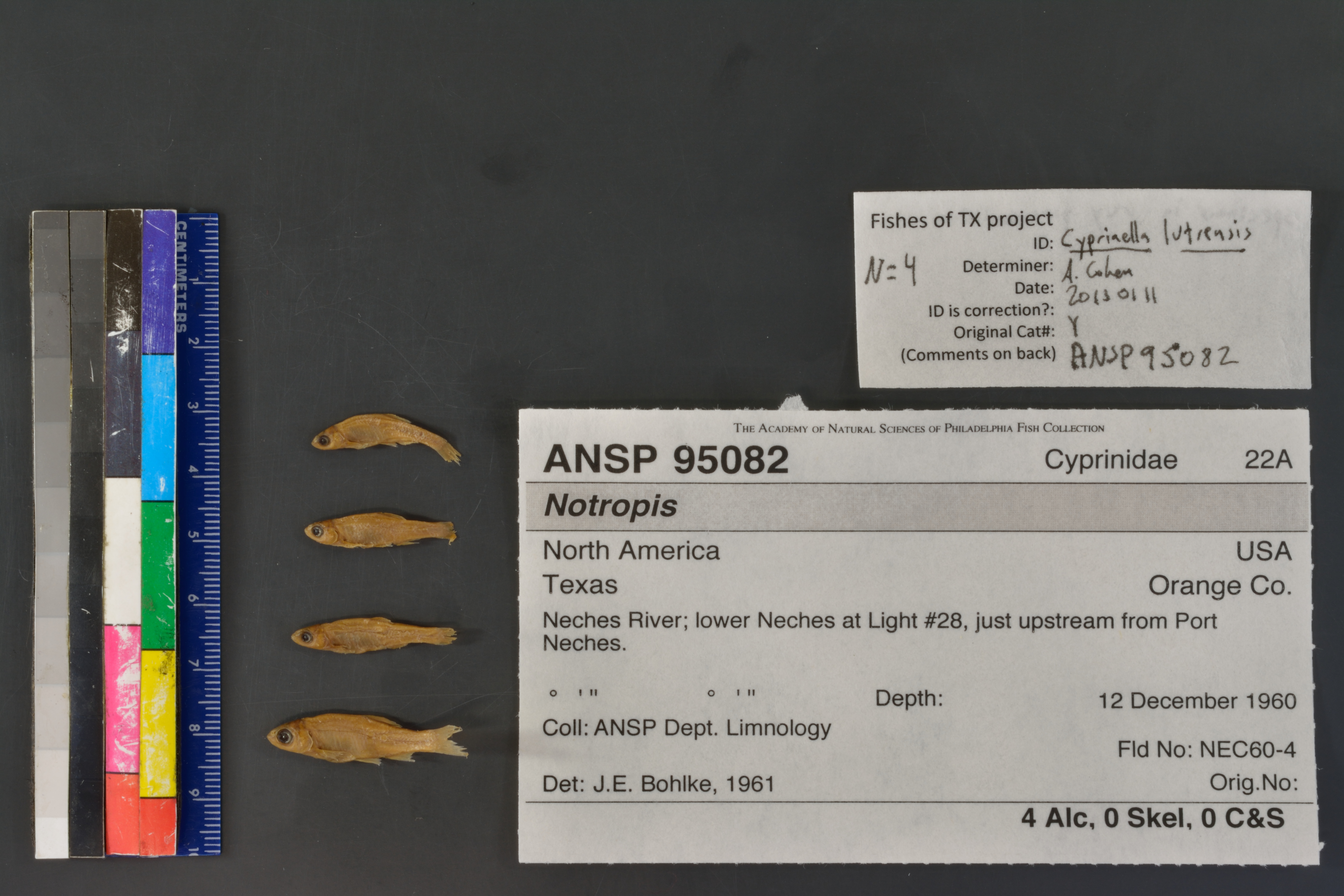
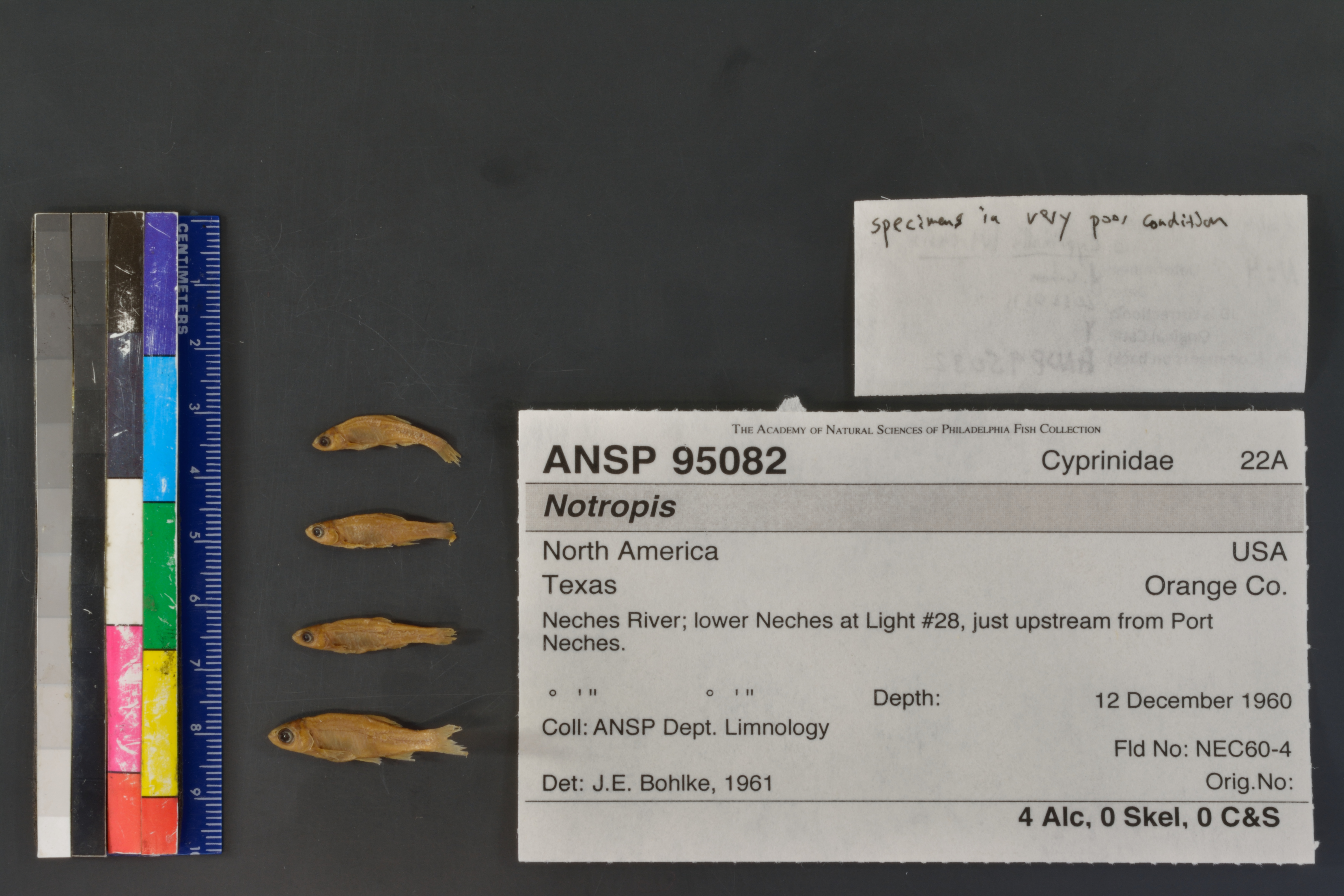
ANSP_95082
Not suspect, examinedPhotos
Map
Location
30.01004° N, 93.98757° W
(± 3791.6
m)
Taxonomy
GenusNotropis
Specimen
Num Specimens4
Preparation4 alcohol; 0 skeleton: 0 clr&stained
Identification
DeterminerJ.E.Bohlke, 1961
Collection Event
CollectorANSP Dept. Limnology
Collected Date1960.December.12-1960.December.18
Field NumberNEC60-4
Geography
CountryUSA
StateTexas
CountyOrange Co.
LocalityNeches River;lower Neches at Light #28,just upstream from Port Neches.
Latitude DMS° ' ''
Longitude DMS° ' ''
Other
Group Number22A
SalinityF
Remarks?
Record Source
Source
Academy of Natural Sciences
(type: specimens)
Institution
Academy of Natural Sciences
(type: museum)
Curator
John G. Lundberg (but transitioning out)
Record Added
April 23, 2015
Record Last Modified
June 22, 2022
Data Processing Track
Track 2
From Data Set Received
04/2009 to 10/2010
Identification
Suspect Notes
None
Count
4
Current Determination
Determiner
Unknown
Determination Date
July 26, 2022
Determination Type
taxonomic adjustment
Identification Comments
correction of taxonomic change
Identification Confidence
Unknown
Previous Determination
Determiner
Unknown
Determination Date
June 30, 2022
Determination Type
taxonomic adjustment
Identification Comments
GIS-based name change, no examination | ID updated based on taxonomic revision for this species/location
Identification Confidence
Unknown
Previous Determination
Determiner
Adam Cohen
Determination Date
Jan. 11, 2013
Determination Type
specimen examination
Identification Comments
Specimen examined and Id'ed for FoTX project. | specimens in poor condition
Identification Confidence
High
Collecting Event
Collected
Dec. 12, 1960
– Dec. 18, 1960
Collecting Event ID
22299
Field Notes
There are no field notes available.
Locality
Region
Gulf Coast Prairies & Marshes
Jurisdiction
Jefferson, Texas
Name
Neches River, midway between Port Neches and McFadden
Hydrography
Texas-Gulf Region
Neches
Neches
Lower Neches
Tenmile Creek-Neches River
Grays Bayou-Neches River
Captive
no
Locality Photos
No locality photos available.
flag (suspect/examine)
suspect: FALSE
flag (suspect/examine)
suspect: noexamination: yes
date
date_range: 12/12/1960-12/18/1960
date
date_range: 12\12\1960-12\18\1960
collectors
collectors: Academy of Natural Science Philadelphia Department of Limnology
Comments On ANSP_95082