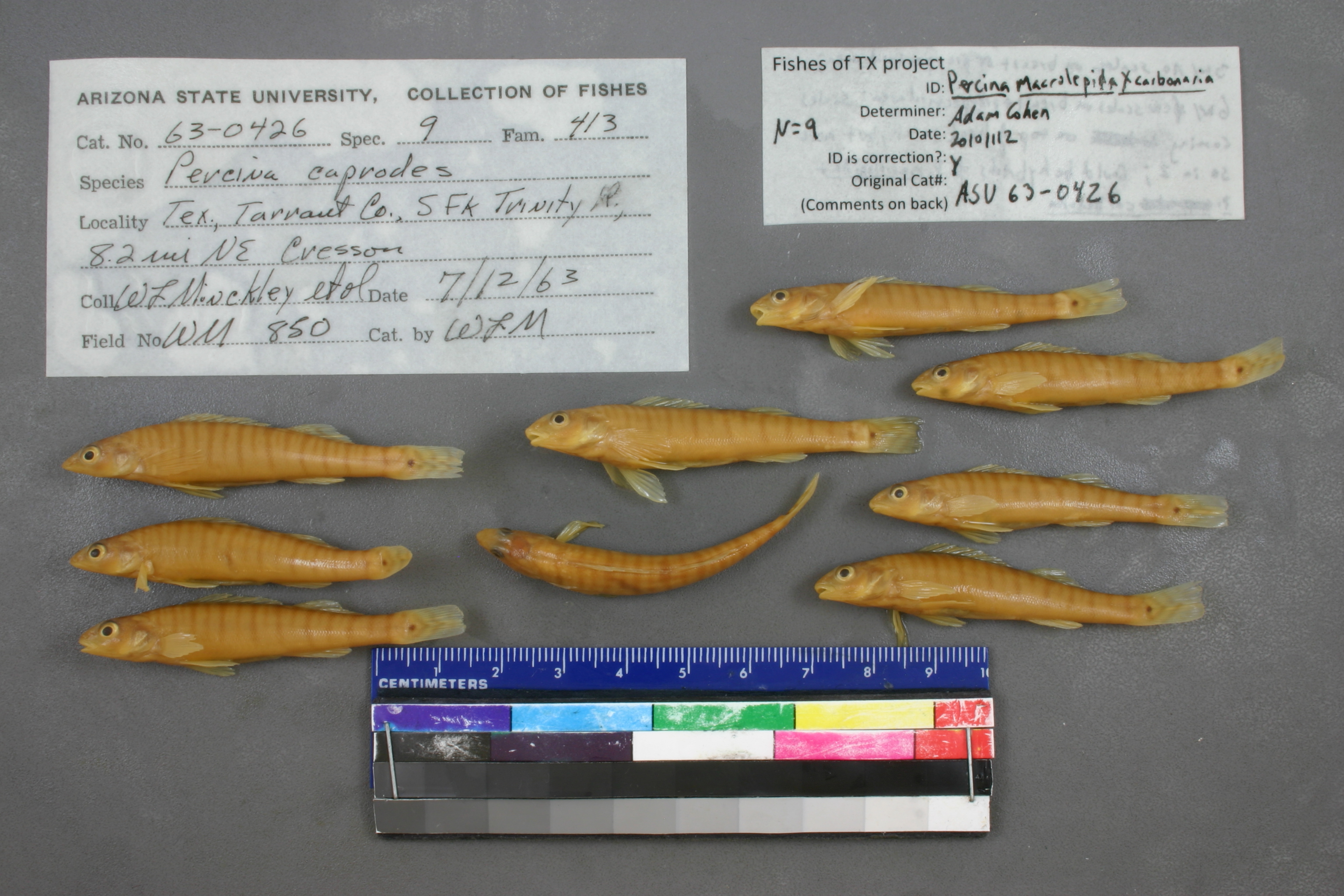
ASU_426
Not suspect, examinedPhotos
Map
Location
32.62073° N, 97.52956° W
(± 43.6
m)
Taxonomy
GenusPercina
Speciescaprodes
Specimen
Num Specimens9
Collection Event
CollectorMinckley W L;
Collected Date1963.7.12
Geography
DrainageTrinity
CountryUnited States
StateTexas
CountyTarrant
Locality; s fork trinity r 8&2/10 mi ne cresson on hwy 377
Record Source
Source
Arizona State University
(type: specimens)
Institution
Arizona State University
(type: university)
Curator
Thomas Dowling (but transitioning out)
Record Added
May 13, 2010
Record Last Modified
June 22, 2022
Data Processing Track
Track 1
From Data Set Received
11/1997 to 05/2006
Identification
Suspect Notes
None
Count
9
Current Determination
Determiner
Unknown
Determination Date
July 11, 2022
Determination Type
taxonomic adjustment
Identification Comments
Determination found in FoTX database and determined to be the most recent determination. However, since the date of determination is not recorded in the database we hereby assign the date of our determination reconciliation effort, which makes it the most recent determination for this record.
Identification Confidence
Unknown
Previous Determination
Determiner
Adam Cohen
Determination Date
Nov. 12, 2010
Determination Type
specimen examination
Identification Comments
ID complete | 3 with no scales on breast or pre-pectoral area; 6 with few scales on breast and pre-pectoral area; scales coming on top of head ( but not covering) in all but more so in 2; probably hybrids
Identification Confidence
Medium
Previous Determination
Determiner
Andrew Joshua Cohen
Determination Date
Nov. 12, 2010
Determination Type
specimen examination
Identification Comments
ID complete | 3 with no scales on breast or pre-pectoral area; 6 with few scales on breast and pre-pectoral area; scales coming on top of head ( but not covering) in all but more so in 2; probably hybrids
Identification Confidence
Medium
Collecting Event
Collected
July 12, 1963
Collector(s)
Collecting Event ID
2182
Field Notes
There are no field notes available.
Locality
Region
Blackland Prairies
Jurisdiction
Tarrant, Texas
Name
Clear Fork Trinity River at US377
Hydrography
USGS HUC
Texas-Gulf Region
Trinity
Upper Trinity
Lower West Fork Trinity
Upper Clear Fork Trinity River
Brown Branch-Clear Fork Trinity River
HydroBASINS
7514
751409
75140960
7514096070
751409607000
Captive
no
Locality Photos
No locality photos available.
flag (suspect/examine)
suspect: FALSE
flag (suspect/examine)
suspect: noexamination: yes
date
date_range: 7/12/1963-7/12/1963
collectors
collectors: Minckley, Wendell L.
staff comment
ID Status: Specimen examined and ID'ed for FoTX project
ID Comments: 3 with no scales on breast or pre-pectoral area; 6 with few scales on breast and pre-pectoral area; scales coming on top of head ( but not covering) in all but more so in 2; probably hybrids
ID Confidence: mediumGeoref Annotation: Clear Fork Trinity River, not S Fork Trinity River
collectors
collectors: Wendell L. Minckley
date
date_range: 7/12/1963-7/12/1963
georeference
Error: 43.645Remarks: Clear Fork Trinity River, not S Fork Trinity RiverLocality: Clear Fork Trinity River at US377Coordinates: 32.620726884;-97.529559949Georeferencer: BJLGeographic note: Inland USA Texas
Clear Fork Trinity River, not S Fork Trinity River
Comments On ASU_426