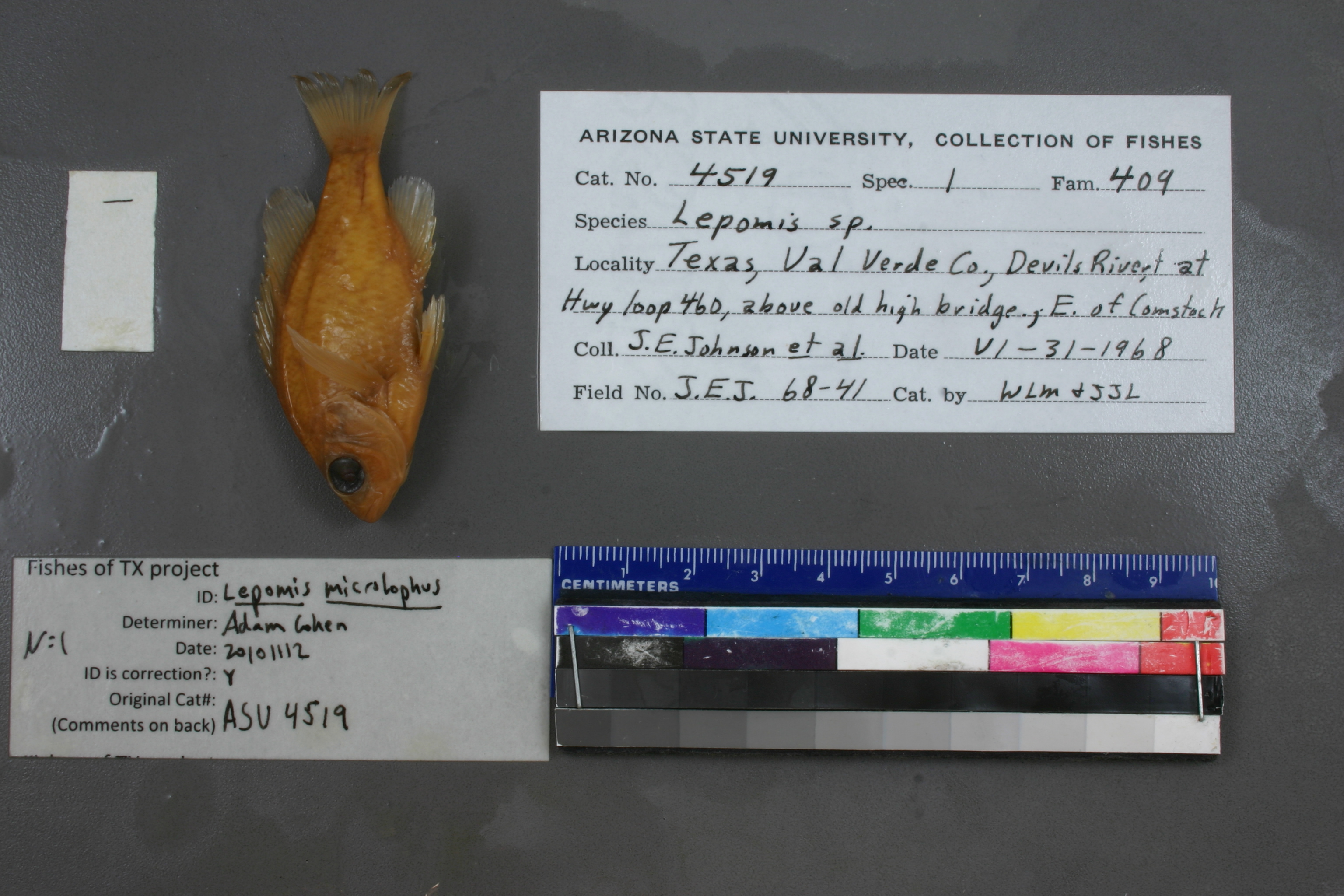
ASU_4519
Not suspect, examinedPhotos
Map
Location
29.50210° N, 100.98476° W
(± 5967.4
m)
Taxonomy
GenusLepomis
Speciessp.
Collection Event
CollectorJohnson J E;
Collected Date1968.6.30
Geography
DrainageRio Grande
CountryUnited States
StateTexas
CountyVal Verde
Locality; devils river at hwy loop 460- above old high bridge- e of comstock
Record Source
Source
Arizona State University
(type: specimens)
Institution
Arizona State University
(type: university)
Curator
Thomas Dowling (but transitioning out)
Record Added
May 13, 2010
Record Last Modified
June 22, 2022
Data Processing Track
Track 1
From Data Set Received
11/1997 to 05/2006
Identification
Suspect Notes
None
Count
No data
Current Determination
Determiner
Adam Cohen
Determination Date
Nov. 12, 2010
Determination Type
specimen examination
Identification Comments
ID complete
Identification Confidence
High
Collecting Event
Collected
June 30, 1968
Collector(s)
Collecting Event ID
2385
Field Notes
There are no field notes available.
Locality
Region
Edwards Plateau
Jurisdiction
Val Verde, Texas
Name
Devils River channel in the Amistad resevoir at the historic SH406 crossing
Hydrography
Rio Grande Region
Rio Grande-Amistad
Devils
Lower Devils
Evans Creek-Amistad Reservoir
130403020403-Amistad Reservoir
Captive
no
Locality Photos
No locality photos available.
HUC 12
130403020403
Georeferencing Remarks
SH406 no longer crosses the river, but ends on north side. SH454 in Lake view was the continuation of SH406. point placed on Devils river channel, extent covers terminus of SH406 &SH454.
Georeferencing Annotation
—
Has not been Georeferenced because
—
flag (suspect/examine)
suspect: FALSE
flag (suspect/examine)
suspect: noexamination: yes
date
date_range: 6/30/1968-6/30/1968
collectors
collectors: Johnson, J.E.
staff comment
ID Status: Specimen examined and ID'ed for FoTX project
Georef Remark: SH406 no longer crosses the river, but ends on north side. SH454 in Lake view was the continuation of SH406. point placed on Devils river channel, extent covers terminus of SH406 &SH454.
ID Confidence: high
collectors
collectors: J.E. Johnson
date
date_range: 6/30/1968-6/30/1968
georeference
Error: 5967.4475519744
Remarks: SH406 no longer crosses the river, but ends on north side. SH454 in Lake view was the continuation of SH406. point placed on Devils river channel, extent covers terminus of SH406 &SH454.
Locality: Devils River channel in the Amistad resevoir at the historic SH406 crossingCoordinates: 29.502096993;-100.984759415Georeferencer: BJLGeographic note: Inland USA TexasSH406 no longer crosses the river, but ends on north side. SH454 in Lake view was the continuation of SH406. point placed on Devils river channel, extent covers terminus of SH406 &SH454.
Comments On ASU_4519