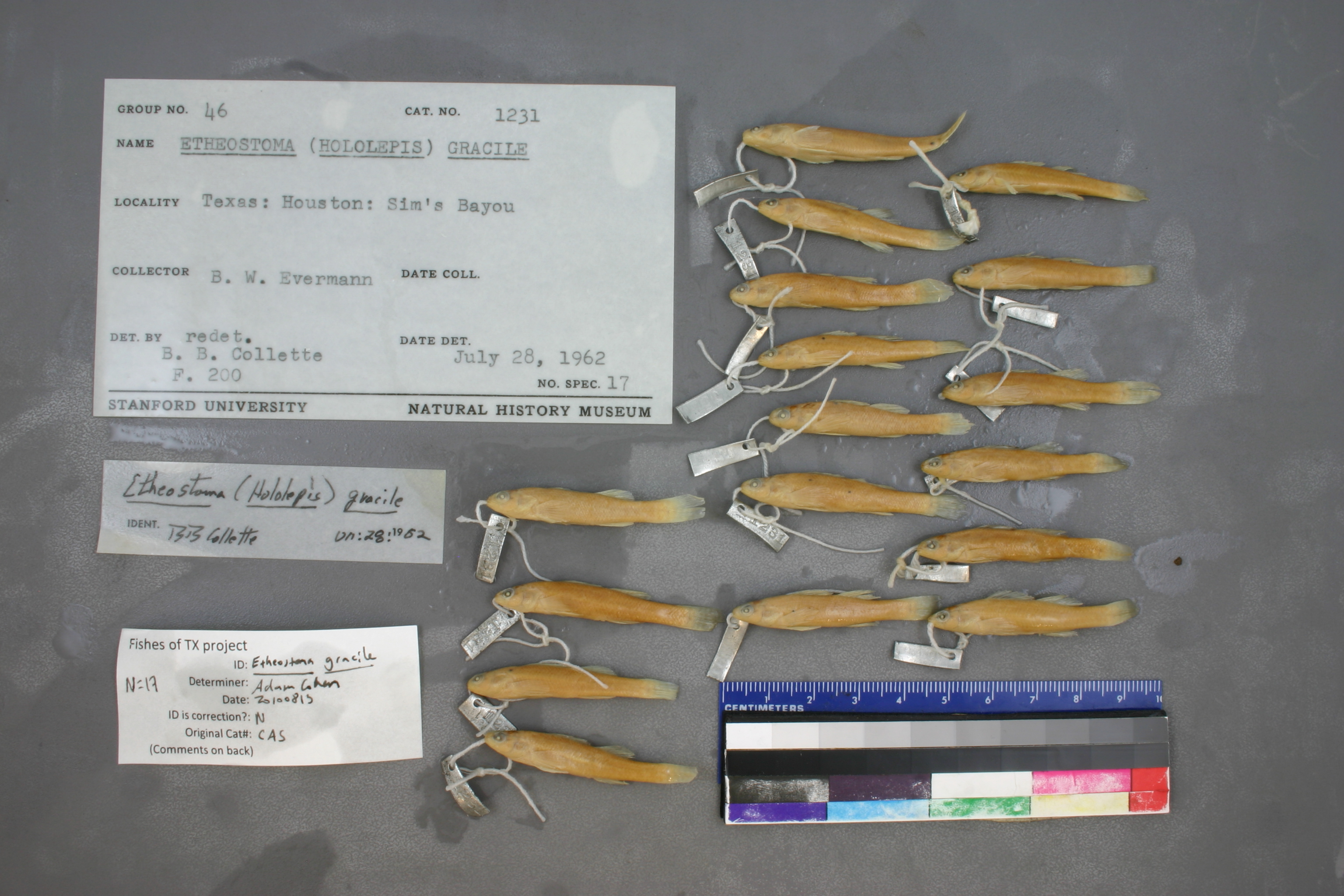
CAS_101231
Not suspect, examinedPhotos
Map
Location
29.76488° N, 95.35857° W
(± 4000
m)
Taxonomy
GenusEtheostoma
Speciesgracile
Specimen
Num Specimens0
Collection Event
CollectorEVERMANN
Collected Datenone
Geography
CountryUnited States
StateTexas
CountyHarris
LocalityHOUSTON, TX
Record Source
Source
California Academy of Sciences
(type: specimens)
Institution
California Academy of Sciences
(type: museum)
Curator
Luiz Rocha
Record Added
May 13, 2010
Record Last Modified
June 22, 2022
Data Processing Track
Track 2
From Data Set Received
04/2009 to 10/2010
Identification
Suspect Notes
None
Count
No data
Current Determination
Determiner
Adam Cohen
Determination Date
Aug. 13, 2010
Determination Type
specimen examination
Identification Comments
ID complete
Identification Confidence
High
Collecting Event
Collected
Nov. 1, 1891
– Nov. 30, 1891
Collector(s)
Collecting Event ID
70
Field Notes
There are no field notes available.
Locality
Region
Gulf Coast Prairies & Marshes
Jurisdiction
Harris, Texas
Name
Houston
Hydrography
Texas-Gulf Region
Galveston Bay-San Jacinto
San Jacinto
Buffalo-San Jacinto
Buffalo Bayou-San Jacinto River
Vince Bayou-Buffalo Bayou
Captive
no
Locality Photos
No locality photos available.
HUC 12
120401040703
Georeferencing Remarks
1890 map of Houston (https://houstorian.files.wordpress.com/2008/08/1890.jpg) shows a much smaller city than what it is currently. Used this to define the geographic extent of Houston. Point placed on Buffalo Bayou and extent runs to most downstream rail crossing.
Georeferencing Annotation
—
Has not been Georeferenced because
—
flag (suspect/examine)
suspect: FALSE
flag (suspect/examine)
suspect: noexamination: yes
georeference
Error: 4000
Remarks: 1890 map of Houston (https://houstorian.files.wordpress.com/2008/08/1890.jpg) shows a much smaller city than what it is currently. Used this to define the geographic extent of Houston. Point placed on Buffalo Bayou and extent runs to most downstream rail crossing.
Locality: HoustonCoordinates: -95.358573, 29.764878Georeferencer: Adam Cohen1890 map of Houston (https://houstorian.files.wordpress.com/2008/08/1890.jpg) shows a much smaller city than what it is currently. Used this to define the geographic extent of Houston. Point placed on Buffalo Bayou and extent runs to most downstream rail crossing.
date
date_range: 11/1/1891-11/30/1891
collectors
collectors: Evermann, Barton Warren Dr.
staff comment
ID Status: Specimen examined and ID'ed for FoTX projectID Confidence: high
collectors
collectors: Barton Warren Evermann
date
date_range: 11/1/1891-11/30/1891
georeference
Error: 35418.442751848Locality: HoustonCoordinates: 29.758978514;-95.358437986Georeferencer: AECGeographic note: Inland USA Texas
Comments On CAS_101231