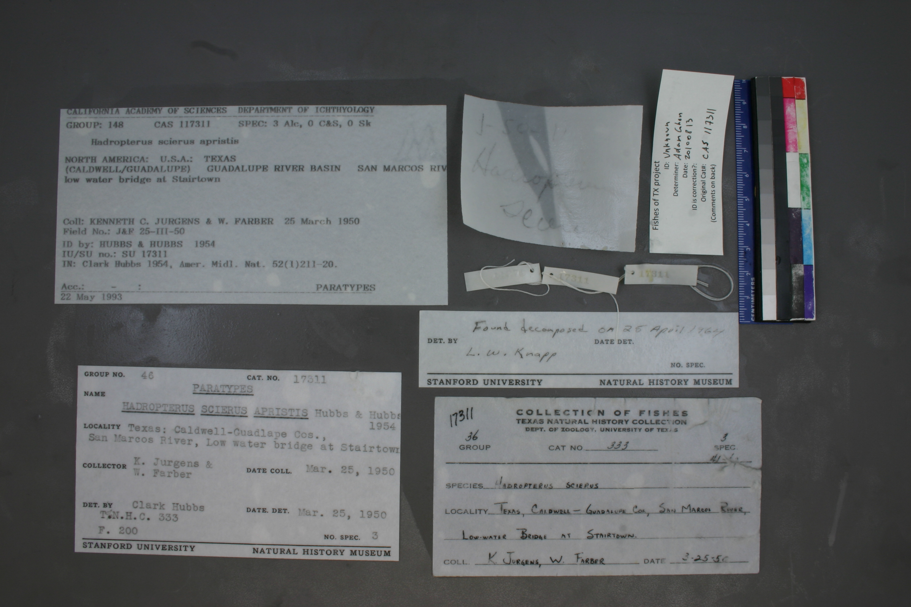
CAS_117311
Not suspect, examinedPhotos
Map
Location
29.71817° N, 97.72821° W
(± 978.5
m)
Taxonomy
GenusHadropterus
Speciesscierus
Specimen
Num Specimens0
Identification
DeterminerHUBBS & HUBBS / 1954
Collection Event
CollectorKENNETH C. JURGENS & W. FARBER
Collected Date1950.3.25
Geography
DrainageGUADALUPE
CountryUnited States
StateTexas
Localitylow water bridge at Stairtown
Record Source
Source
California Academy of Sciences
(type: specimens)
Institution
California Academy of Sciences
(type: museum)
Curator
Luiz Rocha
Record Added
May 13, 2010
Record Last Modified
July 27, 2022
Data Processing Track
Track 2
From Data Set Received
04/2009 to 10/2010
Identification
Suspect Notes
None
Count
No data
Current Determination
Determiner
Adam Cohen
Determination Date
Aug. 13, 2010
Determination Type
specimen examination
Identification Comments
ID complete | specimen/s disentigrated
Identification Confidence
High
Collecting Event
Collected
March 25, 1950
Collector(s)
Collecting Event ID
7749
Field Notes
There are no field notes available.
Locality
Region
Blackland Prairies
Jurisdiction
Caldwell, Texas
Name
near Stairtown
Hydrography
Texas-Gulf Region
Central Texas Coastal
Guadalupe
San Marcos
Lower San Marcos River
Brushy Creek-San Marcos River
Captive
no
Locality Photos
No locality photos available.
flag (suspect/examine)
suspect: FALSE
flag (suspect/examine)
note: Previously examined and can't resolve to species level. ID cannot be made to species level at this time
Examination: Examined
flag (suspect/examine)
suspect: noexamination: yes
date
date_range: 3/25/1950-3/25/1950
collectors
collectors: Jurgens, Kenneth C. Farber, W.
staff comment
ID Status: Specimen examined and ID'ed for FoTX projectID Comments: specimen/s disentigratedGeoref Remark: No waterbody given. Treated as shown. Extent runs halfway toID Confidence: high
collectors
collectors: Kenneth C. Jurgens, W. Farber
date
date_range: 3/25/1950-3/25/1950
georeference
Error: 978.481151995802Remarks: No waterbody given. Treated as shown. Extent runs halfway toLocality: near StairtownCoordinates: 29.718166325;-97.72820807Georeferencer: AECGeographic note: Inland USA Texas
No waterbody given. Treated as shown. Extent runs halfway to
Comments On CAS_117311