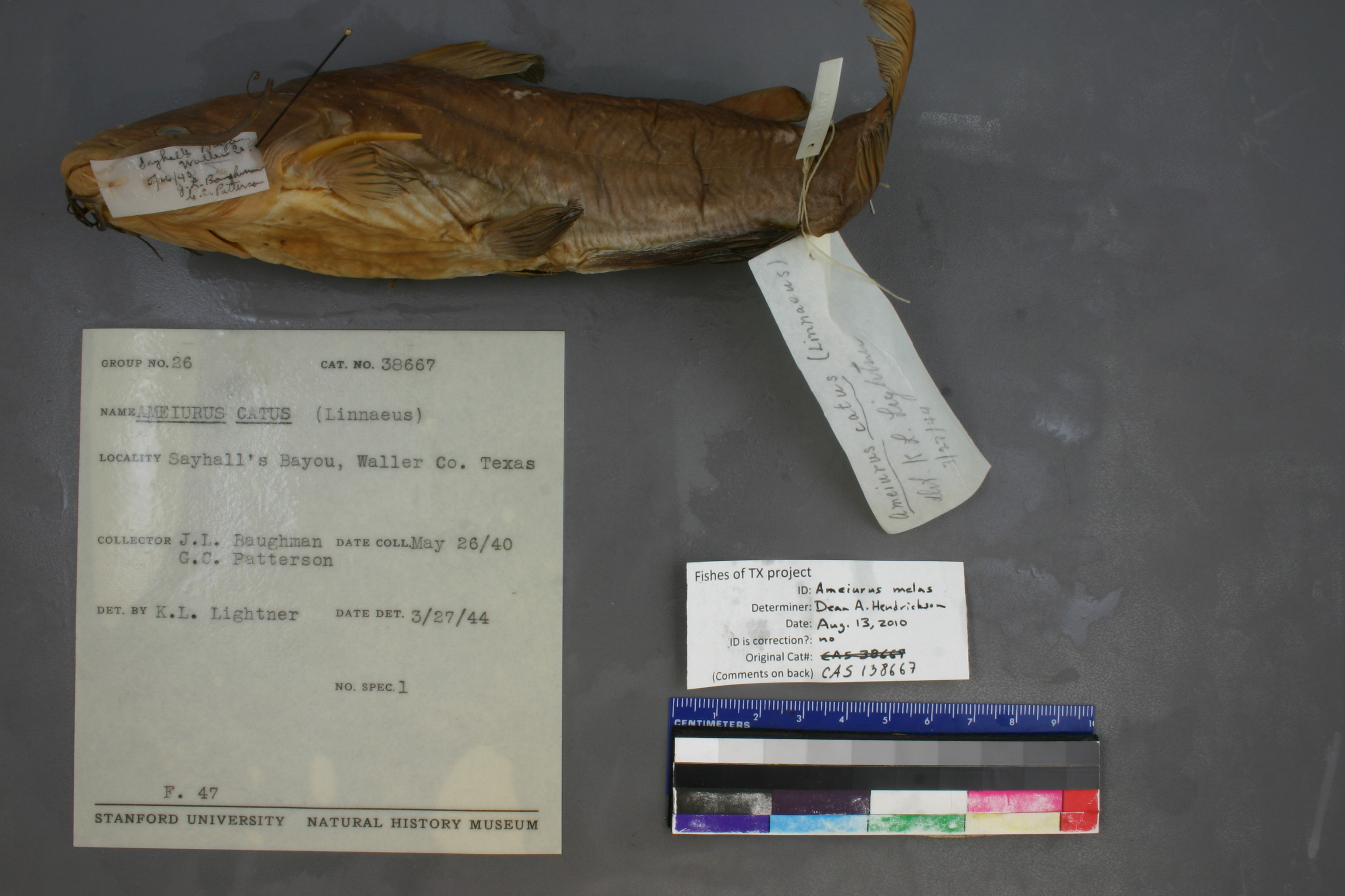
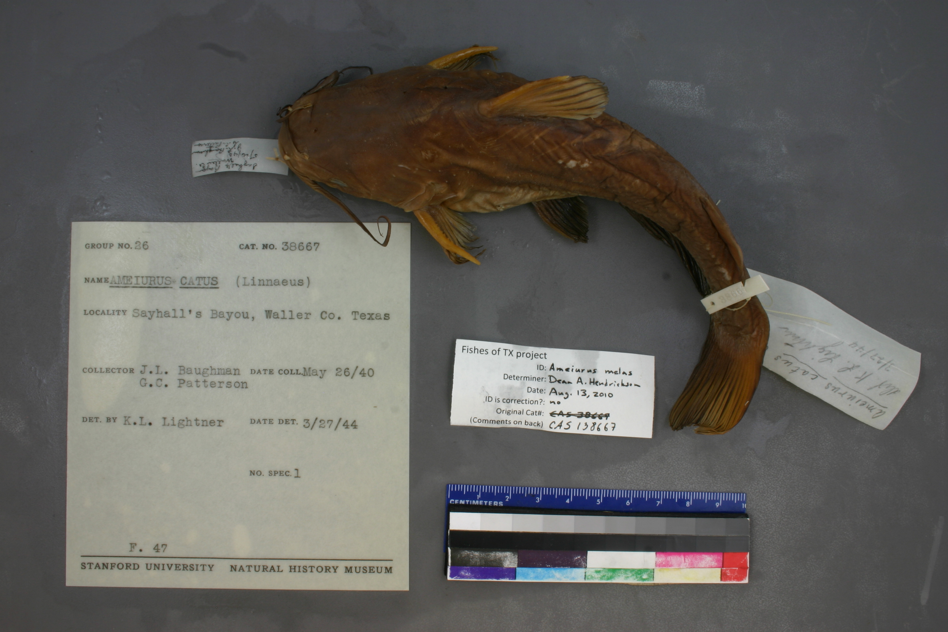
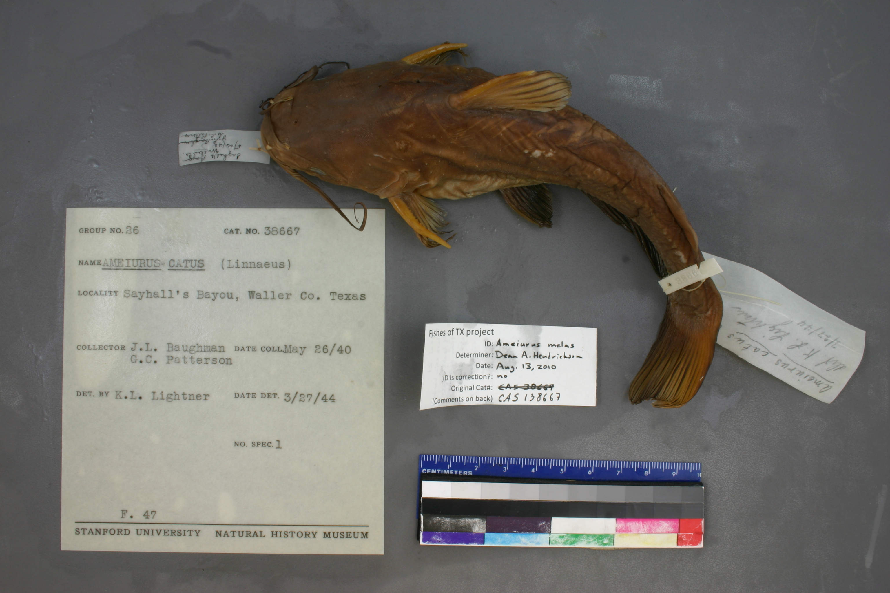
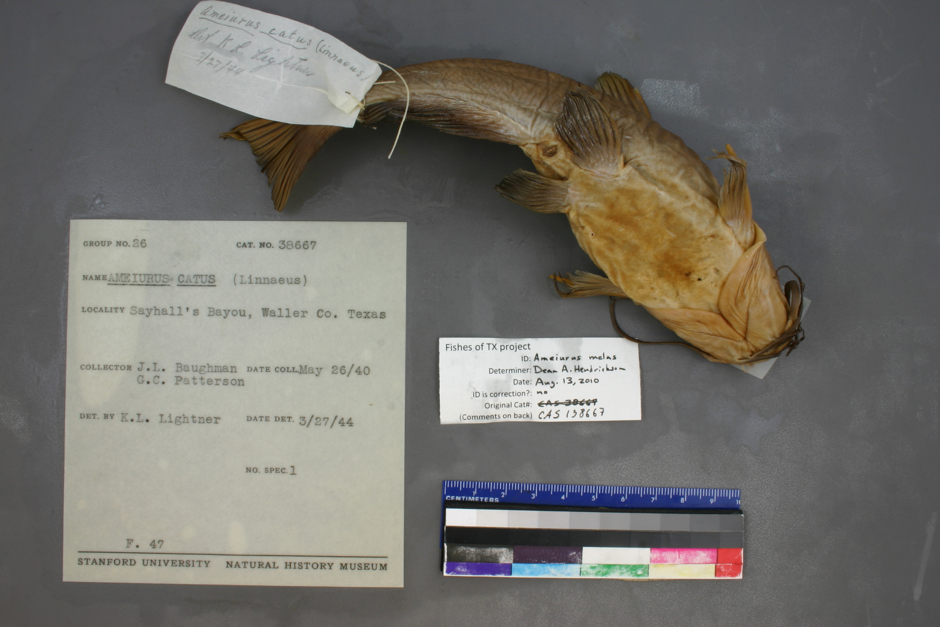
CAS_138667
Not suspect, examinedPhotos
Map
Location
30.00066° N, 96.00011° W
(± 33688.4
m)
Taxonomy
GenusAmeiurus
Speciescatus
Specimen
Num Specimens0
Identification
DeterminerLightner,K./1944
Collection Event
CollectorJ.L. Baughman & G.C. Patterson
Collected Date1940.5.26
Geography
CountryUnited States
StateTexas
CountyWaller
Record Source
Source
California Academy of Sciences
(type: specimens)
Institution
California Academy of Sciences
(type: museum)
Curator
Luiz Rocha
Record Added
May 13, 2010
Record Last Modified
July 27, 2022
Data Processing Track
Track 2
From Data Set Received
04/2009 to 10/2010
Identification
Suspect Notes
None
Count
No data
Current Determination
Determiner
Dean Hendrickson
Determination Date
Aug. 13, 2010
Determination Type
specimen examination
Identification Comments
ID complete | anal rays=21; black chin barbels; P1 teeth larger than some melas; caudal slightly forked; black inter-ray membranes pronounced
Identification Confidence
High
Collecting Event
Collected
May 26, 1940
Collector(s)
Collecting Event ID
7453
Field Notes
There are no field notes available.
Locality
Region
Gulf Coast Prairies & Marshes
Jurisdiction
Waller, Texas
Name
Waller County
Hydrography
Texas-Gulf Region
Lower Brazos
Lower Brazos
Lower Brazos
Bessies Creek-Brazos River
Harris Creek-Irons Creek
Captive
no
Locality Photos
No locality photos available.
HUC 12
120701040301
Georeferencing Remarks
Original georeference from locality ID#2928
Georeferencing Annotation
Cannot find Sayhalls Bayou on maps, but appears to be in Waller County: http://collections.si.edu/search/results.jsp?q=record_ID:nmnhvzfishesweb_5038069
Has not been Georeferenced because
—
flag (suspect/examine)
suspect: FALSE
flag (suspect/examine)
suspect: noexamination: yes
date
date_range: 5/26/1940-5/26/1940
collectors
collectors: Baughman, J.L. Patterson, G.C.
staff comment
ID Status: Specimen examined and ID'ed for FoTX project
ID Comments: anal rays=21; black chin barbels; P1 teeth larger than some melas; caudal slightly forked; black inter-ray membranes pronounced
ID Confidence: high
collectors
collectors: J.L. Baughman, G.C. Patterson
date
date_range: 5/26/1940-5/26/1940
georeference
Error: 33688.3979518555Locality: Waller CountyCoordinates: 30.000659682;-96.000114758Georeferencer: BJLGeographic note: Inland USA Texas
Comments On CAS_138667