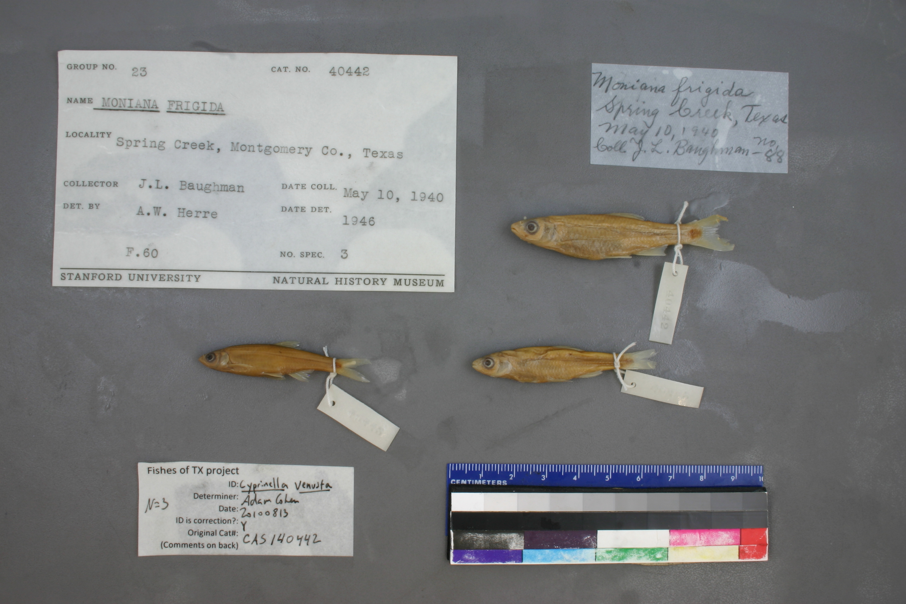
CAS_140442
Not suspect, examinedPhotos
Map
Location
30.31694° N, 95.46678° W
(± 49299.0
m)
Taxonomy
GenusMoniana
Speciesfrigida
Specimen
Num Specimens0
Identification
DeterminerHerre,A.W./1946
Collection Event
CollectorJ.L. Baughman
Collected Date1940.5.10
Geography
DrainageSan Jacinto
CountryUnited States
StateTexas
CountyMontgomery
Record Source
Source
California Academy of Sciences
(type: specimens)
Institution
California Academy of Sciences
(type: museum)
Curator
Luiz Rocha
Record Added
May 13, 2010
Record Last Modified
July 27, 2022
Data Processing Track
Track 2
From Data Set Received
04/2009 to 10/2010
Identification
Suspect Notes
None
Count
No data
Current Determination
Determiner
Adam Cohen
Determination Date
Aug. 13, 2010
Determination Type
specimen examination
Identification Comments
ID complete
Identification Confidence
High
Collecting Event
Collected
May 10, 1940
Collector(s)
Collecting Event ID
7230
Field Notes
There are no field notes available.
Locality
Region
Piney Woods
Jurisdiction
Montgomery, Texas
Name
Montgomery County
Hydrography
Texas-Gulf Region
Galveston Bay-San Jacinto
San Jacinto
West Fork San Jacinto
West Fork San Jacinto River-Conroe Lake
White Oak Creek-West Fork San Jacinto River
Captive
no
Locality Photos
No locality photos available.
flag (suspect/examine)
suspect: FALSE
flag (suspect/examine)
suspect: noexamination: yes
date
date_range: 5/10/1940-5/10/1940
collectors
collectors: Baughman, J.L.
staff comment
ID Status: Specimen examined and ID'ed for FoTX projectID Confidence: high
collectors
collectors: J.L. Baughman
date
date_range: 5/10/1940-5/10/1940
georeference
Error: 49299.0347517885Locality: Montgomery CountyCoordinates: 30.316940115;-95.466781703Georeferencer: AECGeographic note: Inland USA Texas
Comments On CAS_140442