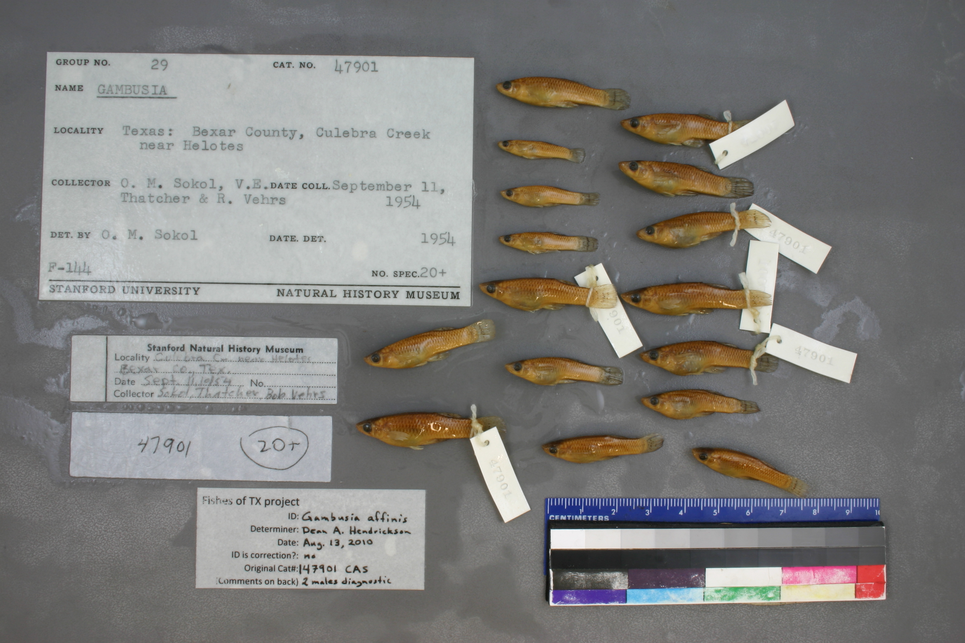
CAS_147901
Not suspect, examinedPhotos
Map
Location
29.57456° N, 98.68939° W
(± 2426.9
m)
Taxonomy
GenusGambusia
Speciessp.
Specimen
Num Specimens0
Identification
DeterminerO.M. Sokol/1954
Collection Event
CollectorO.M. Sokol & V.E. Thatcher & R. Vehrs
Collected Date1954.9.11
Geography
CountryUnited States
StateTexas
CountyBexar
Localitynear Helotes
Record Source
Source
California Academy of Sciences
(type: specimens)
Institution
California Academy of Sciences
(type: museum)
Curator
Luiz Rocha
Record Added
May 13, 2010
Record Last Modified
July 27, 2022
Data Processing Track
Track 2
From Data Set Received
04/2009 to 10/2010
Identification
Suspect Notes
None
Count
No data
Current Determination
Determiner
Dean Hendrickson
Determination Date
Aug. 13, 2010
Determination Type
specimen examination
Identification Comments
ID complete | 2 males are diagnostic
Identification Confidence
High
Collecting Event
Collected
Sept. 11, 1954
Collector(s)
Collecting Event ID
7277
Field Notes
There are no field notes available.
Locality
Region
Edwards Plateau
Jurisdiction
Bexar, Texas
Name
Near Helotes
Hydrography
Texas-Gulf Region
Central Texas Coastal
San Antonio
Medina
Leon Creek
Lower Culebra Creek
Captive
no
Locality Photos
No locality photos available.
flag (suspect/examine)
suspect: FALSE
flag (suspect/examine)
suspect: noexamination: yes
date
date_range: 9/11/1954-9/11/1954
collectors
collectors: Sokol, O.M. Thatcher, V.E. Vehrs, R.
staff comment
ID Status: Specimen examined and ID'ed for FoTX projectID Comments: 2 males are diagnostic
Georef Remark: Extent runs halfway to Grey Forest. Updated coordinates because original georeference had same decimal degree for latitude and longitude.
ID Confidence: high
collectors
collectors: O.M. Sokol, V.E. Thatcher, R. Vehrs
date
date_range: 9/11/1954-9/11/1954
georeference
Error: 2426.89075198959
Remarks: Extent runs halfway to Grey Forest. Updated coordinates because original georeference had same decimal degree for latitude and longitude.
Locality: Near HelotesCoordinates: 29.574559395;-98.689394005Georeferencer: MJCGeographic note: Inland USA TexasExtent runs halfway to Grey Forest. Updated coordinates because original georeference had same decimal degree for latitude and longitude.
Comments On CAS_147901