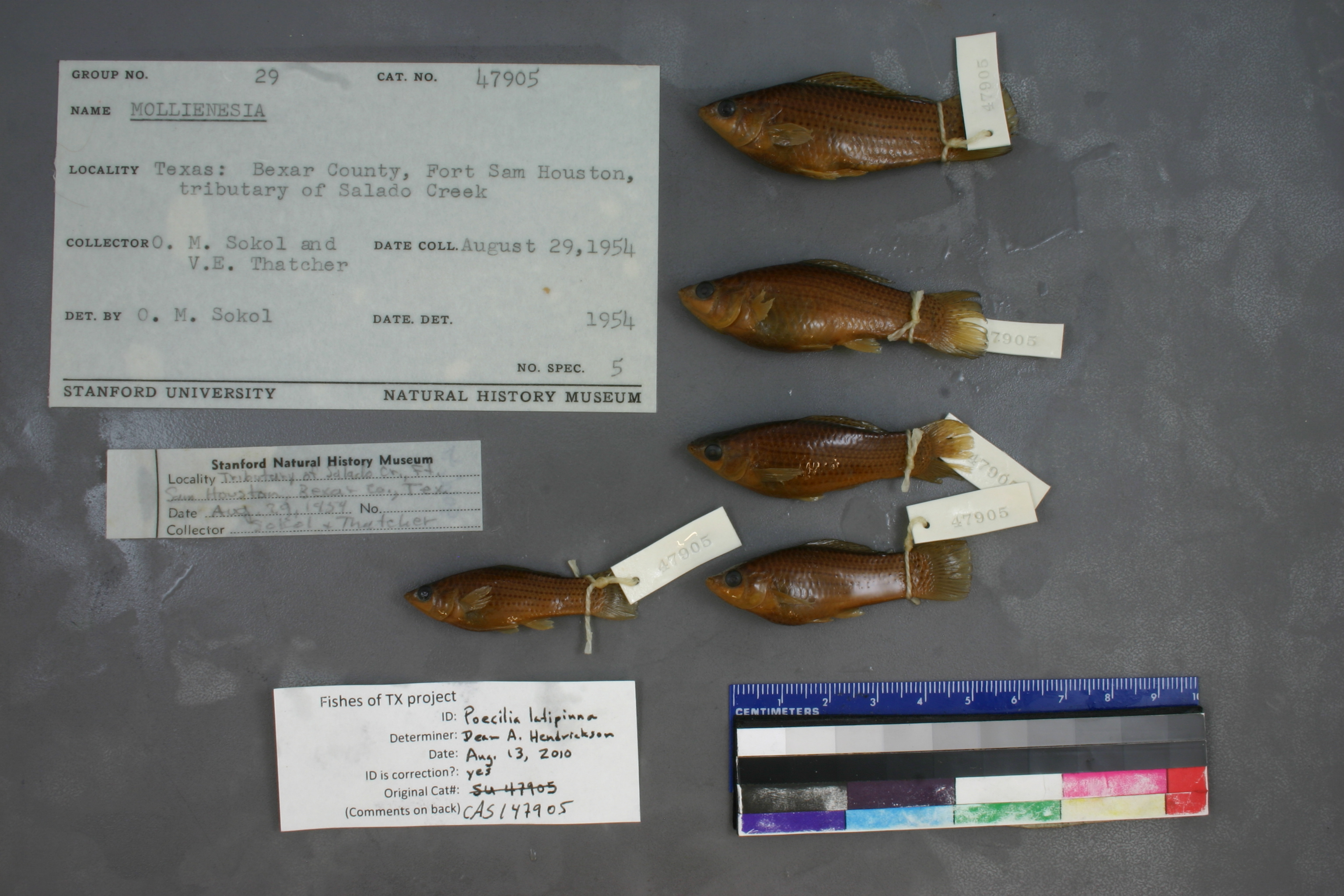
CAS_147905
Not suspect, examinedPhotos
Map
Location
29.46249° N, 98.42867° W
(± 1537.7
m)
Taxonomy
GenusMollienesia
Speciessp.
Specimen
Num Specimens0
Identification
DeterminerO.M. Sokol/1954
Collection Event
CollectorO.M. Sokol & V.E. Thatcher
Collected Date1954.8.29
Geography
CountryUnited States
StateTexas
CountyBexar
LocalityFort Sam Houston, tributary of Selado Creek
Record Source
Source
California Academy of Sciences
(type: specimens)
Institution
California Academy of Sciences
(type: museum)
Curator
Luiz Rocha
Record Added
May 13, 2010
Record Last Modified
July 27, 2022
Data Processing Track
Track 2
From Data Set Received
04/2009 to 10/2010
Identification
Suspect Notes
None
Count
No data
Current Determination
Determiner
Dean Hendrickson
Determination Date
Aug. 13, 2010
Determination Type
specimen examination
Identification Comments
ID complete
Identification Confidence
High
Collecting Event
Collected
Aug. 29, 1954
Collector(s)
Collecting Event ID
7211
Field Notes
There are no field notes available.
Locality
Region
Blackland Prairies
Jurisdiction
Bexar, Texas
Name
Unspecified tributary of Salado Creek at Fort Sam Houston
Hydrography
Texas-Gulf Region
Central Texas Coastal
San Antonio
Upper San Antonio
Headwaters Salado Creek
Walzem Creek
Captive
no
Locality Photos
No locality photos available.
flag (suspect/examine)
suspect: FALSE
flag (suspect/examine)
suspect: noexamination: yes
date
date_range: 8/29/1954-8/29/1954
collectors
collectors: Sokol, O.M. Thatcher, V.E.
staff comment
ID Status: Specimen examined and ID'ed for FoTX projectID Confidence: high
collectors
collectors: O.M. Sokol, V.E. Thatcher
date
date_range: 8/29/1954-8/29/1954
georeference
Error: 1537.66479360615Locality: Unspecified tributary of Salado Creek at Fort Sam HoustonCoordinates: 29.462493661;-98.428665161Georeferencer: AECGeographic note: Inland USA Texas
Comments On CAS_147905