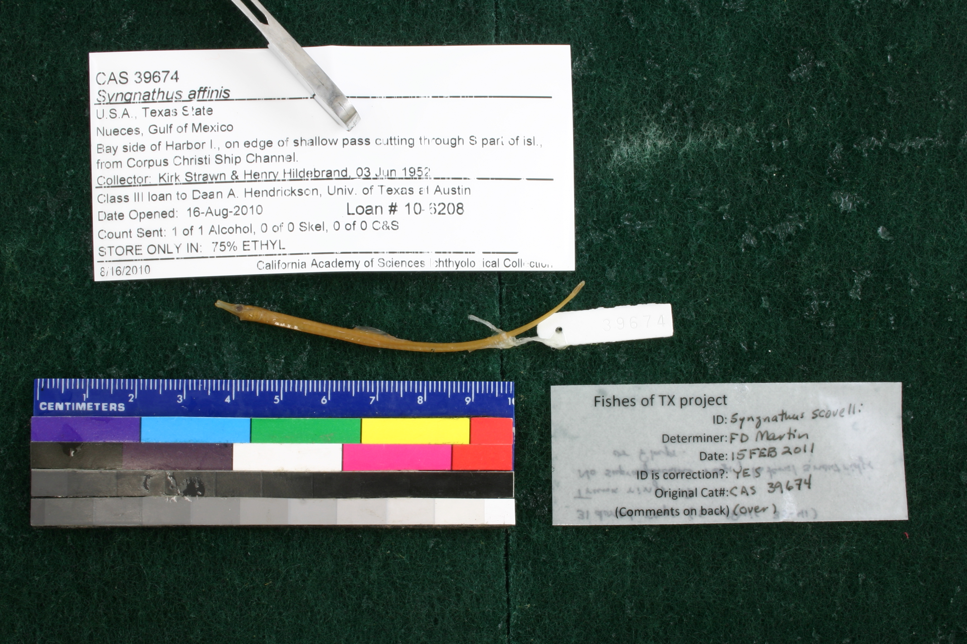
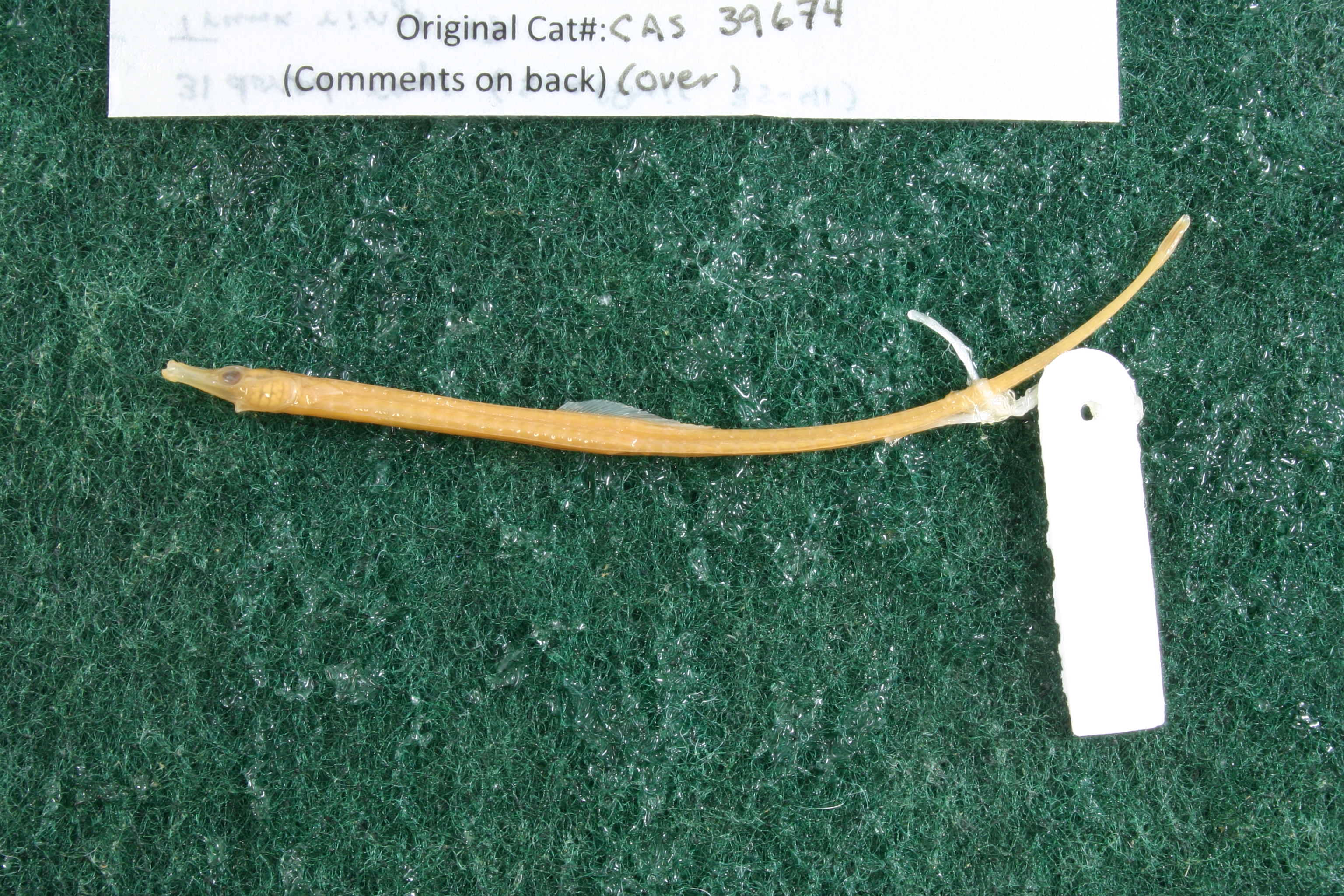
CAS_39674
Not suspect, examinedPhotos
Map
Location
27.84365° N, 97.12839° W
(± 1702.7
m)
Taxonomy
GenusSyngnathus
Speciesaffinis
Specimen
Num Specimens0
Identification
DeterminerC.E. Dawson/25 Jul 1977
Collection Event
CollectorKirk Strawn & Henry Hildebrand
Collected Date1952.6.3
Geography
CountryUnited States
StateTexas
CountyNueces
LocalityBay side of Harbor I., on edge of shallow pass cutting through S part of isl., from Corpus Christi Ship Channel.
Record Source
Source
California Academy of Sciences
(type: specimens)
Institution
California Academy of Sciences
(type: museum)
Curator
Luiz Rocha
Record Added
May 13, 2010
Record Last Modified
July 27, 2022
Data Processing Track
Track 2
From Data Set Received
04/2009 to 10/2010
Identification
Suspect Notes
None
Count
No data
Current Determination
Determiner
Floyd Douglas Martin
Determination Date
Feb. 15, 2011
Determination Type
specimen examination
Identification Comments
Specimen examined and Id'ed for FoTX project. | 31 dorsal rays; 17 trunck rings; no supraopercular ridge, lateral snout ridge or flaps
Identification Confidence
High
Collecting Event
Collected
June 3, 1952
Collector(s)
Collecting Event ID
7906
Field Notes
There are no field notes available.
Locality
Region
Gulf Coast Prairies & Marshes
Jurisdiction
Nueces, Texas
Name
Harbor Island, bay-side of southwest corner
Hydrography
Texas-Gulf Region
Central Texas Coastal
Central Texas Coastal
Aransas Bay
Aransas Bay
Aransas Bay
Captive
no
Locality Photos
No locality photos available.
flag (suspect/examine)
suspect: FALSE
flag (suspect/examine)
suspect: noexamination: yes
date
date_range: 6/3/1952-6/3/1952
collectors
collectors: Strawn, Kirk R. Hildebrand, Henry H.
collectors
collectors: Kirk R. Strawn, Henry Hildebrand
staff comment
ID Status: This lot in need of examination, but we have not been able to find this specimen at the donor institution. Specimen is likely either on loan, mis-shelved, permanently lost or in rare cases destroyed. Work in progress.
Georef Remark: Extent covers to halfway point of south half of island
date
date_range: 6/3/1952-6/3/1952
staff comment
not available or not found
georeference
Error: 1702.68595199269Remarks: Extent covers to halfway point of south half of islandLocality: Harbor Island, bay-side of southwest cornerCoordinates: 27.843650574;-97.128391105Georeferencer: MJCGeographic note: Inland USA Texas
Extent covers to halfway point of south half of island
Comments On CAS_39674