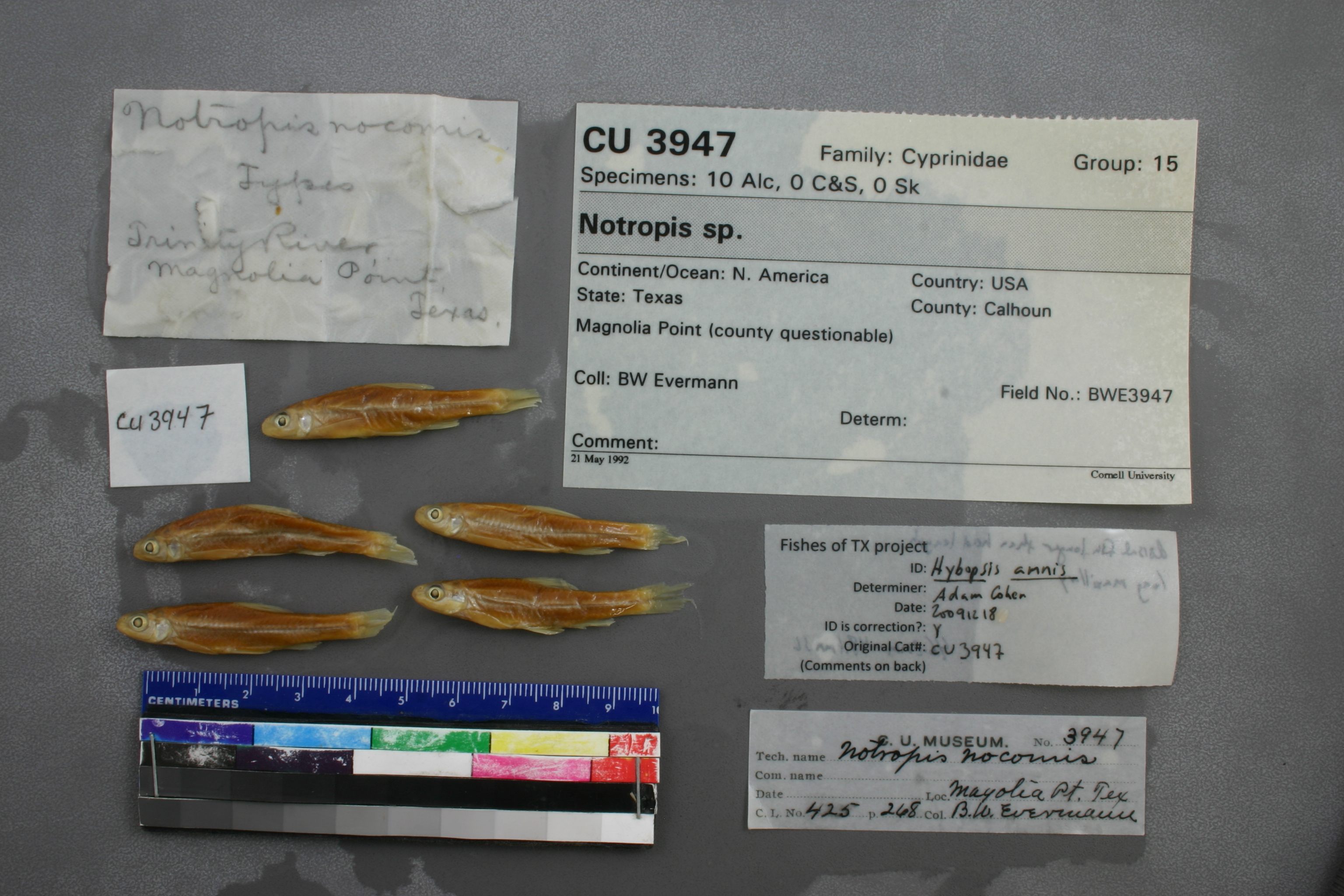
CU_3947
Not suspect, examinedPhotos
Map
Location
31.65419° N, 95.73587° W
(± 500
m)
Taxonomy
GenusNotropis
Speciessp.
Specimen
Num Specimens0
Collection Event
CollectorBW Evermann
Collected Datenone
Geography
CountryUnited States
StateTexas
CountyCalhoun
LocalityMagnolia Point (county questionable)
Record Source
Source
Cornell University Museum of Vertebrates
(type: specimens)
Institution
Cornell University
(type: university)
Curator
John Friel
Record Added
June 22, 2011
Record Last Modified
June 22, 2022
Data Processing Track
Track 2
From Data Set Received
04/2009 to 10/2010
Identification
Suspect Notes
None
Count
No data
Current Determination
Determiner
Adam Cohen
Determination Date
Dec. 18, 2009
Determination Type
specimen examination
Identification Comments
ID complete | dorsal fin longer than head length; long maxillary
Identification Confidence
High
Collecting Event
Collected
Nov. 23, 1891
Collector(s)
Collecting Event ID
383
Field Notes
There are no field notes available.
Locality
Region
Oak Woods & Prairies
Jurisdiction
Leon, Texas
Name
Trinity River at intersection of FM1990 and SH295 (Magnolia Point)
Hydrography
Texas-Gulf Region
Trinity
Lower Trinity
Lower Trinity-Tehuacana
Box Creek-Trinity River
Caney Creek-Trinity River
Captive
no
Locality Photos
No locality photos available.
HUC 12
120302010406
Georeferencing Remarks
Evermann collected at the Trinity SW of Palestine at Magnolia Point according to his report (https://www.biodiversitylibrary.org/item/148449#page/129/mode/1up). That collection point was at the town of Magnolia, which no longer exists, but location found here (https://tshaonline.org/handbook/online/articles/hvm07) inidcates it was at the intersections of modern day FM 1990 and SH 294. Point placed on the Trinity at the closest point to this intersection and error given as 500 meters somewhat arbitrarily.
Georeferencing Annotation
—
Has not been Georeferenced because
—
flag (suspect/examine)
suspect: FALSE
flag (suspect/examine)
suspect: noexamination: yes
date
date_range: 11/23/1891-11/23/1891
collectors
collectors: Evermann, Barton Warren Dr.
staff comment
ID Status: Specimen examined and ID'ed for FoTX projectID Comments: dorsal fin longer than head length; long maxillary
Georef Remark: Can't find Magnolia Point specifically. Assumed to be the strong bend in the river at Magnolia Cemetery which is near Palestine.
ID Confidence: high
collectors
collectors: Barton Warren Evermann
date
date_range: 11/23/1891-11/23/1891
georeference
Error: 8059.59475196542
Remarks: Can't find Magnolia Point specifically. Assumed to be the strong bend in the river at Magnolia Cemetery which is near Palestine.
Locality: Trinity River at Magnolia PointCoordinates: 31.653938079;-95.737251134Georeferencer: AECGeographic note: Inland USA TexasCan't find Magnolia Point specifically. Assumed to be the strong bend in the river at Magnolia Cemetery which is near Palestine.
Comments On CU_3947