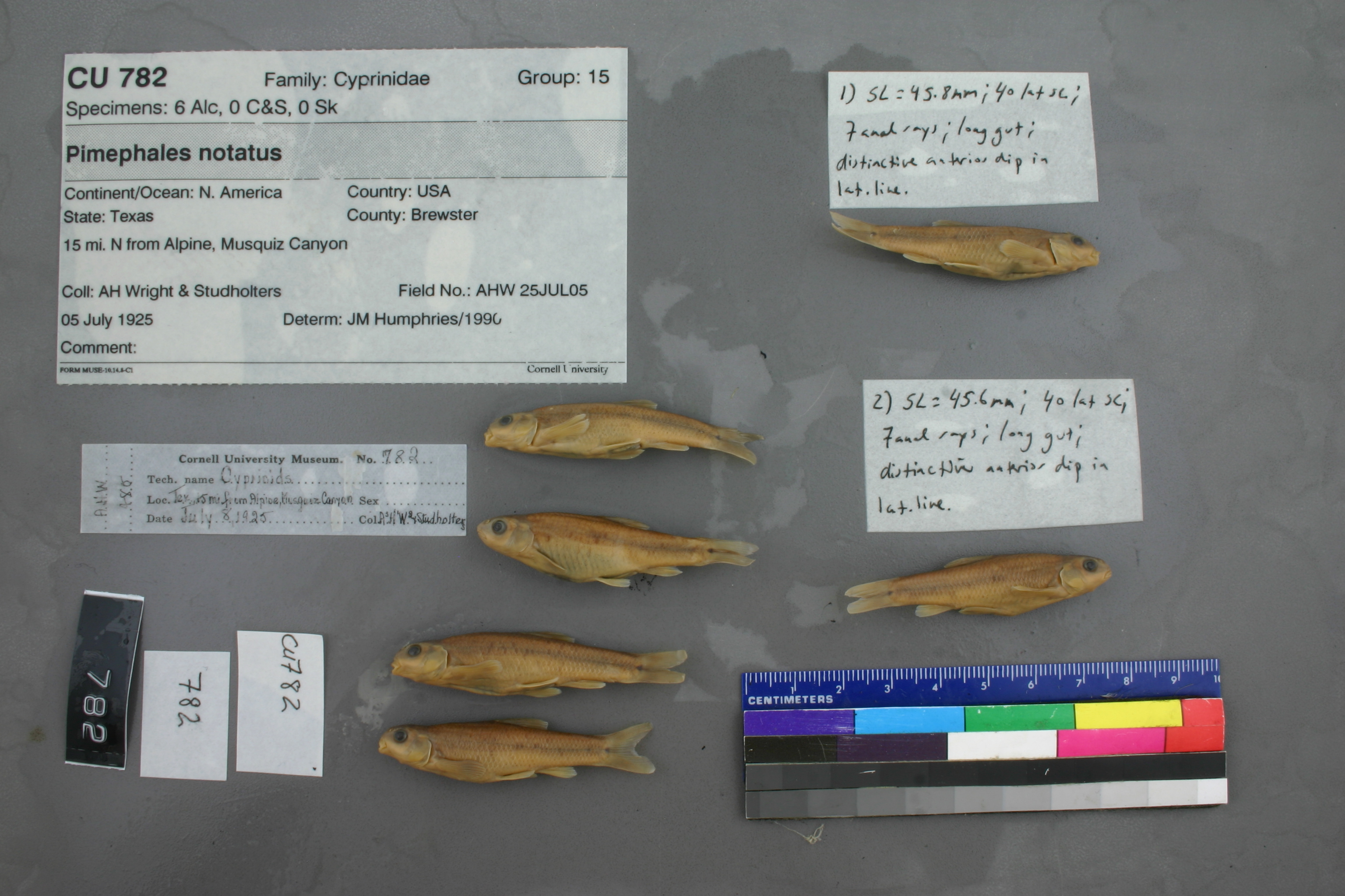
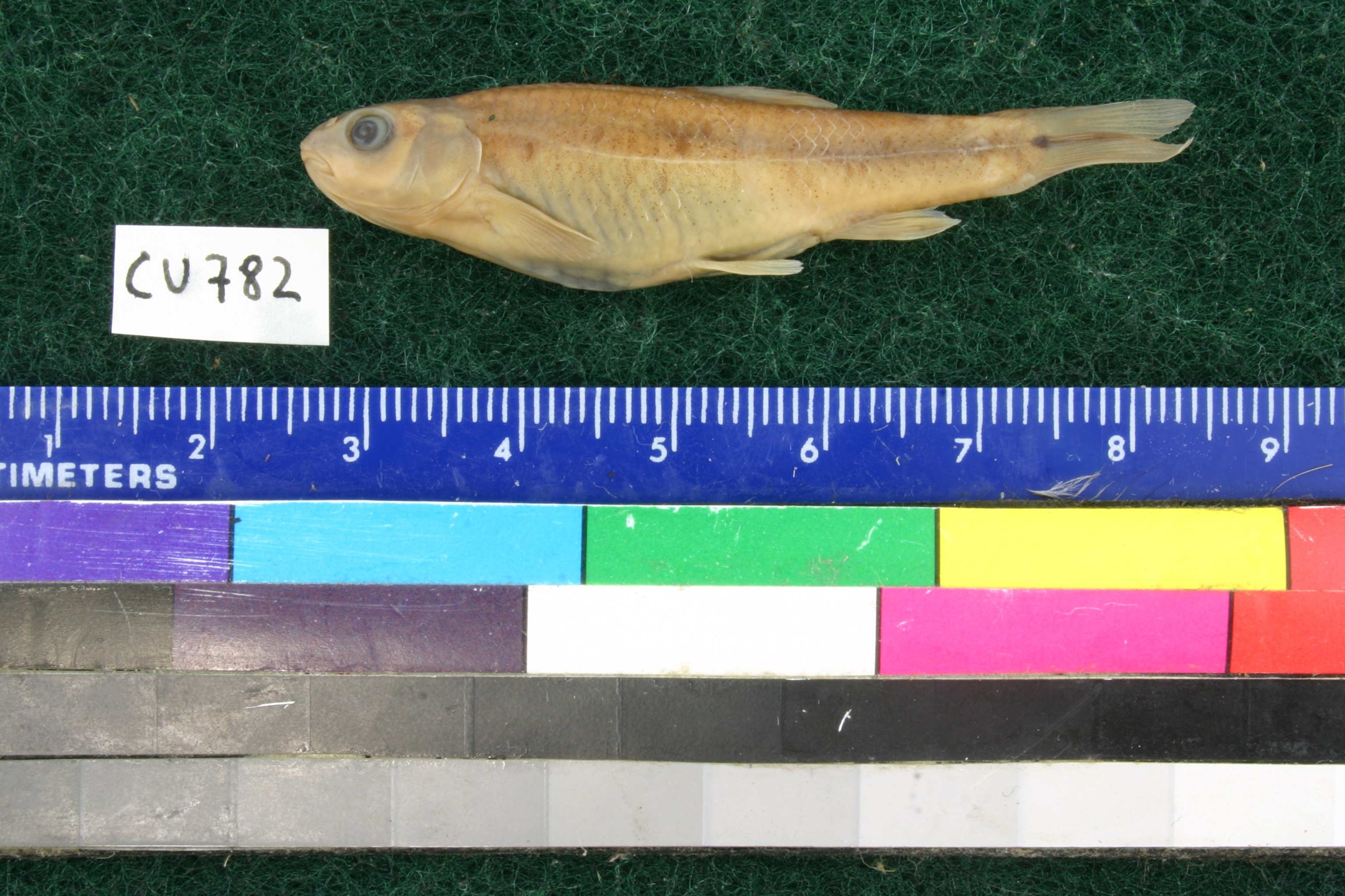
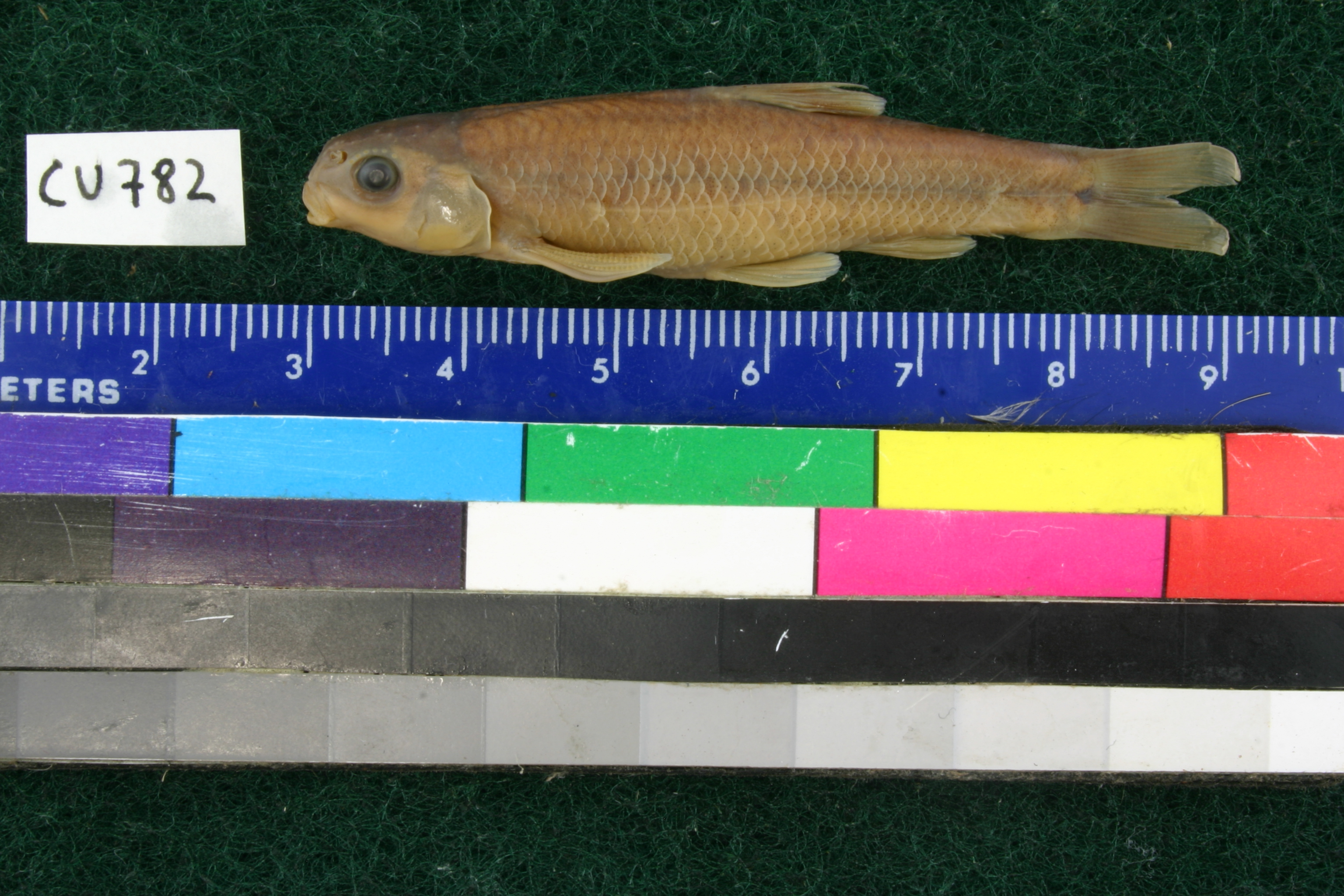
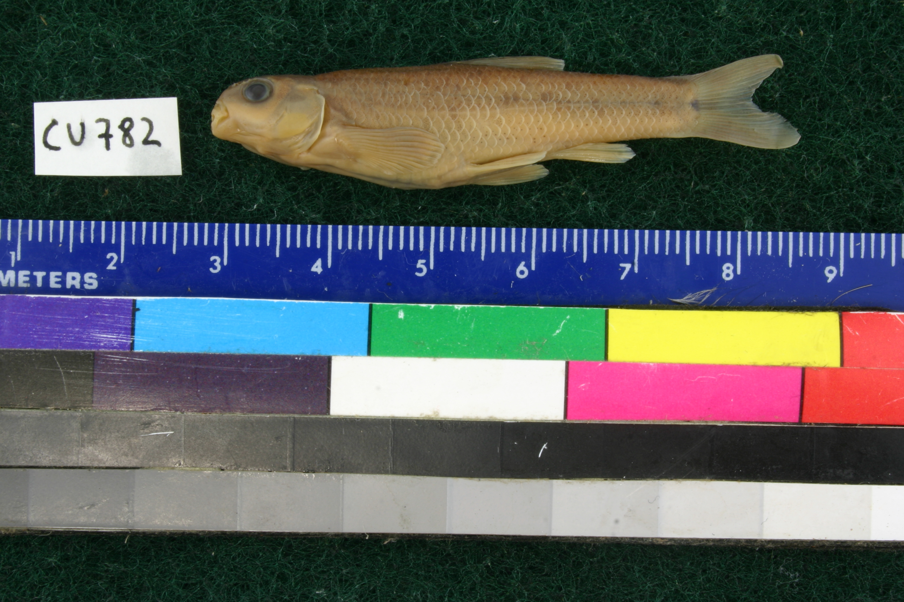
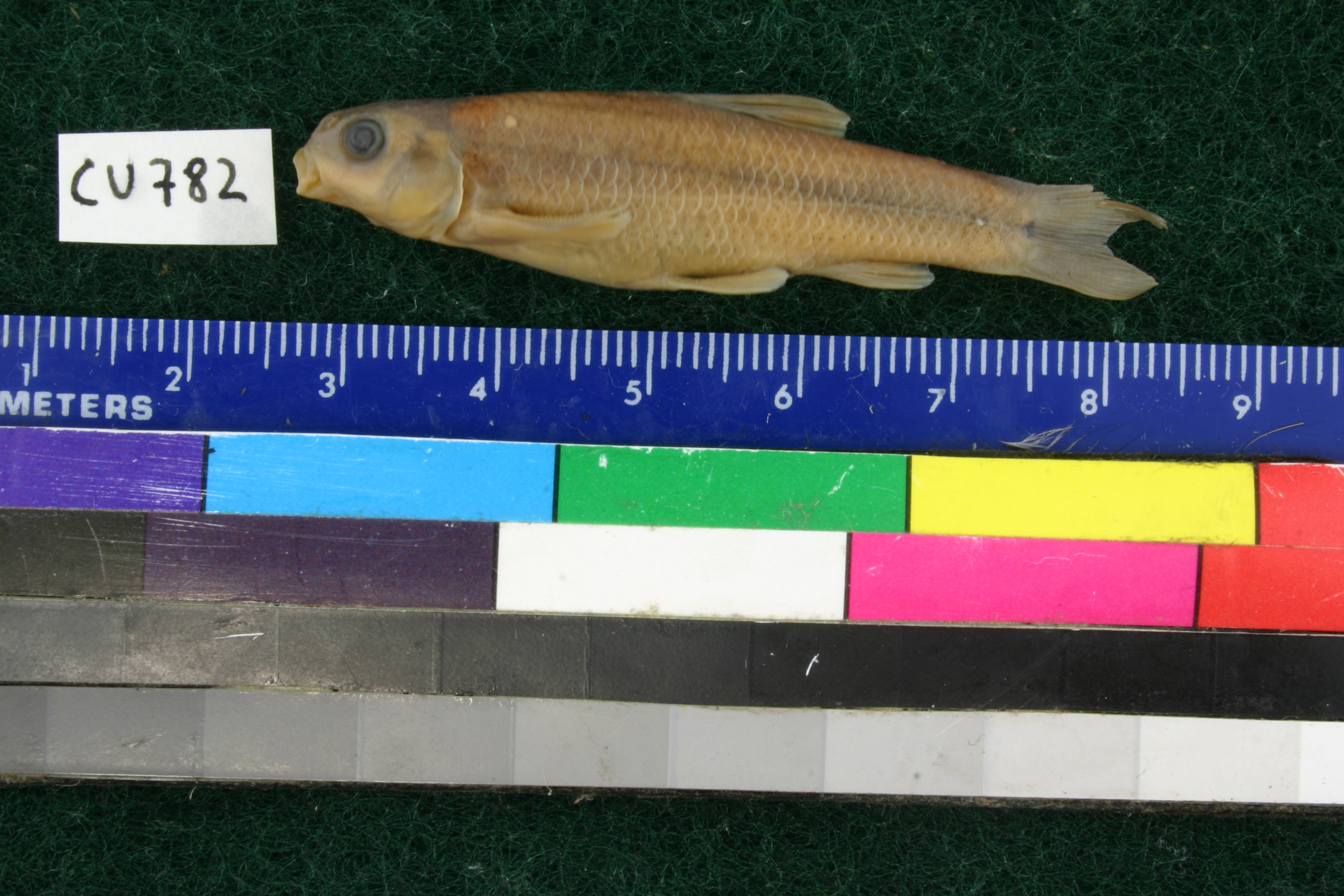
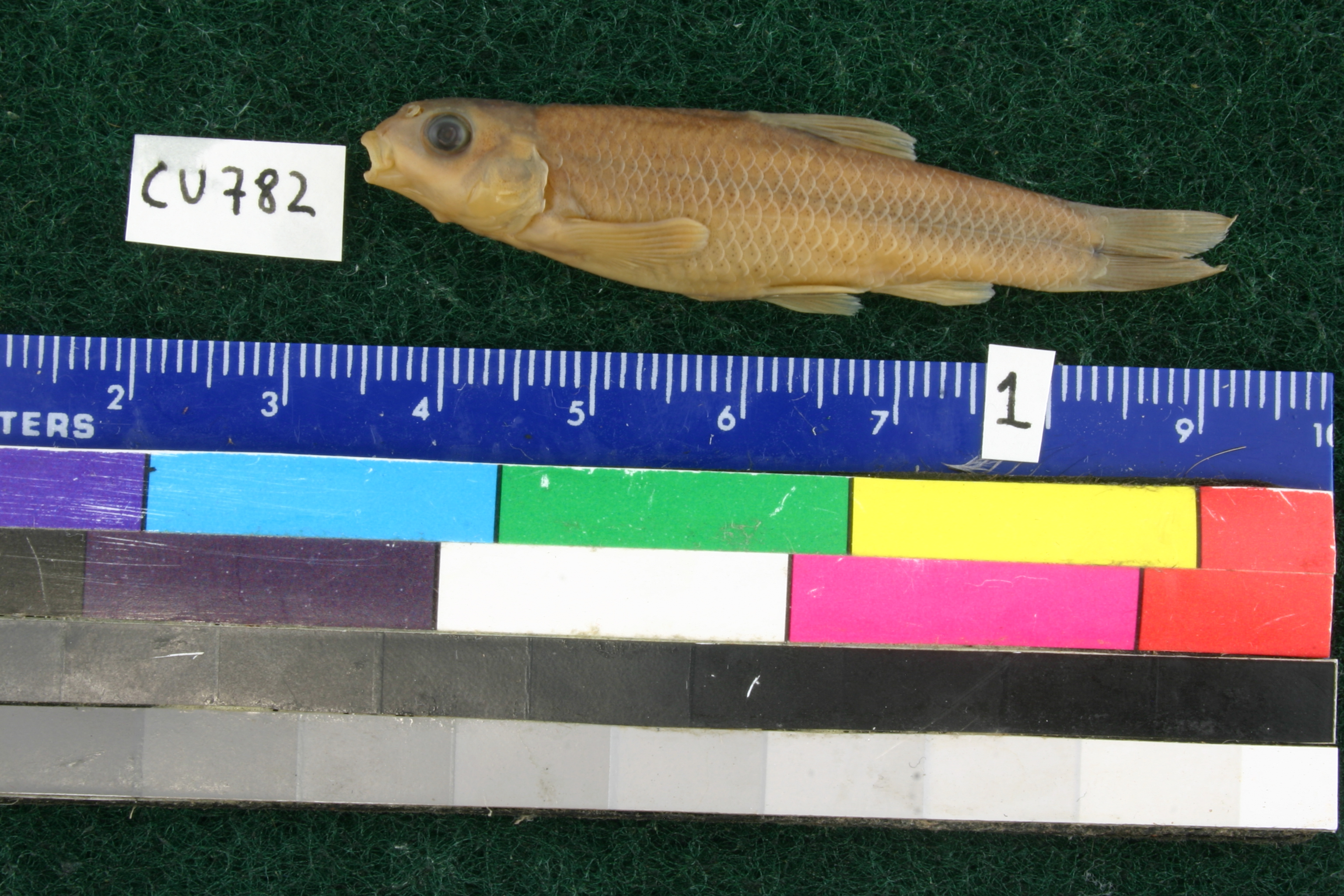
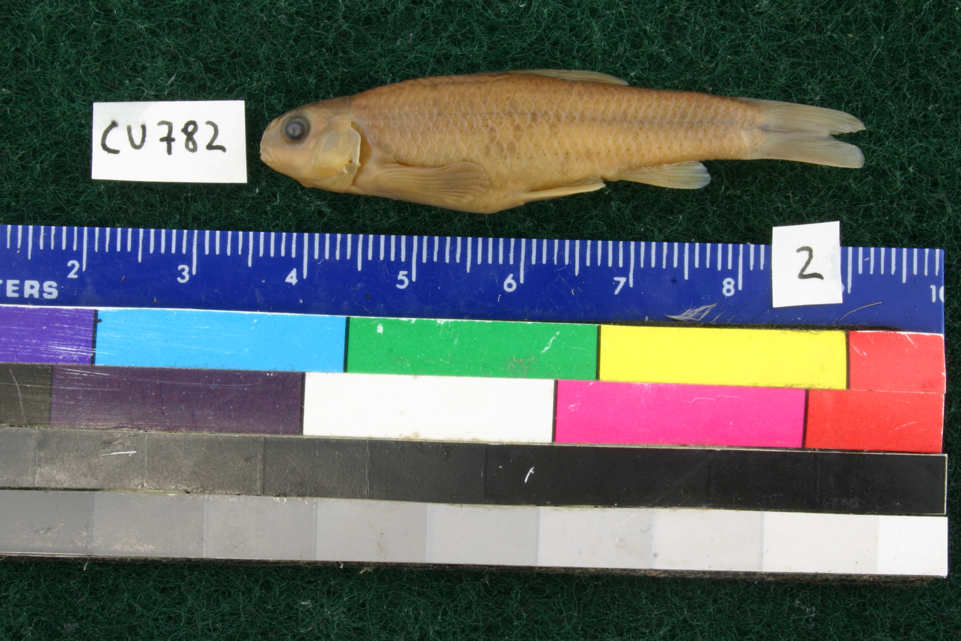
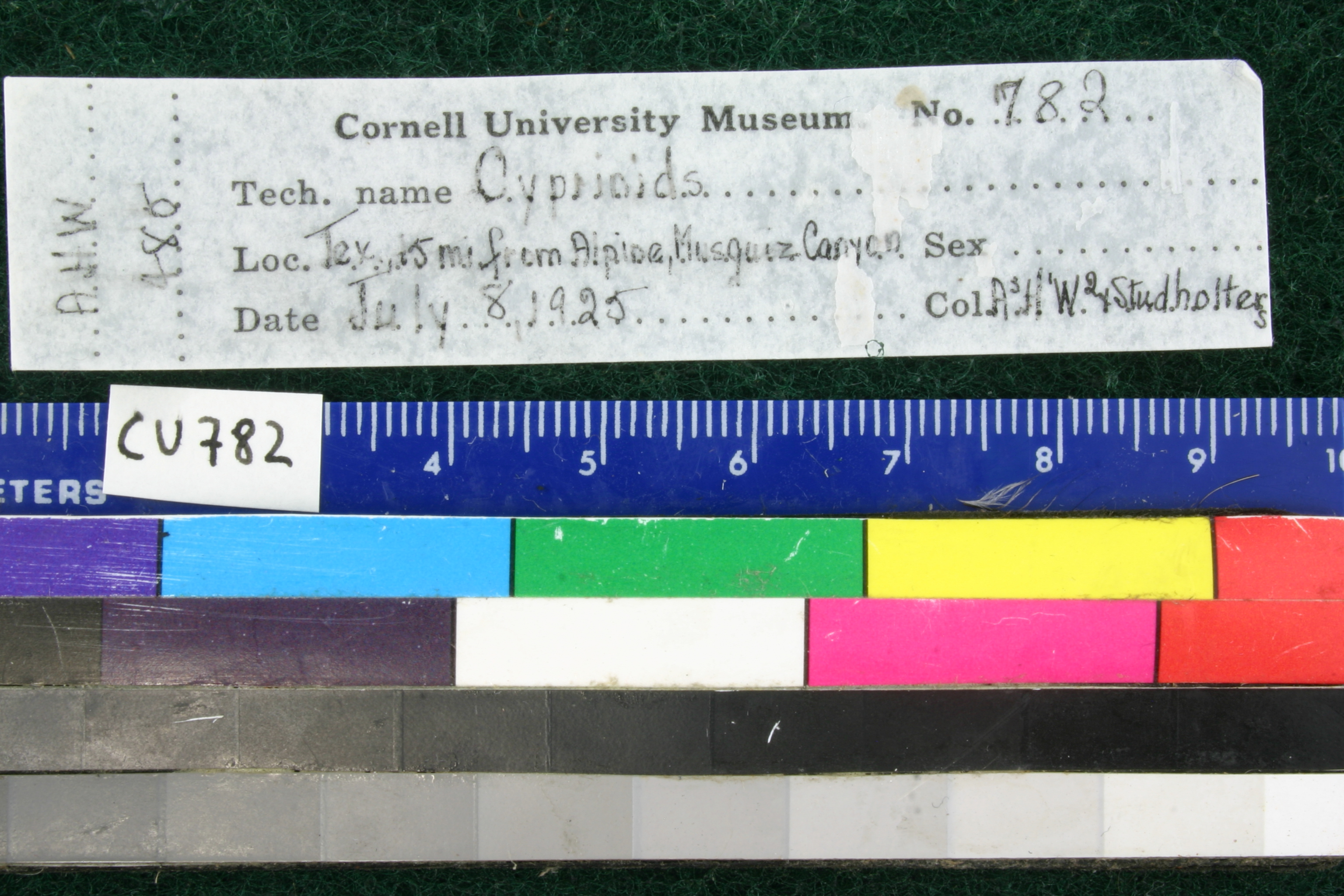
CU_782
Not suspect, examinedPhotos
Map
Location
30.56196° N, 103.50336° W
(± 13249.7
m)
Taxonomy
GenusPimephales
Speciesnotatus
Specimen
Num Specimens0
Identification
DeterminerJM Humphries/1990
Collection Event
CollectorAH Wright & Studholters
Collected Date1925.7.5
Geography
DrainageRio Grande
CountryUnited States
StateTexas
CountyBrewster
LocalityMusquiz Canyon, 15 mi. from Alpine
Record Source
Source
Cornell University Museum of Vertebrates
(type: specimens)
Institution
Cornell University
(type: university)
Curator
John Friel
Record Added
June 22, 2011
Record Last Modified
July 27, 2022
Data Processing Track
Track 2
From Data Set Received
04/2009 to 10/2010
Identification
Suspect Notes
None
Count
No data
Current Determination
Determiner
Adam Cohen
Determination Date
July 13, 2012
Determination Type
specimen examination
Identification Comments
Specimen examined and Id'ed for FoTX project. | very good condition (some with varying levels of tuberculation on head and pectoral fins); Specimen 1: (SL= 45.8mm; 40 lateral scales (left side); 7 anal rays; dorsal insertion anterior to pelvic insertion; pharyngeal teeth (pulled previously and found under opercula) are irregular and in a pattern difficult to define rows (best guess at count is 0,5-4,1), long gut, lateral line has distinctive anterior dip; tuberculation on pectorals and head especially over eye rather like Dionda episcopa and perhaps other Dionda (didn’t check).)Specimen 2: (SL = 45.6mm; all the notes are the same as specimen 1 except pharyngeal teeth are very different; left arch consists of a cluster (no defined rows) of 8 teeth, 2 of which have been worn down presumably and look like molars; right arch has one row of 4 teeth (very clean and normal).) Original ID of P. notatus is doubtful since this species is currently not recognized from TX; also coiling of gut in these specimens differs from some reference material I looked at (these have fewer loops); scales on nape do not look sufficiently crowded to be Pimephales; dorsal insertion much further posteriorly in these specimens compared to notatus reference material If Dionda, which they appear to most resemble, they’d be in the range of D. episcopa, but they appear to differ from episcopa in pharyngeal tooth count, shape of snout, (which is much more blunt and perhaps more like D. nigrotaeniata), and curvature of lateral line. Anal counts of 7 match D. nigrotaeniata. Specimen sent to Rick Mayden and Susana Schonhuth who both confirm this ID.
Identification Confidence
High
Collecting Event
Collected
July 5, 1925
Collector(s)
Collecting Event ID
350
Field Notes
There are no field notes available.
Locality
Region
Trans Pecos
Jurisdiction
Brewster, Texas
Name
Musquiz Creek in Brewster County
Hydrography
Rio Grande Region
Lower Pecos
Lower Pecos
Coyanosa-Hackberry Draws
Alpine Creek-Musquiz Creek
Middle Musquiz Creek
Captive
no
Locality Photos
No locality photos available.
flag (suspect/examine)
suspect: FALSE
flag (suspect/examine)
suspect: noexamination: yes
flag (suspect/examine)
mark examined and not suspect
date
date_range: 7/5/1925-7/5/1925
collectors
collectors: Wright, A.H. Studholters
collectors
collectors: A.H. Wright, Studholters
flag (suspect/examine)
suspect flag — We wish to examine this specimen
staff comment
ID Status: This lot in need of examination, but we have not been able to find this specimen at the donor institution. Specimen is likely either on loan, mis-shelved, permanently lost or in rare cases destroyed. Work in progress.
Georef Remark: Musquiz Canyon labeled as Musquiz Creek in Terrain Navigator
date
date_range: 7/5/1925-7/5/1925
staff comment
not available or not found
georeference
Error: 13249.7291519432Remarks: Musquiz Canyon labeled as Musquiz Creek in Terrain NavigatorLocality: Musquiz Creek in Brewster CountyCoordinates: 30.561955314;-103.503356009Georeferencer: BJLGeographic note: Inland USA Texas
Musquiz Canyon labeled as Musquiz Creek in Terrain Navigator
Comments On CU_782