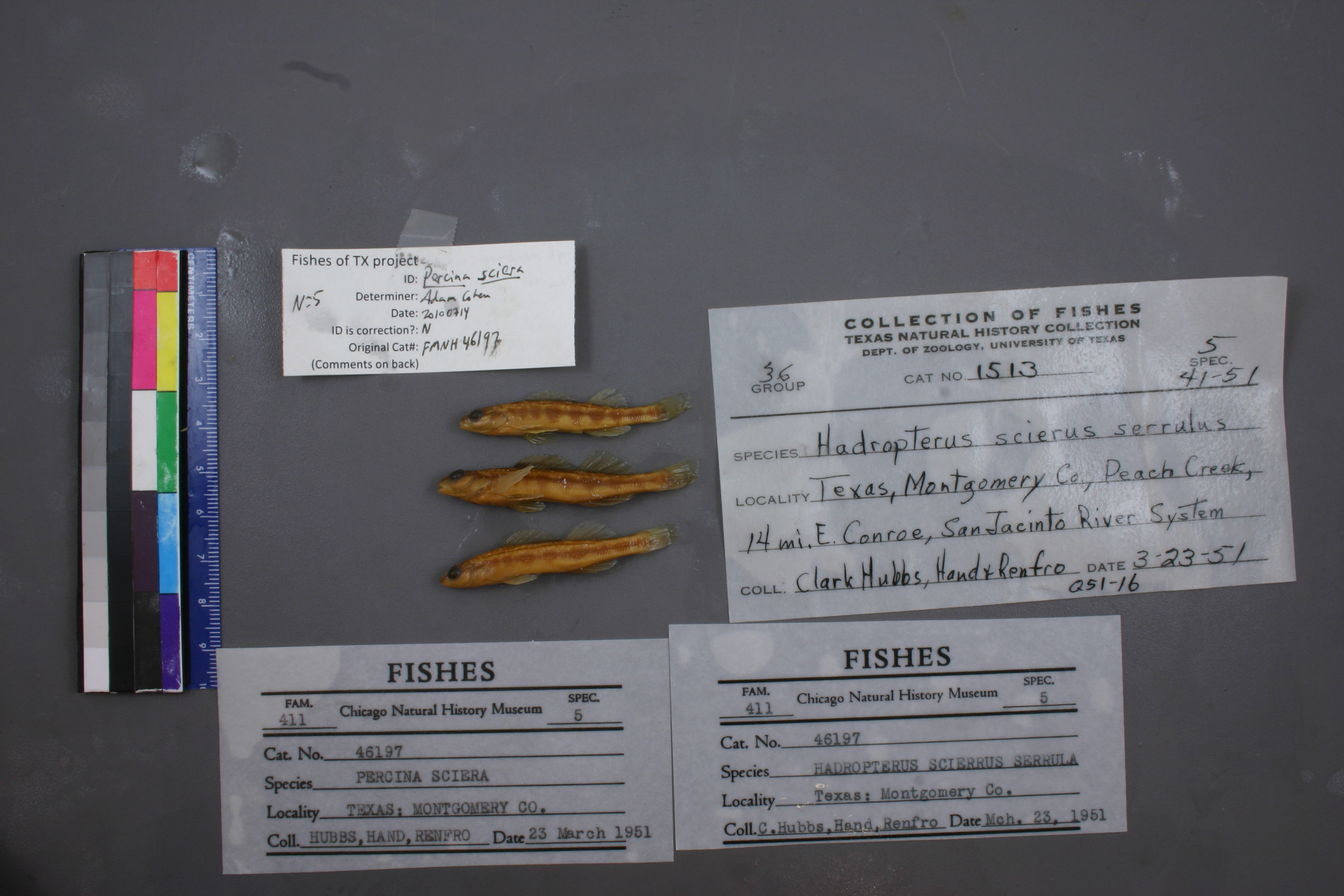
FMNH_46197
Not suspect, examinedPhotos
Map
Location
30.31543° N, 95.22392° W
(± 15824.7
m)
Taxonomy
GenusPercina
Speciessciera
Specimen
Num Specimens0
Collection Event
Collector"Clark Hubbs, Hand & Renfro"
Collected Date1951.3.23
Geography
DrainageSan Jacinto
CountryUnited States
StateTexas
CountyMontgomery
Locality"Peach Creek, 14 mi. E. Conroe, San Jacinto River System"
Record Source
Source
Field Museum of Natural History
(type: specimens)
Institution
Field Museum of Natural History
(type: museum)
Curator
Mark W. Westneat
Record Added
May 13, 2010
Record Last Modified
June 22, 2022
Data Processing Track
Track 2
From Data Set Received
5/2017 to 11/2017
Identification
Suspect Notes
None
Count
No data
Current Determination
Determiner
Adam Cohen
Determination Date
July 14, 2010
Determination Type
specimen examination
Identification Comments
ID complete | gill membrane connected broadly across isthmus
Identification Confidence
High
Collecting Event
Collected
March 23, 1951
Collector(s)
Collecting Event ID
7360
Field Notes
There are no field notes available.
Locality
Region
Piney Woods
Jurisdiction
Montgomery, Texas
Name
Peach Creek east of Conroe
Hydrography
Texas-Gulf Region
Galveston Bay-San Jacinto
San Jacinto
East Fork San Jacinto
Peach Creek-Caney Creek
Lawrence Creek-Peach Creek
Captive
no
Locality Photos
No locality photos available.
flag (suspect/examine)
suspect: FALSE
flag (suspect/examine)
suspect: noexamination: yes
date
date_range: 3/23/1951-3/23/1951
collectors
collectors: Hubbs, Clark Hand, H. Renfro, W.
staff comment
ID Status: Specimen examined and ID'ed for FoTX projectID Comments: gill membrane connected broadly across isthmus
Georef Remark: Point is placed due east of Conroe on Peach Creek and extent runs to line drawn northeast of Conroe.
ID Confidence: high
collectors
collectors: Clark Hubbs, H. Hand, W. Renfro
date
date_range: 3/23/1951-3/23/1951
georeference
Error: 15824.6795519321
Remarks: Point is placed due east of Conroe on Peach Creek and extent runs to line drawn northeast of Conroe.
Locality: Peach Creek east of ConroeCoordinates: 30.315430477;-95.223915482Georeferencer: AECGeographic note: Inland USA TexasPoint is placed due east of Conroe on Peach Creek and extent runs to line drawn northeast of Conroe.
Comments On FMNH_46197