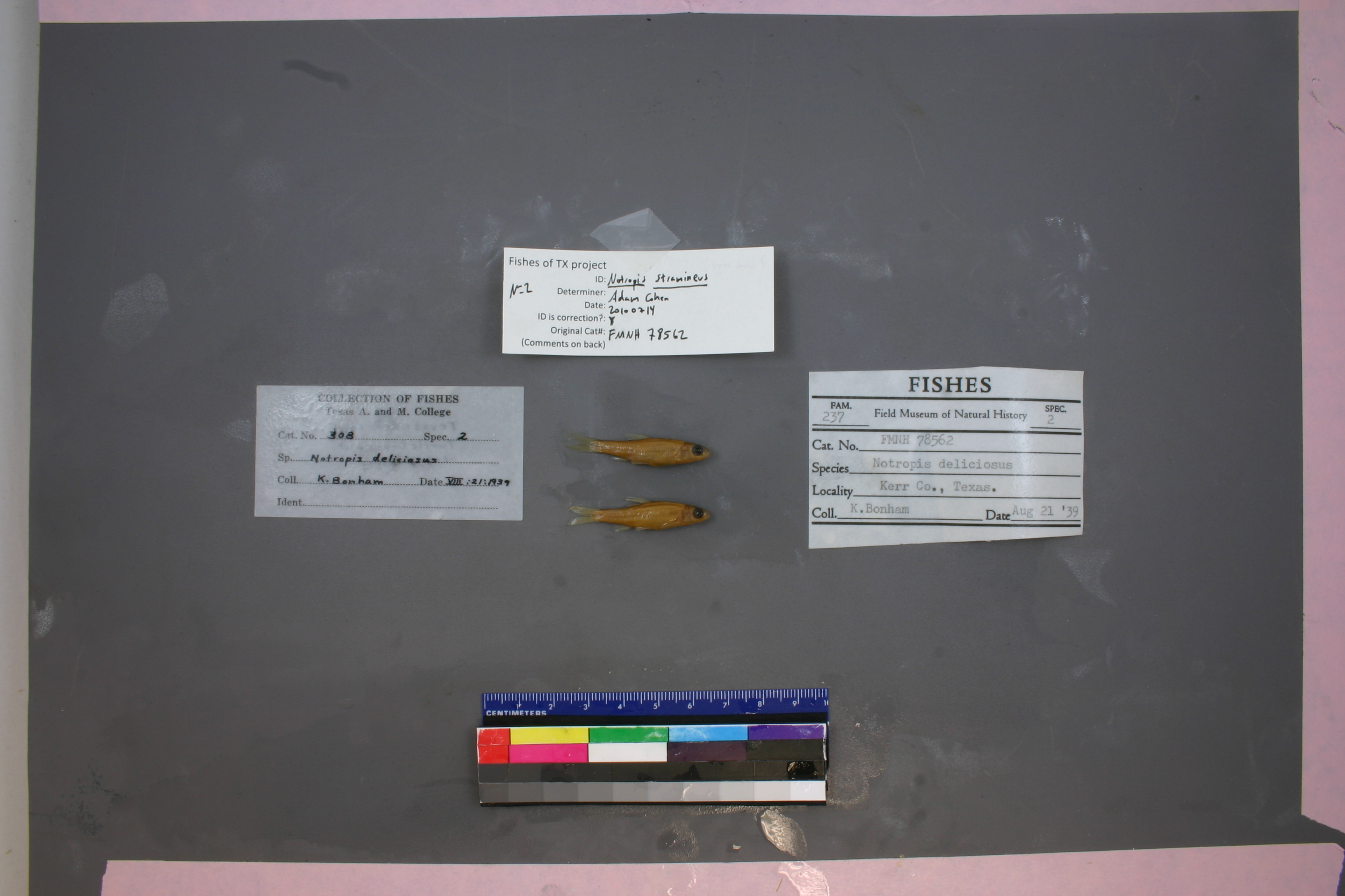
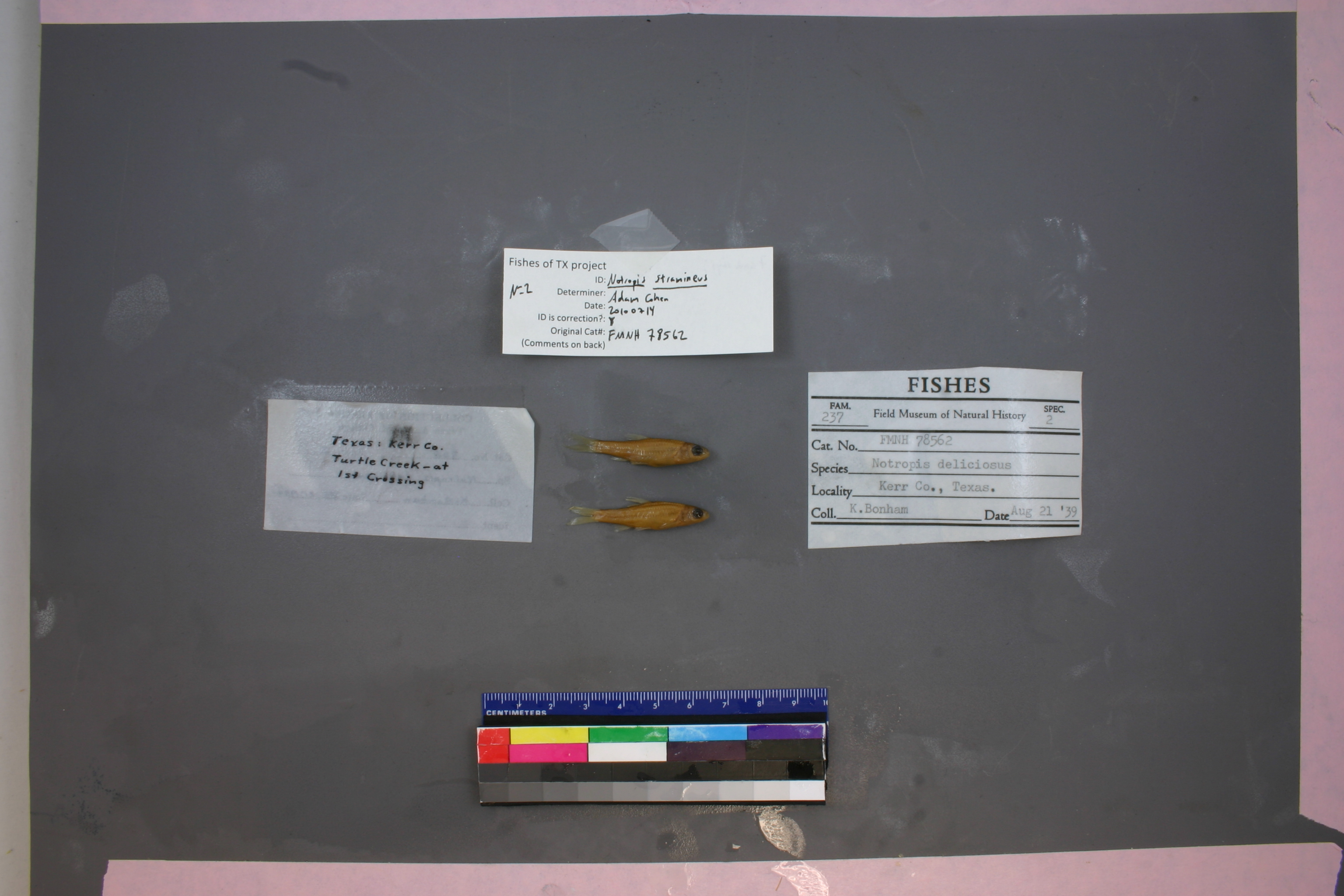
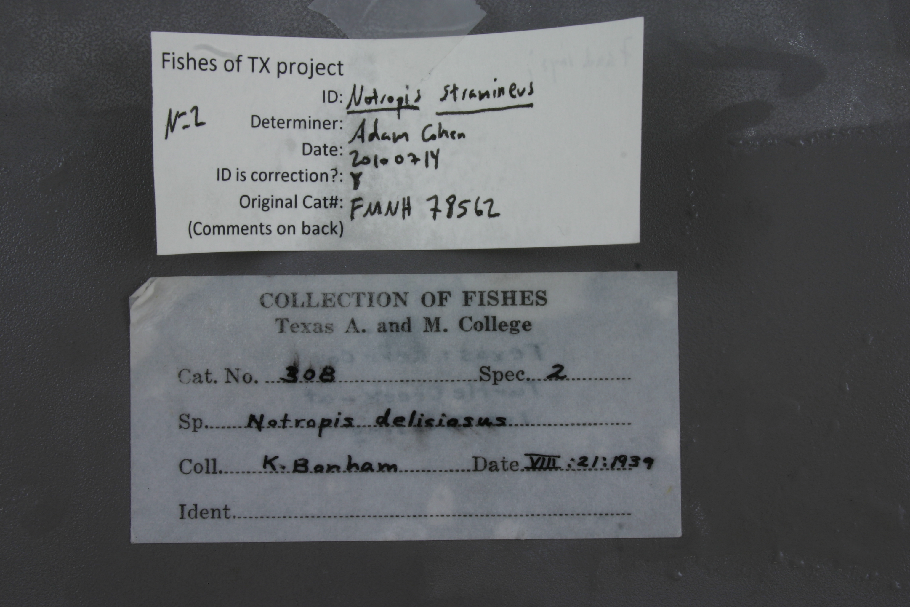
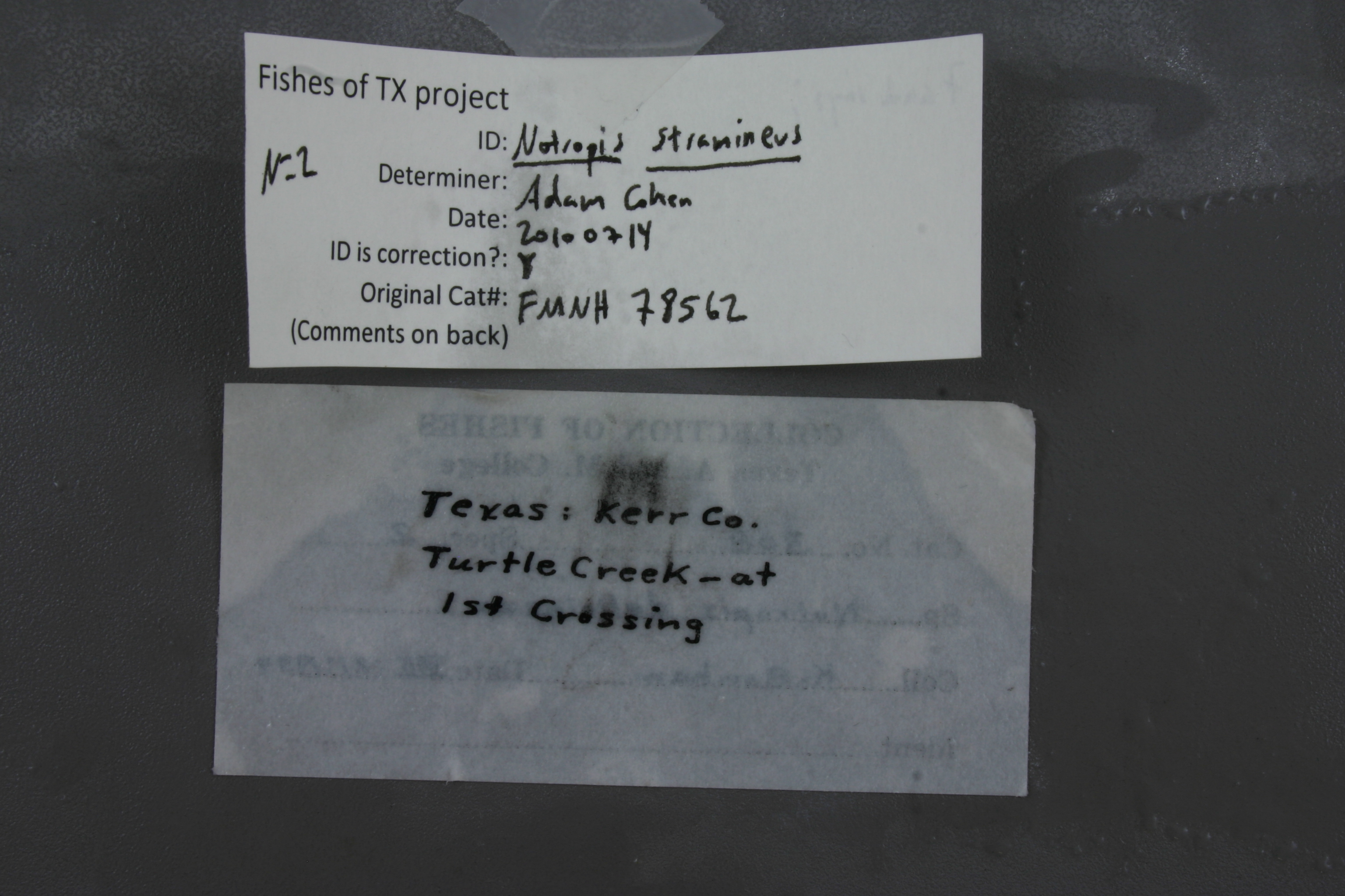
FMNH_78562
Not suspect, examinedPhotos
Map
Location
29.95350° N, 99.10386° W
(± 43.7
m)
Taxonomy
GenusNotropis
Speciesdeliciosus
Specimen
Num Specimens0
Collection Event
CollectorK. Bonham
Collected Date1939.8.21
Geography
CountryUnited States
StateTexas
CountyKerr
LocalityTurtle Creek at 1st crossing.
Record Source
Source
Field Museum of Natural History
(type: specimens)
Institution
Field Museum of Natural History
(type: museum)
Curator
Mark W. Westneat
Record Added
May 13, 2010
Record Last Modified
June 22, 2022
Data Processing Track
Track 2
From Data Set Received
5/2017 to 11/2017
Identification
Suspect Notes
None
Count
No data
Current Determination
Determiner
Adam Cohen
Determination Date
July 14, 2010
Determination Type
specimen examination
Identification Comments
ID complete | 7 anal rays
Identification Confidence
High
Collecting Event
Collected
Aug. 21, 1939
Collector(s)
Collecting Event ID
1150
Field Notes
There are no field notes available.
Locality
Region
Edwards Plateau
Jurisdiction
Kerr, Texas
Name
Turtle Creek at SH 173
Hydrography
Texas-Gulf Region
Central Texas Coastal
Guadalupe
Upper Guadalupe
Turtle Creek-Guadalupe River
Lower Turtle Creek
Captive
no
Locality Photos
No locality photos available.
flag (suspect/examine)
suspect: FALSE
flag (suspect/examine)
suspect: noexamination: yes
date
date_range: 8/21/1939-8/21/1939
collectors
collectors: Bonham, Kelshaw class
staff comment
ID Status: Specimen examined and ID'ed for FoTX projectID Comments: 7 anal raysGeoref Remark: Assumed that first crossing is determined from its most downstream point.ID Confidence: high
collectors
collectors: Kelshaw Bonham, class
date
date_range: 8/21/1939-8/21/1939
georeference
Error: 43.662Remarks: Assumed that first crossing is determined from its most downstream point.Locality: Turtle Creek at SH 173Coordinates: 29.953495953;-99.103863433Georeferencer: AECGeographic note: Inland USA Texas
Assumed that first crossing is determined from its most downstream point.
Comments On FMNH_78562