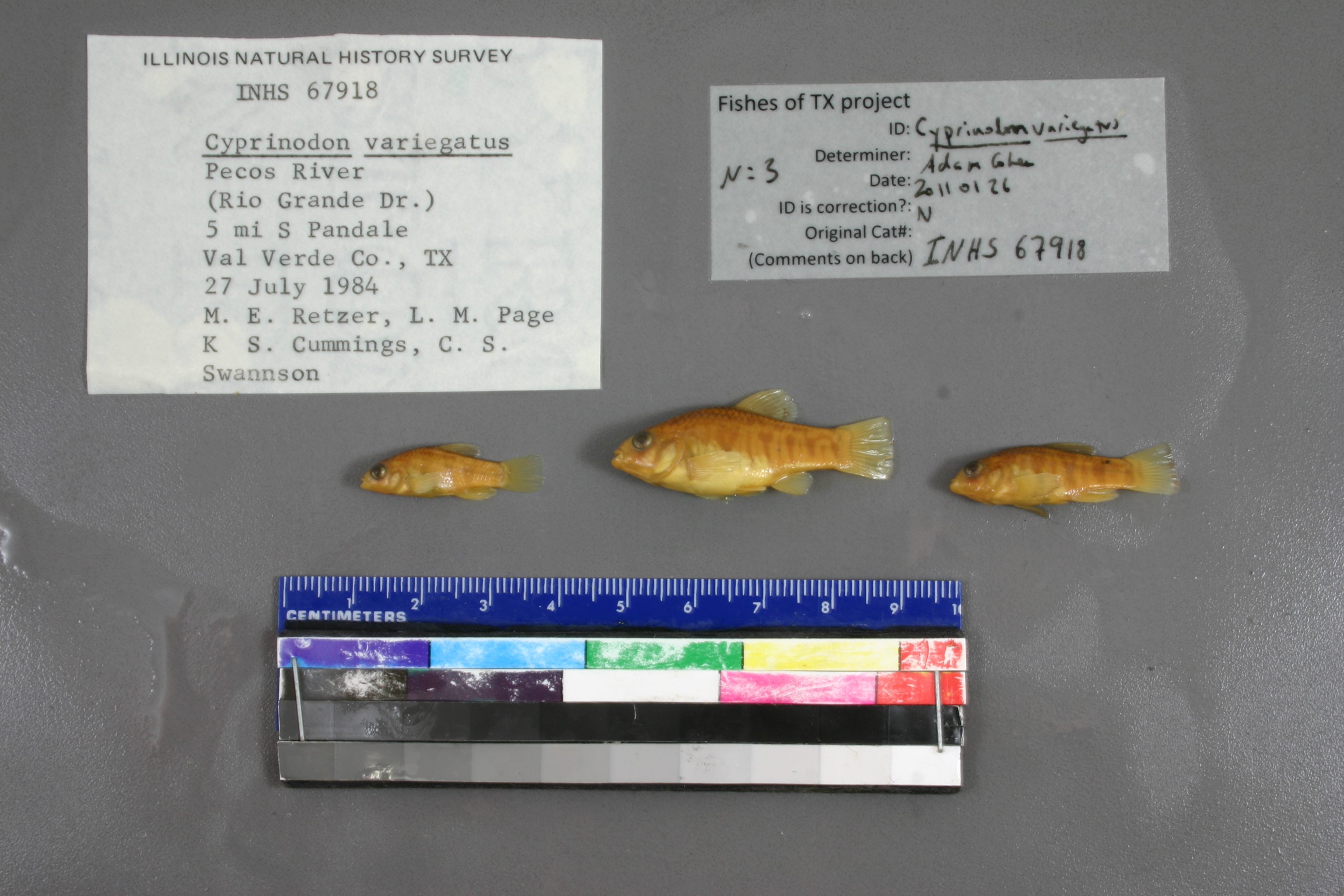
INHS_67918
Not suspect, examinedPhotos
Map
Location
30.13227° N, 101.57425° W
(± 3746.6
m)
Taxonomy
GenusCyprinodon
Speciesvariegatus
Specimen
Num Specimens0
Collection Event
CollectorL.M. Page,C.S. Swanson, K.S. Cummings & M.E. Retze
Collected Date1984.7.27
Geography
DrainageRio Grande
CountryUnited States
StateTexas
CountyVal Verde
LocalityPecos River; 5 mi SPandale
Record Source
Source
Illinois Natural History Survey
(type: specimens)
Institution
Illinois Natural History Survey
(type: museum)
Curator
Chris Taylor
Record Added
May 13, 2010
Record Last Modified
June 22, 2022
Data Processing Track
Track 2
From Data Set Received
11/1997 to 05/2006
Identification
Suspect Notes
None
Count
No data
Current Determination
Determiner
Adam Cohen
Determination Date
Jan. 26, 2011
Determination Type
specimen examination
Identification Comments
ID complete
Identification Confidence
High
Collecting Event
Collected
July 27, 1984
Collector(s)
Collecting Event ID
2757
Field Notes
There are no field notes available.
Locality
Region
Trans Pecos
Jurisdiction
Val Verde, Texas
Name
Pecos River 5 miles south of Pandale
Hydrography
Rio Grande Region
Lower Pecos
Lower Pecos
Lower Pecos
Big Fielder Draw-Pecos River
Little Fielder Draw-Pecos River
Captive
no
Locality Photos
No locality photos available.
flag (suspect/examine)
suspect: FALSE
flag (suspect/examine)
suspect: noexamination: yes
date
date_range: 7/27/1984-7/27/1984
collectors
collectors: Page, Larry M. Swanson, C.S. Cummings, K.S. Retzer, Michael E.
staff comment
ID Status: Specimen examined and ID'ed for FoTX project
Georef Remark: Measured by SH 1024 and point placed on river at closest point. Distance to measurement by river is added to starting extent.
ID Confidence: high
collectors
collectors: Larry M. Page, C.S. Swanson, K.S. Cummings, M.E. Retzer
date
date_range: 7/27/1984-7/27/1984
georeference
Error: 3746.55283198392
Remarks: Measured by SH 1024 and point placed on river at closest point. Distance to measurement by river is added to starting extent.
Locality: Pecos River 5 miles south of PandaleCoordinates: 30.13227452;-101.574246167Georeferencer: AECGeographic note: Inland USA TexasMeasured by SH 1024 and point placed on river at closest point. Distance to measurement by river is added to starting extent.
Comments On INHS_67918