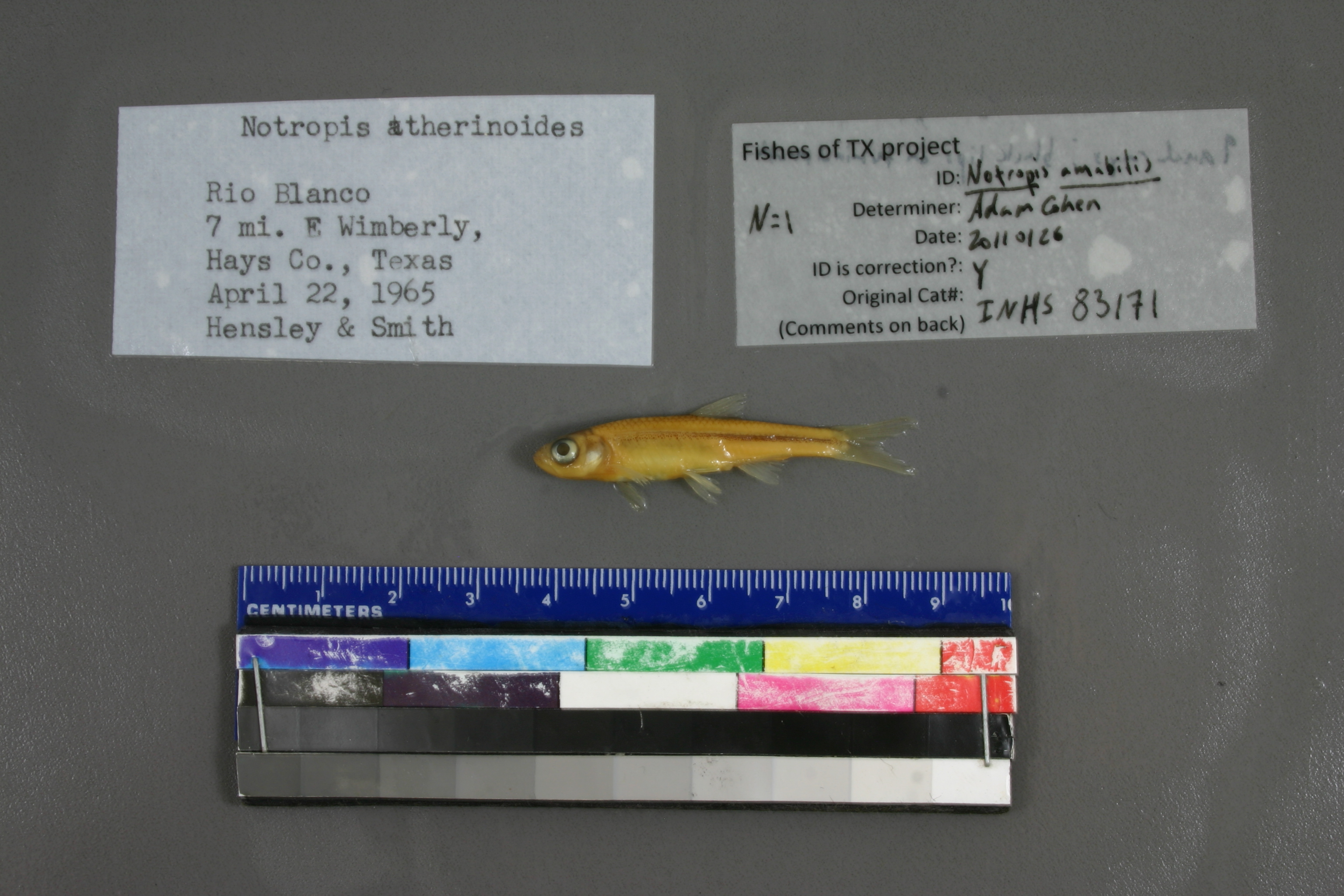
INHS_83171
Not suspect, examinedPhotos
Map
Location
29.98703° N, 98.00843° W
(± 1714.0
m)
Taxonomy
GenusNotropis
Speciesatherinoides
Specimen
Num Specimens0
Collection Event
CollectorP.W. Smith & M.M. Hensley
Collected Date1965.4.22
Geography
DrainageGuadalupe
CountryUnited States
StateTexas
CountyHays
LocalityRio Blanco; 7 mi EWimberly
Record Source
Source
Illinois Natural History Survey
(type: specimens)
Institution
Illinois Natural History Survey
(type: museum)
Curator
Chris Taylor
Record Added
May 13, 2010
Record Last Modified
June 22, 2022
Data Processing Track
Track 2
From Data Set Received
11/1997 to 05/2006
Identification
Suspect Notes
None
Count
No data
Current Determination
Determiner
Adam Cohen
Determination Date
Jan. 26, 2011
Determination Type
specimen examination
Identification Comments
ID complete | 9 anal rays; black lips on terminal mouth
Identification Confidence
Unknown
Collecting Event
Collected
April 22, 1965
Collector(s)
Collecting Event ID
2784
Field Notes
There are no field notes available.
Locality
Region
Edwards Plateau
Jurisdiction
Hays, Texas
Name
Blanco River, 7 miles downstream of Wimberley
Hydrography
Texas-Gulf Region
Central Texas Coastal
Guadalupe
San Marcos
Lower Blanco River
Lone Man Creek-Blanco River
Captive
no
Locality Photos
No locality photos available.
flag (suspect/examine)
suspect: FALSE
flag (suspect/examine)
suspect: noexamination: yes
date
date_range: 4/22/1965-4/22/1965
collectors
collectors: Smith, P.W. Hensley, M.M.
staff comment
ID Status: Specimen examined and ID'ed for FoTX projectID Comments: 9 anal rays; black lips on terminal mouthGeoref Remark: Measured by stream
collectors
collectors: P.W. Smith, M.M. Hensley
date
date_range: 4/22/1965-4/22/1965
georeference
Error: 1713.95135999265Remarks: Measured by streamLocality: Blanco River, 7 miles downstream of WimberleyCoordinates: 29.987026923;-98.00842579Georeferencer: AECGeographic note: Inland USA Texas
Measured by stream
Comments On INHS_83171