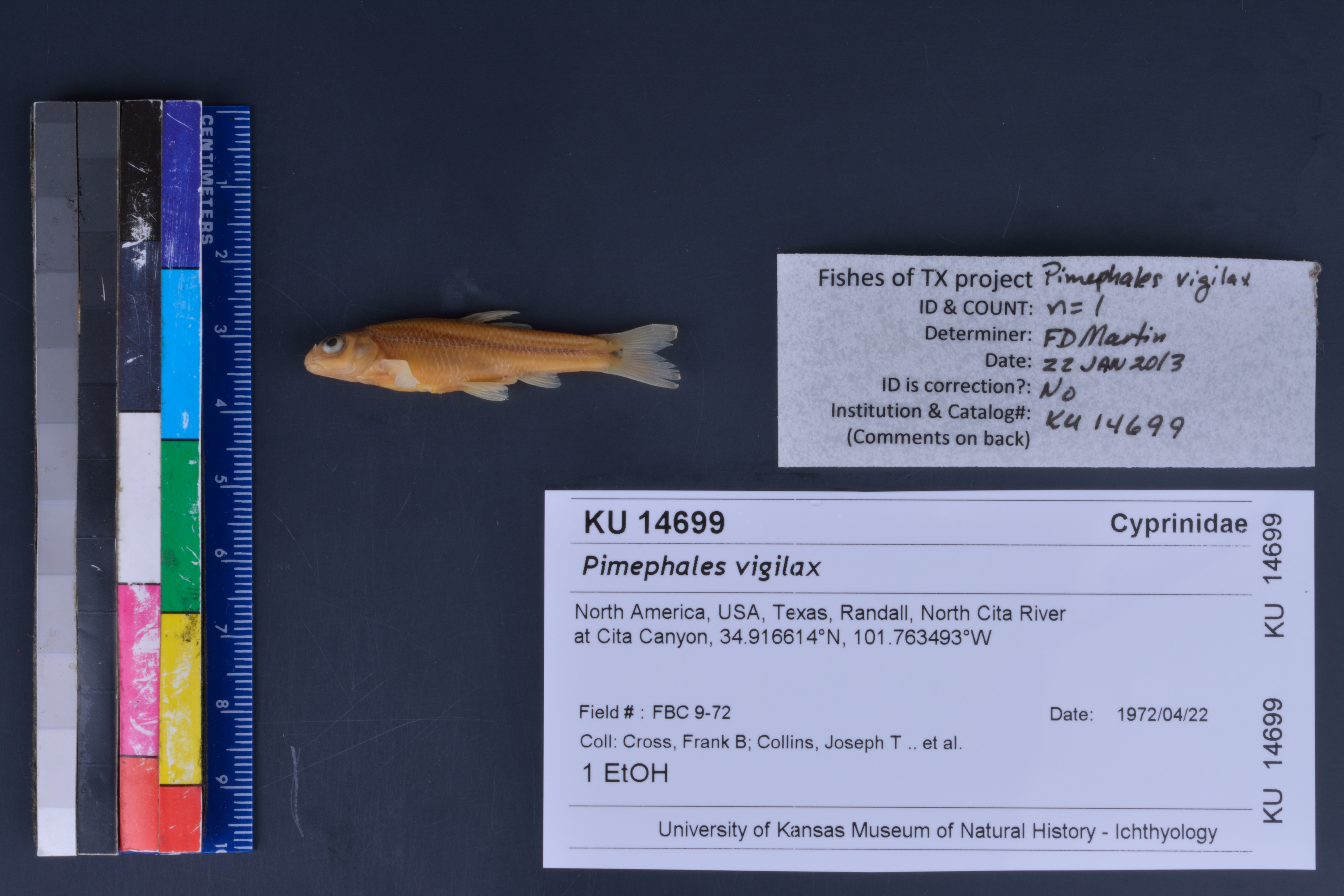
KUI_14699
Not suspect, examinedPhotos
Map
Location
34.88800° N, 101.62764° W
(± 11278.3
m)
Taxonomy
GenusPimephales
Speciesvigilax
Specimen
Num Specimens0
Identification
DeterminerUnknown
Collection Event
Collector"F.B. Cross, J.T. Collins, M. Whitenton"
Collected Date1972.4.22
Geography
CountryUnited States
StateTexas
CountyUnknown
LocalityCeta Canyon
Record Source
Source
Natural History Museum and Biodiversity Research Center
(type: specimens)
Institution
Natural History Museum and Biodiversity Research Center
(type: museum)
Curator
Leo Smith
Record Added
May 13, 2010
Record Last Modified
March 23, 2026
Data Processing Track
Track 2
From Data Set Received
11/1997 to 05/2006
Identification
Suspect Notes
None
Count
No data
Current Determination
Determiner
Floyd Douglas Martin
Determination Date
Jan. 22, 2013
Determination Type
specimen examination
Identification Comments
Specimen examined and Id'ed for FoTX project. | mouth subinferior; peritoneum silvery; basicaudal spot separate from lateral streak
Identification Confidence
High
Collecting Event
Collected
April 22, 1972
Collector(s)
Collecting Event ID
9053
Field Notes
There are no field notes available.
Locality
Region
Rolling Plains
Jurisdiction
Randall, Texas
Name
Cita Canyon
Hydrography
Arkansas-White-Red Region
Red Headwaters
Prairie Dog Town Fork Red
Upper Prairie Dog Town Fork Red
Headwaters Prarie Dog Town Fork Red River
South Cita Creek-Cita Creek
Captive
no
Locality Photos
No locality photos available.
flag (suspect/examine)
suspect: FALSE
flag (suspect/examine)
suspect: noexamination: yes
date
date_range: 4/22/1972-4/22/1972
collectors
collectors: Cross, Frank B. Collins, Joseph T. Whitenton, M.
staff comment
ID Status: Not flagged for specimen examination. By default we accept donor specimen determinations (after synonymization to our taxonomy). If georeferenced to TX this record has been considered in spatial context with other occurences of this species and accepted as correct.
ID Comments: NAGeoref Remark: Point is placed at the confluence of North and South Cita Creek and extent covers both canyons.
Georef Annotation: Should be 'Cita' not 'Ceta'
collectors
collectors: Frank B. Cross, J.T. Collins, M. Whitenton
date
date_range: 4/22/1972-4/22/1972
georeference
Error: 11278.2827519516
Remarks: Point is placed at the confluence of North and South Cita Creek and extent covers both canyons. Should be 'Cita' not 'Ceta'
Locality: Cita CanyonCoordinates: 34.887997082;-101.627635225Georeferencer: AECGeographic note: Inland USA TexasPoint is placed at the confluence of North and South Cita Creek and extent covers both canyons. Should be 'Cita' not 'Ceta'
Comments On KUI_14699