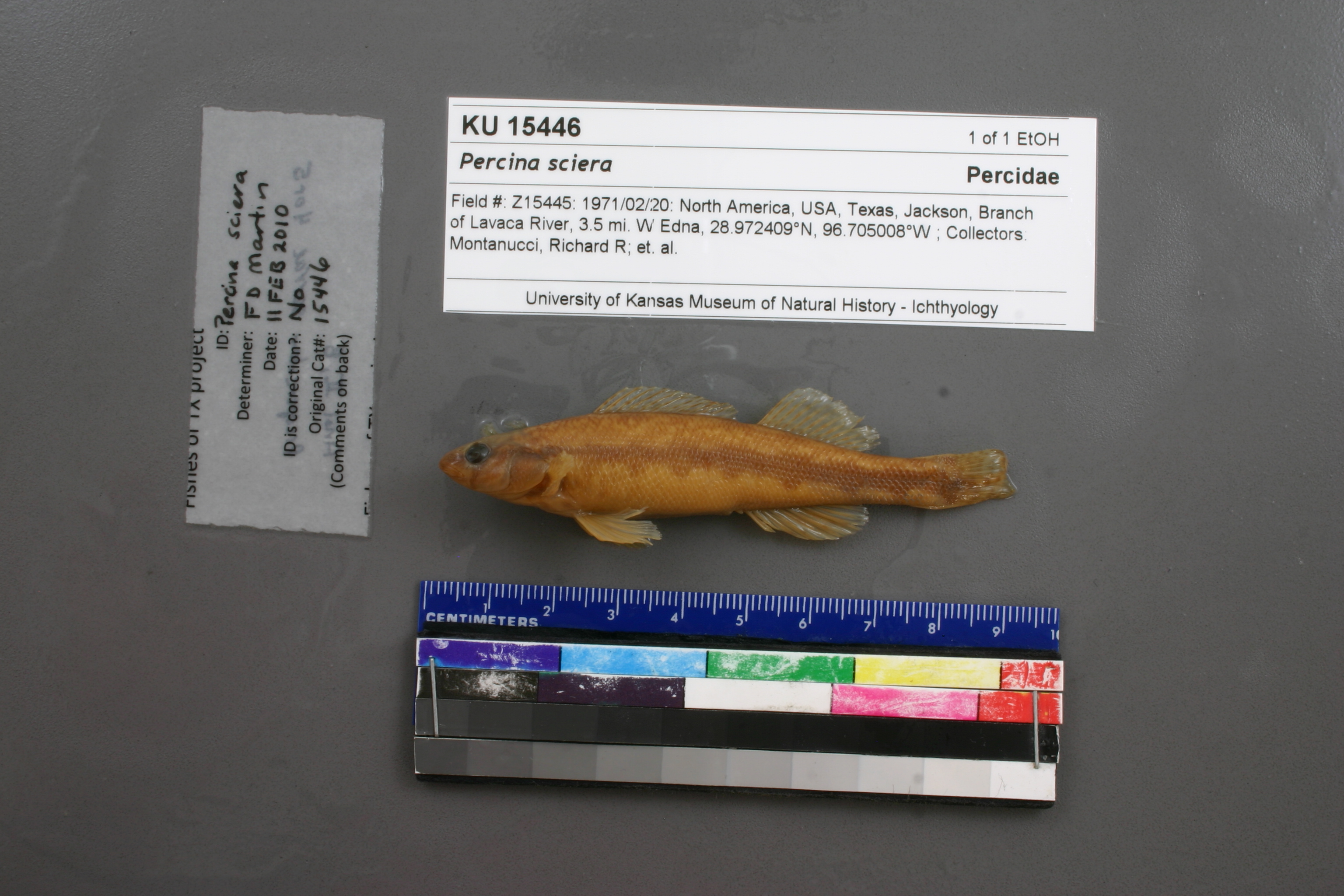
KUI_15446
Not suspect, examinedPhotos
Map
Location
28.97852° N, 96.70365° W
(± 6054.4
m)
Taxonomy
GenusPercina
Speciessciera
Specimen
Num Specimens0
Identification
DeterminerUnknown
Collection Event
Collector"R.R. Montanucci, et al."
Collected Date1971.2.20
Geography
CountryUnited States
StateTexas
CountyJackson
Locality3.5 mi. W Edna
Record Source
Source
Natural History Museum and Biodiversity Research Center
(type: specimens)
Institution
Natural History Museum and Biodiversity Research Center
(type: museum)
Curator
Leo Smith
Record Added
May 13, 2010
Record Last Modified
March 23, 2026
Data Processing Track
Track 2
From Data Set Received
11/1997 to 05/2006
Identification
Suspect Notes
None
Count
No data
Current Determination
Determiner
Floyd Douglas Martin
Determination Date
Feb. 11, 2010
Determination Type
specimen examination
Identification Comments
ID complete | Anal II,8; preopercular serrae 4 or 5
Identification Confidence
Medium
Collecting Event
Collected
Feb. 20, 1971
Collector(s)
Collecting Event ID
7401
Field Notes
There are no field notes available.
Locality
Region
Gulf Coast Prairies & Marshes
Jurisdiction
Jackson, Texas
Name
3.5 miles west of Edna
Hydrography
Texas-Gulf Region
Central Texas Coastal
Lavaca
Lavaca
Keller Branch-Lavaca River
Milby Branch-Lavaca River
Captive
no
Locality Photos
No locality photos available.
flag (suspect/examine)
suspect: FALSE
flag (suspect/examine)
suspect: noexamination: yes
date
date_range: 2/20/1971-2/20/1971
collectors
collectors: Montanucci, R.R.
staff comment
ID Status: Specimen examined and ID'ed for FoTX project
ID Comments: 15 pectoral rays(l&r); 9 anal rays; 69 lat scales(l);16 pre-opercular serrae (l&r); referred to Robins and Page (2007) for characters that distinguish from P. apristis
Georef Remark: Measured by airID Confidence: high
collectors
collectors: R.R. Montanucci
date
date_range: 2/20/1971-2/20/1971
georeference
Error: 6054.35212797402Remarks: Measured by airLocality: 3.5 miles west of EdnaCoordinates: 28.978523059;-96.703650651Georeferencer: AECGeographic note: Inland USA Texas
Measured by air
Comments On KUI_15446