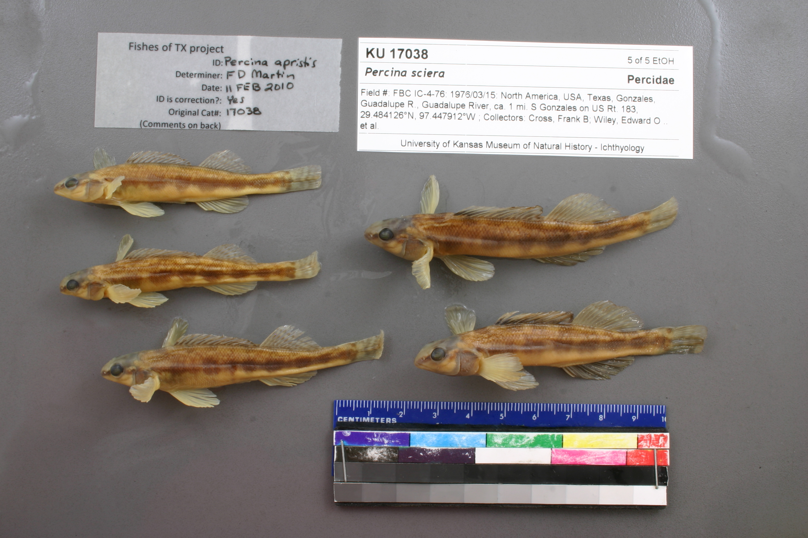
KUI_17038
Not suspect, examinedPhotos
Map
Location
29.49158° N, 97.44930° W
(± 3392.5
m)
Taxonomy
GenusPercina
Speciessciera
Specimen
Num Specimens0
Identification
DeterminerUnknown
Collection Event
Collector"F.B. Cross, E.O. Wiley, R. Moss"
Collected Date1976.3.15
Geography
DrainageGuadalupe
CountryUnited States
StateTexas
CountyGonzales
Localityca. 1 mi. S Gonzales on US Rt. 183
Record Source
Source
Natural History Museum and Biodiversity Research Center
(type: specimens)
Institution
Natural History Museum and Biodiversity Research Center
(type: museum)
Curator
Leo Smith
Record Added
May 13, 2010
Record Last Modified
March 23, 2026
Data Processing Track
Track 2
From Data Set Received
11/1997 to 05/2006
Identification
Suspect Notes
None
Count
No data
Current Determination
Determiner
Floyd Douglas Martin
Determination Date
Feb. 11, 2010
Determination Type
specimen examination
Identification Comments
ID complete | No preopercular serrae, 10 anal rays, nape scaled
Identification Confidence
High
Collecting Event
Collected
March 15, 1976
Collector(s)
Collecting Event ID
6980
Field Notes
There are no field notes available.
Locality
Region
Blackland Prairies
Jurisdiction
Gonzales, Texas
Name
1 mile south of Gonzales on US 183
Hydrography
Texas-Gulf Region
Central Texas Coastal
Guadalupe
Middle Guadalupe
Mill Creek-Guadalupe River
Kerr Creek-Guadalupe River
Captive
no
Locality Photos
No locality photos available.
Comments On KUI_17038