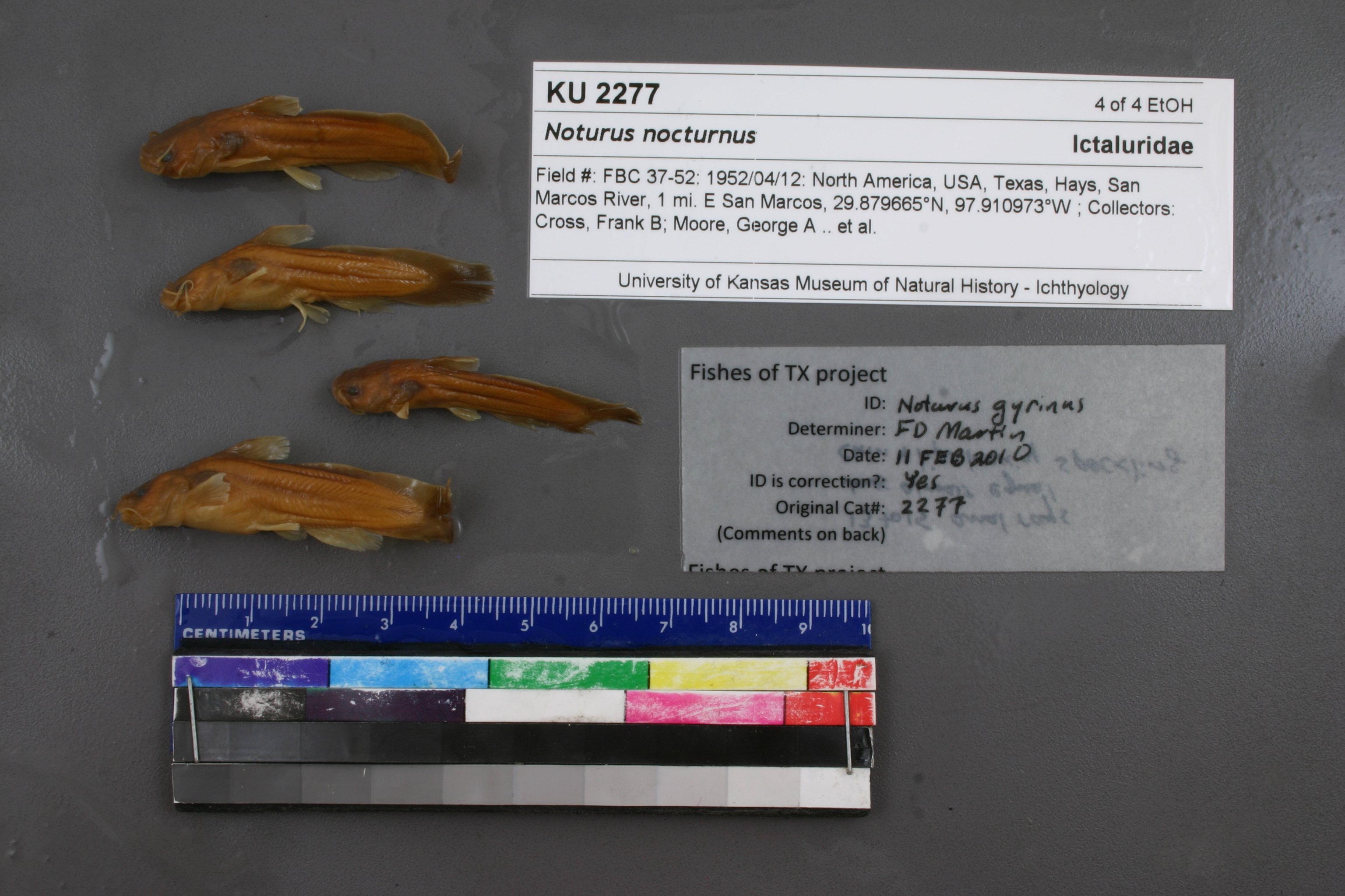
KUI_2277
Not suspect, examinedPhotos
Map
Location
29.88355° N, 97.93520° W
(± 3231.6
m)
Taxonomy
GenusNoturus
Speciesnocturnus
Specimen
Num Specimens0
Identification
DeterminerFrank B. Cross
Collection Event
Collector"F. B. Cross, G. A. Moore & R. R. Miller"
Collected Date1952.4.12
Geography
DrainageGuadalupe
CountryUnited States
StateTexas
CountyHays
Locality"San Marcos River, 1 mi E San Marcos"
Record Source
Source
Natural History Museum and Biodiversity Research Center
(type: specimens)
Institution
Natural History Museum and Biodiversity Research Center
(type: museum)
Curator
Leo Smith
Record Added
May 13, 2010
Record Last Modified
March 23, 2026
Data Processing Track
Track 2
From Data Set Received
11/1997 to 05/2006
Identification
Suspect Notes
None
Count
No data
Current Determination
Determiner
Floyd Douglas Martin
Determination Date
Feb. 11, 2010
Determination Type
specimen examination
Identification Comments
ID complete | 13-15 anal rays, jaws almost equal, chin and lower lips lack speckling
Identification Confidence
High
Collecting Event
Collected
April 12, 1952
Collecting Event ID
979
Field Notes
There are no field notes available.
Locality
Region
Blackland Prairies
Jurisdiction
Hays, Texas
Name
San Marcos River at San Marcos
Hydrography
Texas-Gulf Region
Central Texas Coastal
Guadalupe
San Marcos
Upper San Marcos River
Purgatory Creek-San Marcos River
Captive
no
Locality Photos
No locality photos available.
flag (suspect/examine)
suspect: FALSE
flag (suspect/examine)
suspect: noexamination: yes
date
date_range: 4/12/1952-4/12/1952
collectors
collectors: Cross, Frank B. Moore, George A. Dr.Miller, Robert Rush
staff comment
ID Status: Specimen examined and ID'ed for FoTX projectID Comments: 13-15 anal rays, jaws almost equal, chin and lower lips lack speckling
Georef Remark: Treated as San Marcos River at San Marcos. Reach inside 2.5 mile radius of city center
ID Confidence: high
collectors
collectors: Frank B. Cross, George A. Moore, Robert Rush Miller
date
date_range: 4/12/1952-4/12/1952
georeference
Error: 3231.56275198613
Remarks: Treated as San Marcos River at San Marcos. Reach inside 2.5 mile radius of city center
Locality: San Marcos River at San MarcosCoordinates: 29.883550469;-97.935203692Georeferencer: AECGeographic note: Inland USA TexasTreated as San Marcos River at San Marcos. Reach inside 2.5 mile radius of city center
Comments On KUI_2277