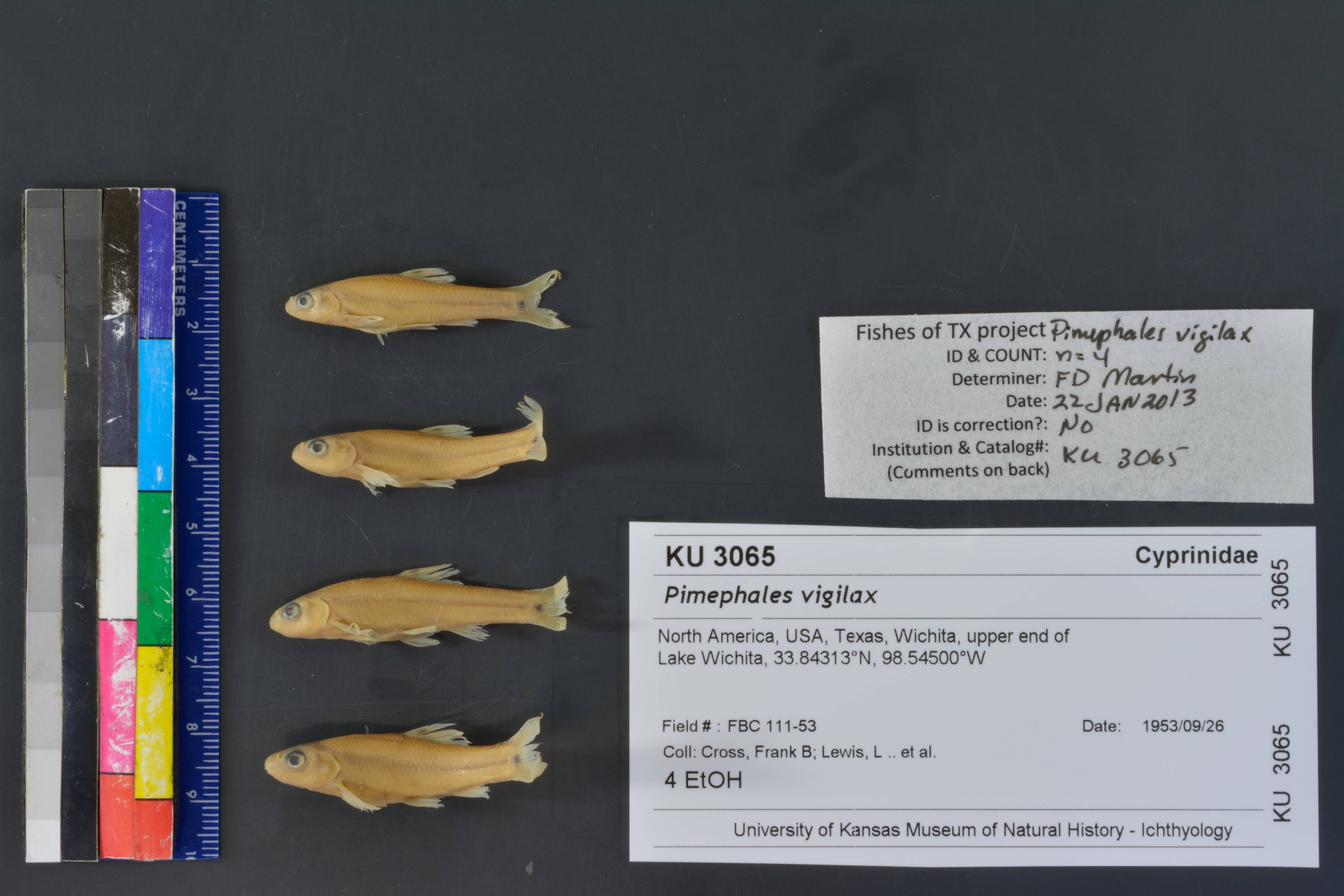
KUI_3065
Not suspect, examinedPhotos
Map
Location
33.83646° N, 98.56341° W
(± 4559.3
m)
Taxonomy
GenusPimephales
Speciesvigilax
Specimen
Num Specimens0
Identification
DeterminerFrank B. Cross
Collection Event
Collector"F. B. Cross, L. Lewis, W. Dalquest"
Collected Date1953.9.26
Geography
DrainageRed
CountryUnited States
StateTexas
CountyWichita
Localityupper end of Lake Wichita
Record Source
Source
Natural History Museum and Biodiversity Research Center
(type: specimens)
Institution
Natural History Museum and Biodiversity Research Center
(type: museum)
Curator
Leo Smith
Record Added
May 13, 2010
Record Last Modified
March 23, 2026
Data Processing Track
Track 2
From Data Set Received
11/1997 to 05/2006
Identification
Suspect Notes
None
Count
No data
Current Determination
Determiner
Floyd Douglas Martin
Determination Date
Jan. 22, 2013
Determination Type
specimen examination
Identification Comments
Specimen examined and Id'ed for FoTX project. | mouth subinferior; peritoneum silvery; basicaudal spot separate from lateral streak
Identification Confidence
High
Collecting Event
Collected
Sept. 26, 1953
Collector(s)
Collecting Event ID
8126
Field Notes
There are no field notes available.
Locality
Region
Rolling Plains
Jurisdiction
Wichita, Texas
Name
Lake Wichita
Hydrography
Arkansas-White-Red Region
Red-Washita
Red-Lake Texoma
Wichita
Holliday Creek
Middle Holliday Creek
Captive
no
Locality Photos
No locality photos available.
flag (suspect/examine)
suspect: FALSE
flag (suspect/examine)
suspect: noexamination: yes
date
date_range: 9/26/1953-9/26/1953
collectors
collectors: Cross, Frank B. Lewis, Leo Dalquest, Walter W.
staff comment
ID Status: Not flagged for specimen examination. By default we accept donor specimen determinations (after synonymization to our taxonomy). If georeferenced to TX this record has been considered in spatial context with other occurences of this species and accepted as correct.
ID Comments: NAGeoref Remark: not sure if upper refers to upstream or Northern part of Lake, took extent of entire lake
collectors
collectors: Frank B. Cross, Leo Lewis, Walter W. Dalquest
date
date_range: 9/26/1953-9/26/1953
georeference
Error: 4559.27155198044
Remarks: not sure if upper refers to upstream or Northern part of Lake, took extent of entire lake
Locality: Lake WichitaCoordinates: 33.836461504;-98.563410479Georeferencer: BJLGeographic note: Inland USA Texasnot sure if upper refers to upstream or Northern part of Lake, took extent of entire lake
Comments On KUI_3065