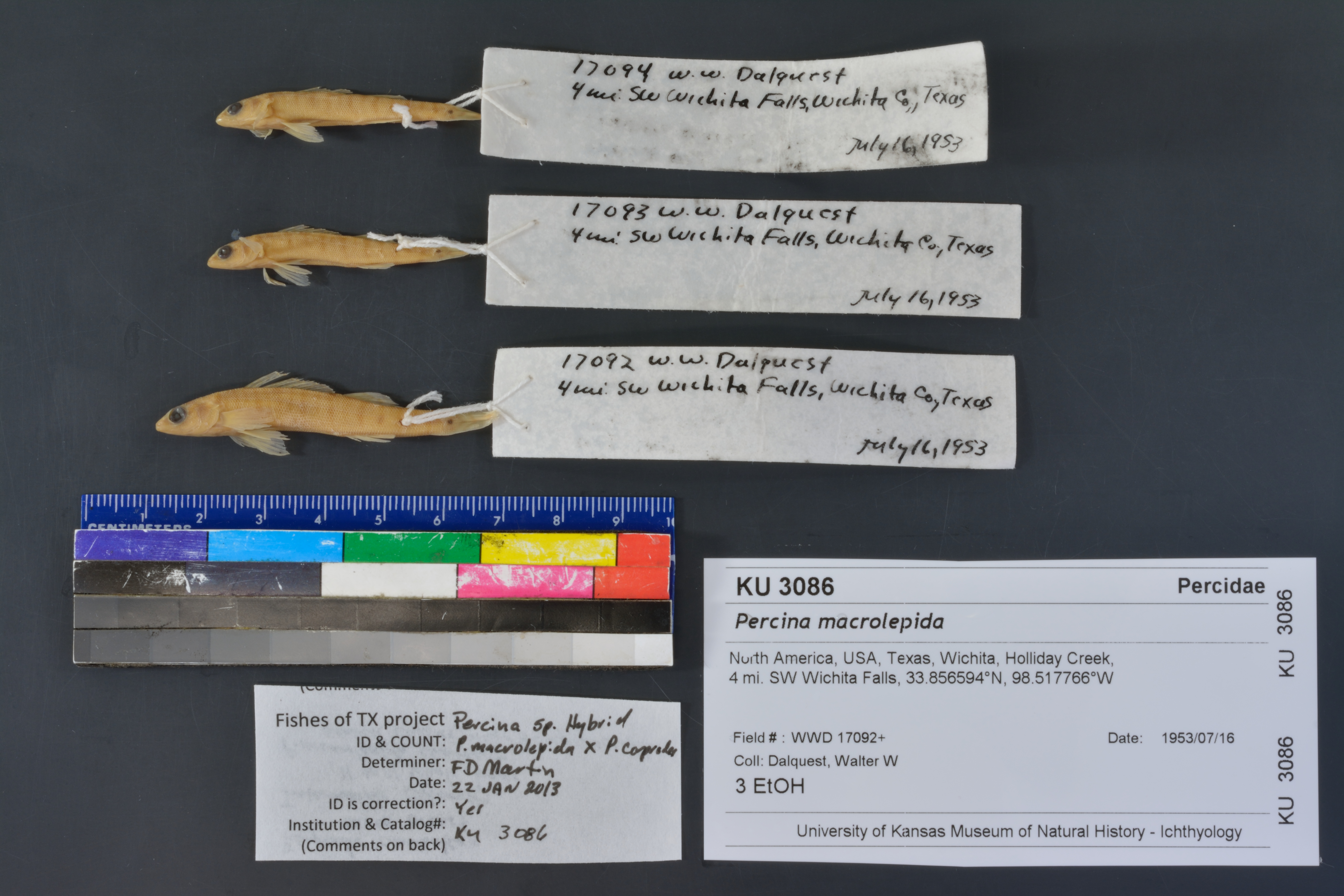
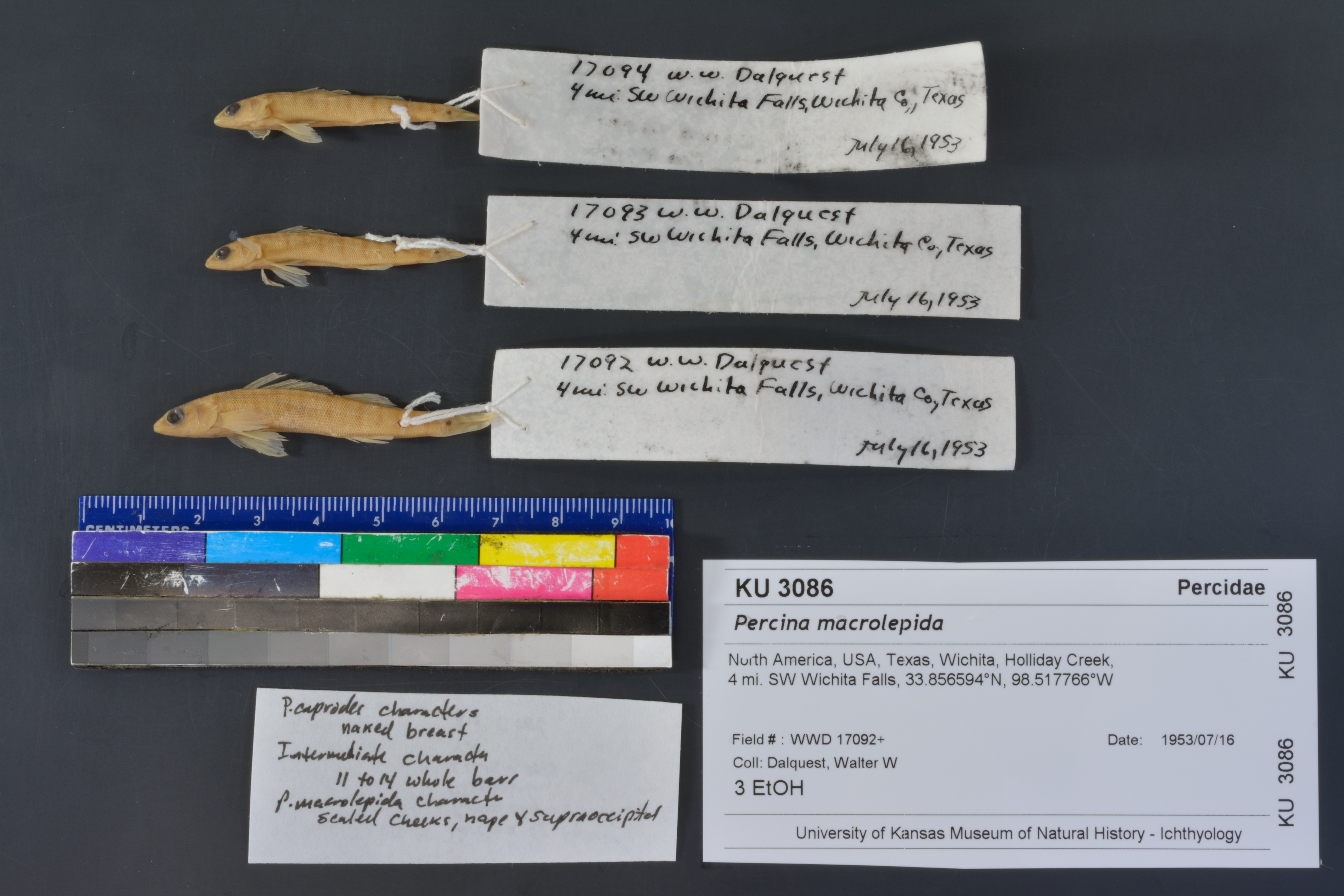
KUI_3086
Not suspect, examinedPhotos
Map
Location
33.85641° N, 98.56053° W
(± 10491.3
m)
Taxonomy
GenusPercina
Speciesmacrolepida
Specimen
Num Specimens0
Identification
DeterminerFrank B. Cross
Collection Event
CollectorW. W. Dalquest
Collected Date1953.7.16
Geography
DrainageRed
CountryUnited States
StateTexas
CountyWichita
Locality4 mi SW Wichita Falls
Record Source
Source
Natural History Museum and Biodiversity Research Center
(type: specimens)
Institution
Natural History Museum and Biodiversity Research Center
(type: museum)
Curator
Leo Smith
Record Added
May 13, 2010
Record Last Modified
March 23, 2026
Data Processing Track
Track 2
From Data Set Received
11/1997 to 05/2006
Identification
Suspect Notes
None
Count
No data
Current Determination
Determiner
Floyd Douglas Martin
Determination Date
Jan. 22, 2013
Determination Type
specimen examination
Identification Comments
Specimen examined and Id'ed for FoTX project. | caprodes characters: naked breast; intermediate characters: 11 to 14 whole bars on sides: macrolepida characters: scaled cheeks, nape and supraoccipitals
Identification Confidence
High
Collecting Event
Collected
July 16, 1953
Collector(s)
Collecting Event ID
8100
Field Notes
There are no field notes available.
Locality
Region
Rolling Plains
Jurisdiction
Wichita, Texas
Name
4 miles Southwest of Wichita Falls
Hydrography
Arkansas-White-Red Region
Red-Washita
Red-Lake Texoma
Wichita
Holliday Creek
Middle Holliday Creek
Captive
no
Locality Photos
No locality photos available.
flag (suspect/examine)
suspect: FALSE
flag (suspect/examine)
suspect: noexamination: yes
date
date_range: 7/16/1953-7/16/1953
collectors
collectors: Dalquest, Walter W.
staff comment
ID Status: Not flagged for specimen examination. By default we accept donor specimen determinations (after synonymization to our taxonomy). If georeferenced to TX this record has been considered in spatial context with other occurences of this species and accepted as correct.
ID Comments: NAGeoref Remark: measured by air
collectors
collectors: Walter W. Dalquest
date
date_range: 7/16/1953-7/16/1953
georeference
Error: 10491.313535955Remarks: measured by airLocality: 4 mile Southwest of Wichita FallsCoordinates: 33.856410984;-98.560530464Georeferencer: BJLGeographic note: Inland USA Texas
measured by air
Comments On KUI_3086