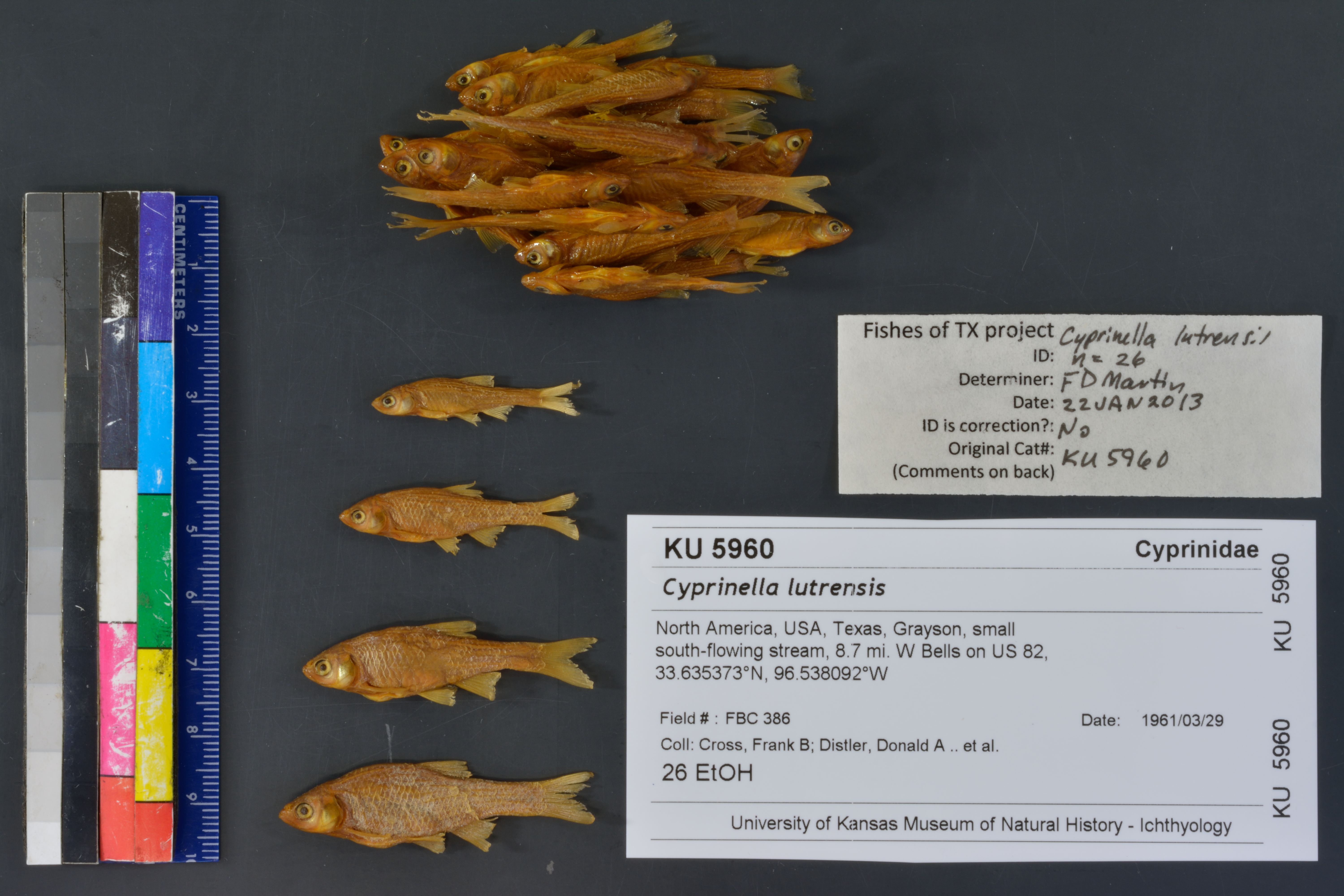
KUI_5960
Not suspect, examinedPhotos
Map
Location
33.63793° N, 96.55150° W
(± 3070.6
m)
Taxonomy
GenusCyprinella
Specieslutrensis
Specimen
Num Specimens0
Identification
DeterminerFrank B. Cross
Collection Event
Collector"F. B. Cross, D. A. Distler & D. Bardack"
Collected Date1961.3.29
Geography
CountryUnited States
StateTexas
CountyGrayson
Locality"small south-flowing stream, 8.7 mi W Bells on US Rt. 82"
Record Source
Source
Natural History Museum and Biodiversity Research Center
(type: specimens)
Institution
Natural History Museum and Biodiversity Research Center
(type: museum)
Curator
Leo Smith
Record Added
May 13, 2010
Record Last Modified
March 23, 2026
Data Processing Track
Track 2
From Data Set Received
11/1997 to 05/2006
Identification
Suspect Notes
None
Count
No data
Current Determination
Determiner
Floyd Douglas Martin
Determination Date
Jan. 22, 2013
Determination Type
specimen examination
Identification Comments
Specimen examined and Id'ed for FoTX project.
Identification Confidence
High
Collecting Event
Collected
March 29, 1961
Collector(s)
Collecting Event ID
8087
Field Notes
There are no field notes available.
Locality
Region
Blackland Prairies
Jurisdiction
Grayson, Texas
Name
8.7 miles from Bells geographic center W on SH82
Hydrography
Arkansas-White-Red Region
Red-Sulphur
Red-Little
Bois D'arc-Island
Choctaw Creek-Red River
Calf Creek-Choctaw Creek
Captive
no
Locality Photos
No locality photos available.
flag (suspect/examine)
suspect: FALSE
flag (suspect/examine)
suspect: noexamination: yes
date
date_range: 3/29/1961-3/29/1961
collectors
collectors: Cross, Frank B. Distler, D.A. Bardack, D.
staff comment
ID Status: Not flagged for specimen examination. By default we accept donor specimen determinations (after synonymization to our taxonomy). If georeferenced to TX this record has been considered in spatial context with other occurences of this species and accepted as correct.
ID Comments: NAGeoref Remark: Point placed on SH82 8.7 miles West of Bells from SH82/US69 intersection, extent of Bells used
collectors
collectors: Frank B. Cross, D.A. Distler, D. Bardack
date
date_range: 3/29/1961-3/29/1961
georeference
Error: 3070.62835198683
Remarks: Point placed on SH82 8.7 miles West of Bells from SH82/US69 intersection, extent of Bells used
Locality: 8.7 miles from Bells geographic center W on SH82Coordinates: 33.637930573;-96.551496754Georeferencer: BJLGeographic note: Inland USA TexasPoint placed on SH82 8.7 miles West of Bells from SH82/US69 intersection, extent of Bells used
Comments On KUI_5960