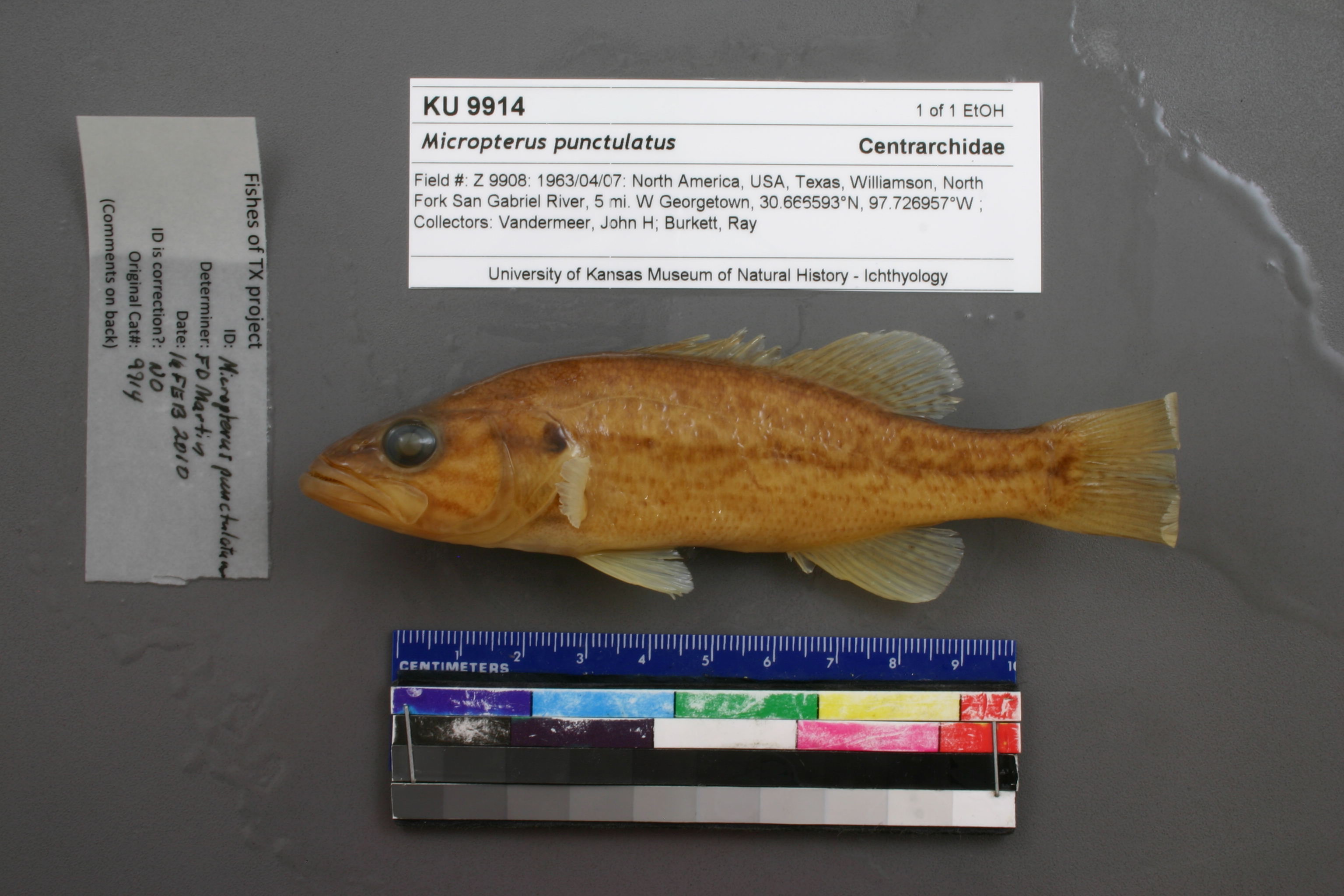
KUI_9914
Not suspect, examinedPhotos
Map
Location
30.66617° N, 97.72630° W
(± 4881.1
m)
Taxonomy
GenusMicropterus
Speciespunctulatus
Specimen
Num Specimens0
Identification
DeterminerUnknown
Collection Event
CollectorJohn K. Vandermeer & Ray Burkett
Collected Date1963.4.7
Geography
DrainageBrazos
CountryUnited States
StateTexas
CountyWilliamson
Locality"N San Gabriel R., 5 mi. W Georgetown"
Record Source
Source
Natural History Museum and Biodiversity Research Center
(type: specimens)
Institution
Natural History Museum and Biodiversity Research Center
(type: museum)
Curator
Leo Smith
Record Added
May 13, 2010
Record Last Modified
March 23, 2026
Data Processing Track
Track 2
From Data Set Received
11/1997 to 05/2006
Identification
Suspect Notes
None
Count
No data
Current Determination
Determiner
Floyd Douglas Martin
Determination Date
Feb. 16, 2010
Determination Type
specimen examination
Identification Comments
ID complete
Identification Confidence
High
Collecting Event
Collected
April 7, 1963
Collector(s)
Collecting Event ID
7312
Field Notes
There are no field notes available.
Locality
Region
Edwards Plateau
Jurisdiction
Williamson, Texas
Name
North San Gabriel River 5 miles upstream of Georgetown
Hydrography
Texas-Gulf Region
Lower Brazos
Little
San Gabriel
North Fork San Gabriel River
Middle Fork San Gabriel River-North Fork San Gabriel River
Captive
no
Locality Photos
No locality photos available.
flag (suspect/examine)
suspect: FALSE
flag (suspect/examine)
suspect: noexamination: yes
date
date_range: 4/7/1963-4/7/1963
collectors
collectors: Vandermeer, John H. Burkett, Ray
staff comment
ID Status: Specimen examined and ID'ed for FoTX project
Georef Remark: measured by stream, point placed at North San Gabriel Dam, extent of George town used
ID Confidence: high
collectors
collectors: John K. Vandermeer, Ray Burkett
date
date_range: 4/7/1963-4/7/1963
georeference
Error: 4881.14035197906
Remarks: measured by stream, point placed at North San Gabriel Dam, extent of George town used
Locality: North San Gabriel River 5 miles upstream of GeorgetownCoordinates: 30.666165446;-97.726300217Georeferencer: BJLGeographic note: Inland USA Texasmeasured by stream, point placed at North San Gabriel Dam, extent of George town used
Comments On KUI_9914