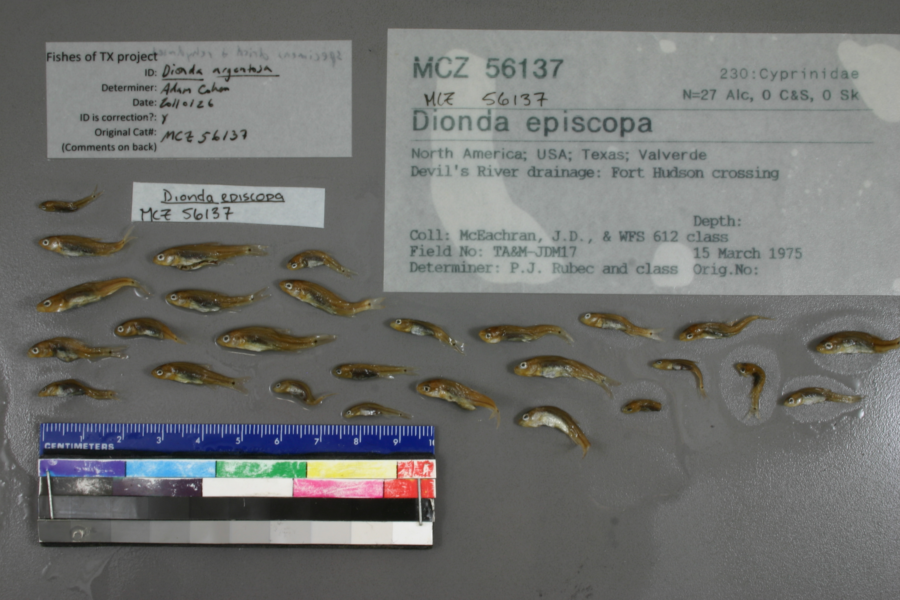
MCZ_56137
Not suspect, not examinedPhotos
Map
Location
29.96630° N, 101.14915° W
(± 45
m)
Taxonomy
GenusDionda
Speciesepiscopa
Specimen
Num Specimens0
Identification
DeterminerP.J. Rubec and class
Collection Event
CollectorMcEachran, J.D., & WFS 612 class
Collected Date1975.3.15
Geography
DrainageRio Grande
CountryUnited States
StateTexas
CountyVal Verde
LocalityDevil's River drainage: Fort Hudson crossing
Record Source
Source
Museum of Comparative Zoology
(type: specimens)
Institution
Museum of Comparative Zoology
(type: museum)
Curator
Karel Liem
Record Added
May 13, 2010
Record Last Modified
July 27, 2022
Data Processing Track
Track 1
From Data Set Received
11/1997 to 05/2006
Identification
Suspect Notes
None
Count
No data
Current Determination
Determiner
Adam Cohen
Determination Date
Feb. 3, 2011
Determination Type
specimen examination
Identification Comments
ID complete | specimens appear to be dried and re-hydrated.
Identification Confidence
High
Collecting Event
Collected
March 15, 1975
Collector(s)
Collecting Event ID
2406
Field Notes
There are no field notes available.
Locality
Region
Edwards Plateau
Jurisdiction
Val Verde, Texas
Name
Devils River at SH 163
Hydrography
Rio Grande Region
Rio Grande-Amistad
Devils
Lower Devils
Devils River-Amistad Reservoir
Indian Creek-Devils River
Captive
no
Locality Photos
No locality photos available.
flag (suspect/examine)
suspect: FALSE
flag (suspect/examine)
suspect: noexamination: no
georeference
Error: 45
Remarks: McEachron's fieldnotes indicate this collection was from the Devils River at Hwy 163
Locality: Devils River at SH 163Coordinates: -101.149153, 29.966298Georeferencer: Adam CohenMcEachron's fieldnotes indicate this collection was from the Devils River at Hwy 163
date
date_range: 3/15/1975-3/15/1975
collectors
collectors: McEachran, John D. WFS 612 class
staff comment
ID Status: Specimen examined and ID'ed for FoTX projectID Comments: specimens appear to be dried and re-hydrated.Georef Remark: Could not find location of Fort Hudson crossingID Confidence: high
collectors
collectors: John D. McEachran, WFS 612 class
date
date_range: 3/15/1975-3/15/1975
georeference
Error: 46361.9819518011Remarks: Could not find location of Fort Hudson crossingLocality: Devils river in Val Verde CountyCoordinates: 29.873234502;-100.993300768Georeferencer: BJLGeographic note: Inland USA Texas
Could not find location of Fort Hudson crossing
Comments On MCZ_56137