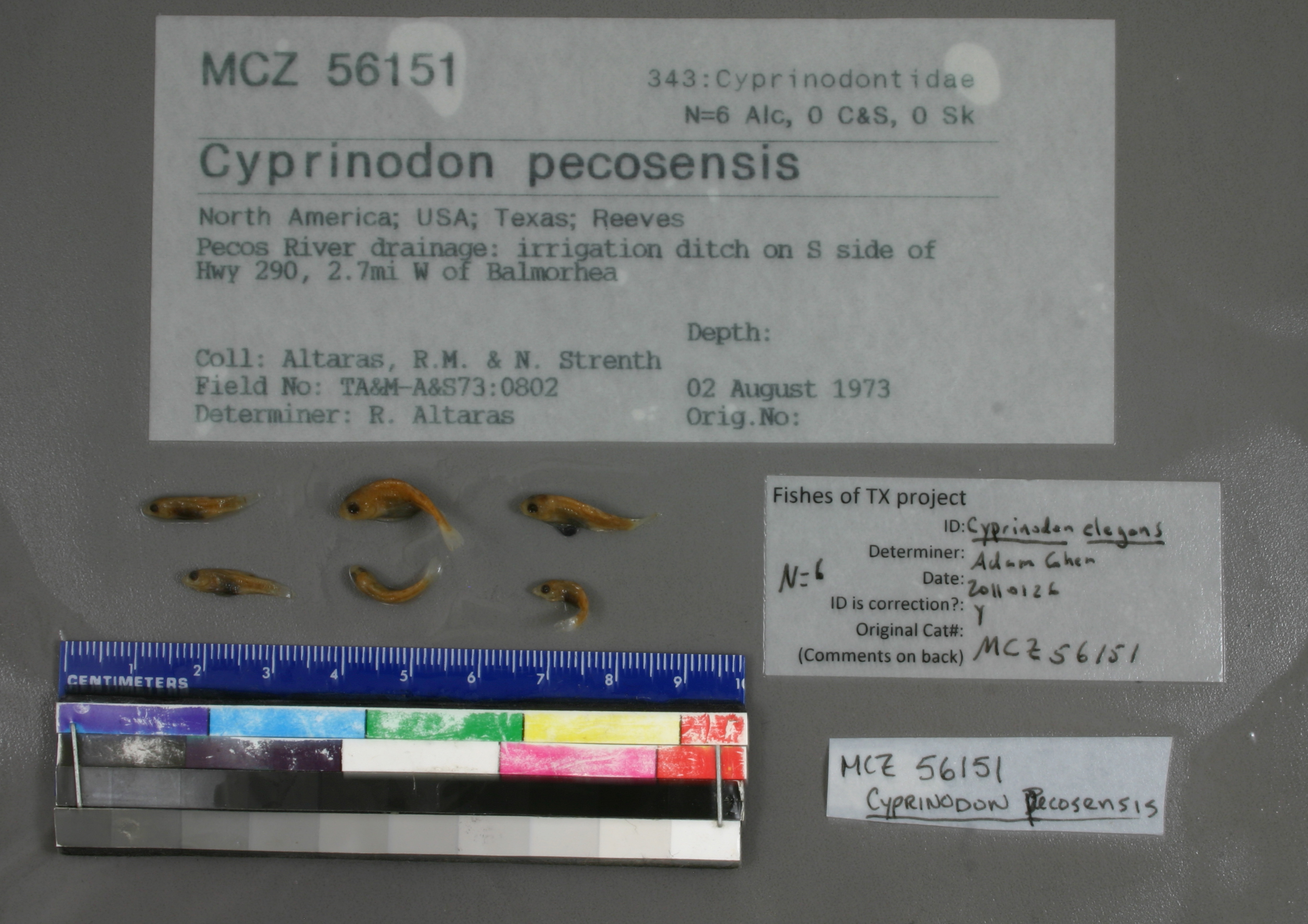
MCZ_56151
Not suspect, examined
Comanche Springs Pupfish –
Cyprinodon elegans
TX Endangered
SGCN
Federal:
Endangered
NS
NatureServeStatus object (G1)
NS
NatureServeStatus object (S1)
Photos
Map
Location
30.95782° N, 103.76801° W
(± 906.1
m)
Taxonomy
GenusCyprinodon
Speciespecosensis
Specimen
Num Specimens0
Identification
DeterminerR. Altaras
Collection Event
CollectorAltaras, R.M. & N. Strenth
Collected Date1973.8.2
Geography
DrainageRio Grande
CountryUnited States
StateTexas
CountyReeves
LocalityPecos River drainage: irrigation ditch on S side of Hwy 290, 2.7mi W of Balmorhea
Record Source
Source
Museum of Comparative Zoology
(type: specimens)
Institution
Museum of Comparative Zoology
(type: museum)
Curator
Karel Liem
Record Added
May 13, 2010
Record Last Modified
July 27, 2022
Data Processing Track
Track 1
From Data Set Received
11/1997 to 05/2006
Identification
Suspect Notes
None
Count
No data
Current Determination
Determiner
Adam Cohen
Determination Date
Jan. 26, 2011
Determination Type
specimen examination
Identification Comments
ID complete
Identification Confidence
High
Collecting Event
Collected
Aug. 2, 1973
Collector(s)
Collecting Event ID
2062
Field Notes
There are no field notes available.
Locality
Region
Trans Pecos
Jurisdiction
Reeves, Texas
Name
Unspecified irrigation ditch on SH 290, 2.7 miles west of Balmorhea
Hydrography
USGS HUC
Rio Grande Region
Lower Pecos
Lower Pecos
Toyah
Upper Toyah Creek
San Solomon Creek-Toyah Creek
HydroBASINS
7521
752164
75216402
7521640225
752164022520
Captive
no
Locality Photos
No locality photos available.
flag (suspect/examine)
suspect: FALSE
flag (suspect/examine)
suspect: noexamination: yes
date
date_range: 8/2/1973-8/2/1973
collectors
collectors: Altaras, R.M. Strenth, N.
staff comment
ID Status: Specimen examined and ID'ed for FoTX projectGeoref Remark: Point is placed on canal south of SH 290 as measured by SH 290.ID Confidence: high
collectors
collectors: R.M. Altaras, N. Strenth
date
date_range: 8/2/1973-8/2/1973
georeference
Error: 906.060671996112Remarks: Point is placed on canal south of SH 290 as measured by SH 290.Locality: Unspecified irrigation ditch on SH 290, 2.7 miles west of BalmorheaCoordinates: 30.957821852;-103.768014188Georeferencer: AECGeographic note: Inland USA Texas
Point is placed on canal south of SH 290 as measured by SH 290.
Comments On MCZ_56151