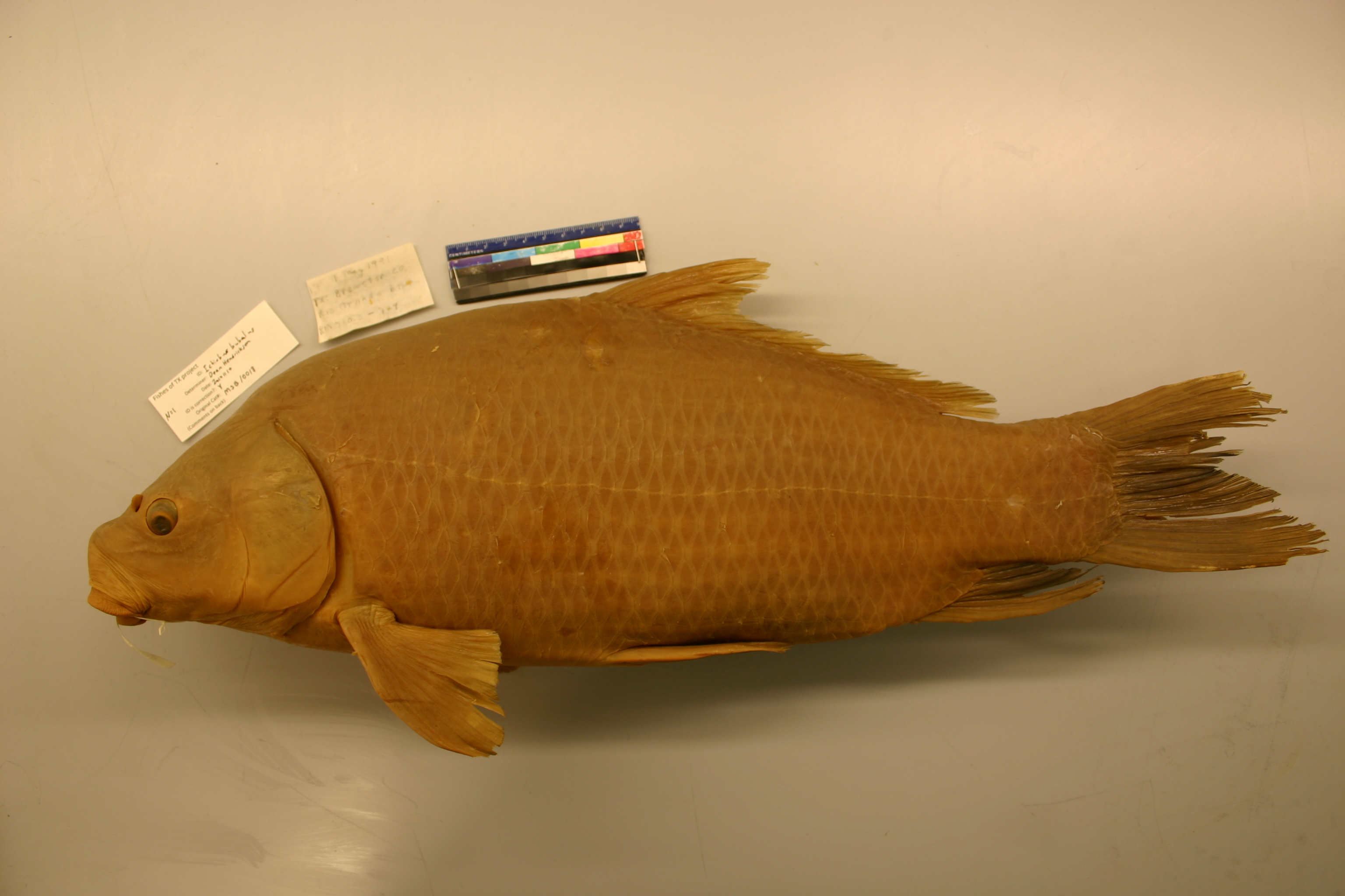
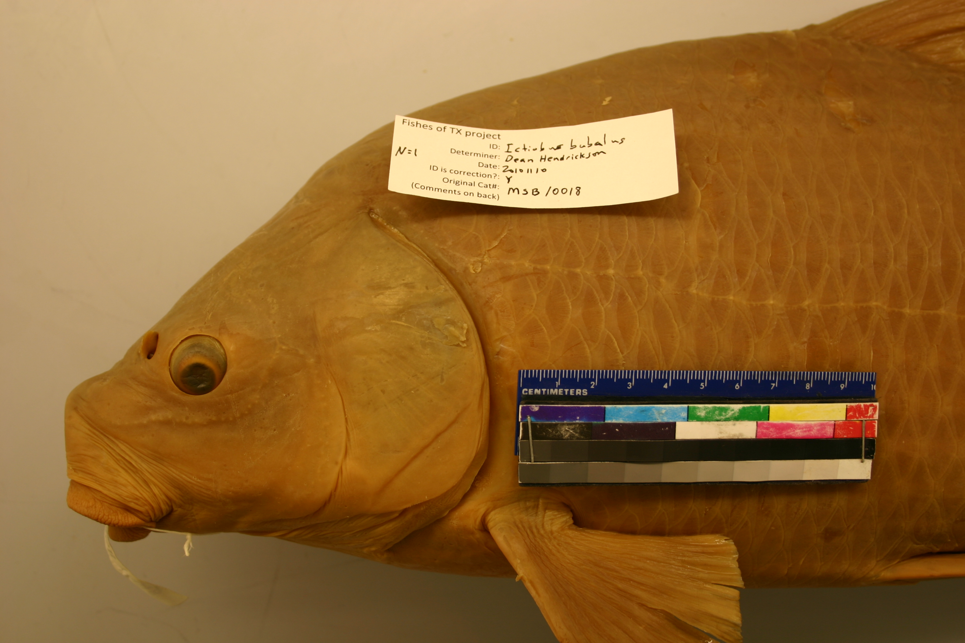
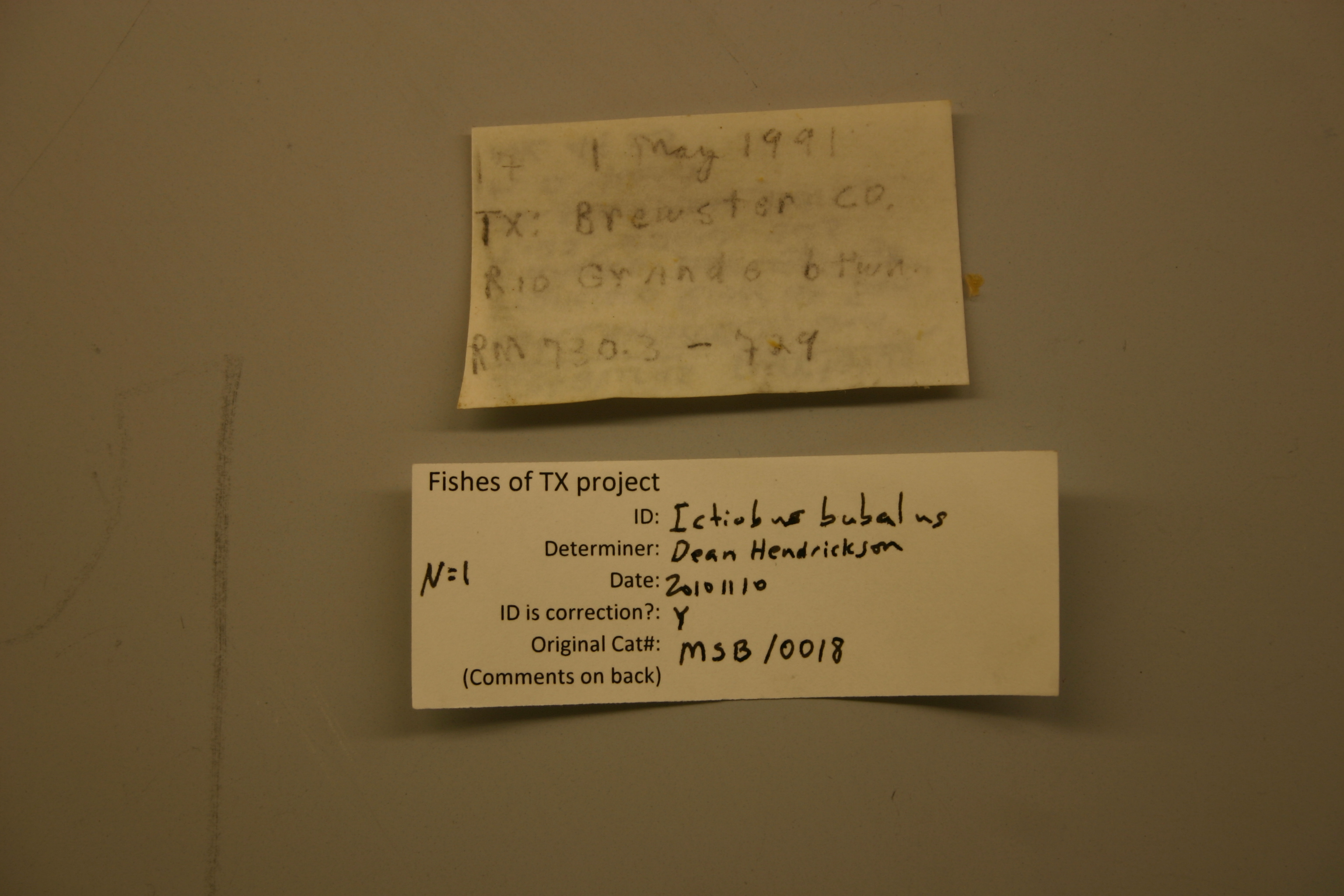
MSB_10018
Not suspect, examinedPhotos
Map
Location
29.78664° N, 102.48740° W
(± 204.4
m)
Taxonomy
GenusIctiobus
Speciessp.
Specimen
Num Specimens1
Collection Event
CollectorS.P. PLATANIA, ET AL
Collected Date1991.5.1
Geography
DrainageRIO GRANDE
CountryUnited States
StateTexas
CountyBrewster
LocalityRio Grande, ca. 19.8 miles upstream of Brewster-Terrell County line, between river miles 730.3 and 729.
Record Source
Source
Museum of Southwestern Biology
(type: specimens)
Institution
Museum of Southwestern Biology
(type: museum)
Curator
Thomas F. Turner
Record Added
May 13, 2010
Record Last Modified
June 22, 2022
Data Processing Track
Track 2
From Data Set Received
04/2009 to 10/2010
Identification
Suspect Notes
None
Count
1
Current Determination
Determiner
Dean Hendrickson
Determination Date
Nov. 10, 2010
Determination Type
specimen examination
Identification Comments
ID complete | fits key in Boschung & Mayden 2004
Identification Confidence
Medium
Collecting Event
Collected
May 1, 1991
Collector(s)
Collecting Event ID
7566
Field Notes
There are no field notes available.
Locality
Region
Trans Pecos
Jurisdiction
Brewster, Texas
Name
Rio Grande, 19.8 miles upstream of Brewster/Terrell County Line
Hydrography
Rio Grande Region
Rio Grande-Amistad
Rio Grande-Amistad
Reagan-Sanderson
Reagan Canyon-Rio Grande
Mal Paso-Rio Grande
Captive
no
Locality Photos
No locality photos available.
flag (suspect/examine)
suspect: FALSE
flag (suspect/examine)
suspect: noexamination: yes
date
date_range: 5/1/1991-5/1/1991
collectors
collectors: Platania, Steven P.
staff comment
ID Status: Specimen examined and ID'ed for FoTX projectID Comments: fits key in Boschung & Mayden 2004Georef Remark: Measured by streamID Confidence: medium
collectors
collectors: Steven P. Platania
date
date_range: 5/1/1991-5/1/1991
georeference
Error: 204.386687999123Remarks: Measured by streamLocality: Rio Grande River, 19.8 miles upstream of Brewster/Terrell County LineCoordinates: 29.786643672;-102.487397828Georeferencer: AECGeographic note: Inland USA Texas
Measured by stream
Comments On MSB_10018