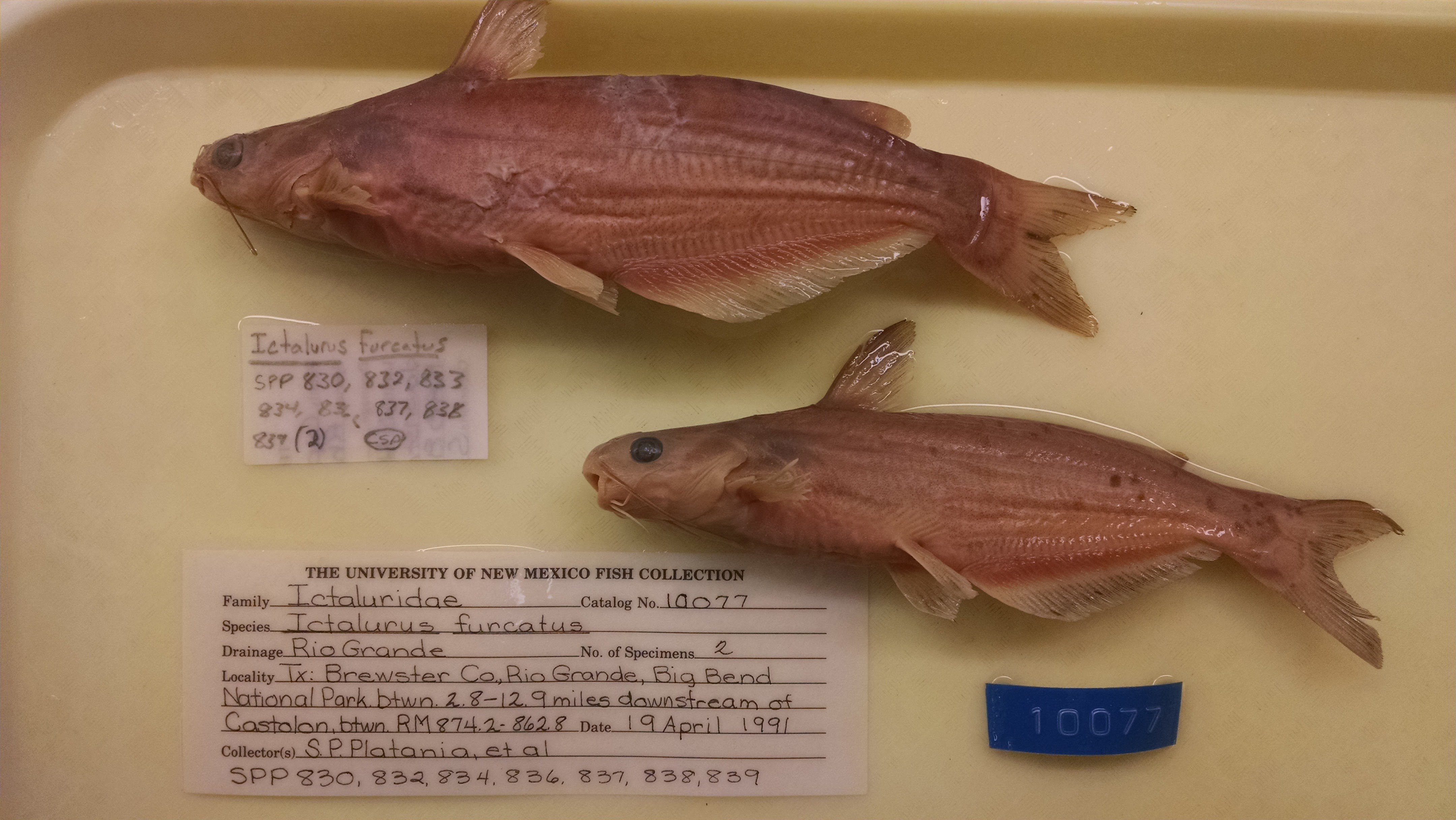
MSB_10077
Not suspect, not examinedPhotos
Map
Location
29.07000° N, 103.46071° W
(± 10071.3
m)
Taxonomy
GenusIctalurus
Speciesfurcatus
Specimen
Num Specimens2
Collection Event
CollectorS.P. PLATANIA, ET AL
Collected Date1991.4.19
Geography
DrainageRIO GRANDE
CountryUnited States
StateTexas
CountyBrewster
LocalityRio Grande, Big Bend National Park, between 2.8 and 12.9 miles downstream of Castolon, between river miles 874.2 and 862.8.
Record Source
Source
Museum of Southwestern Biology
(type: specimens)
Institution
Museum of Southwestern Biology
(type: museum)
Curator
Thomas F. Turner
Record Added
May 13, 2010
Record Last Modified
June 22, 2022
Data Processing Track
Track 2
From Data Set Received
04/2009 to 10/2010
Identification
Suspect Notes
None
Count
2
Current Determination
Determiner
Fishes of Texas staff
Determination Date
Unknown
Determination Type
Unspecified
Identification Comments
None
Identification Confidence
Unknown
Collecting Event
Collected
April 19, 1991
Collector(s)
Collecting Event ID
10933
Field Notes
There are no field notes available.
Locality
Region
Trans Pecos
Jurisdiction
Manuel Benavides, Chihuahua
Name
Rio Grande, between 2.8 to 12.9 miles downstream of Castolon
Hydrography
Rio Grande Region
Rio Grande-Amistad
Rio Grande-Amistad
Big Bend
Alamo Creek-Rio Grande
Trap Spring-Rio Grande
Captive
no
Locality Photos
No locality photos available.
HUC 12
130402050107
Georeferencing Remarks
Point is placed at midpoint of given range as measured by stream downstream of Castolon. Half of distance between range extents is added to the starting extent. Starting point is at Santa Elena Crossing and extent runs to Cottonwoon Campground.
Georeferencing Annotation
—
Has not been Georeferenced because
—
flag (suspect/examine)
suspect: FALSE
flag (suspect/examine)
suspect: noexamination: no
flag (suspect/examine)
mark for examination, but not suspect
date
date_range: 4/19/1991-4/19/1991
collectors
collectors: Platania, Steven P.
staff comment
ID Status: Not flagged for specimen examination. By default we accept donor specimen determinations (after synonymization to our taxonomy). If georeferenced to TX this record has been considered in spatial context with other occurences of this species and accepted as correct.
ID Comments: NAGeoref Remark: Point is placed at midpoint of given range as measured by stream downstream of Castolon. Half of distance between range extents is added to the starting extent. Starting point is at Santa Elena Crossing and extent runs to Cottonwoon Campground.
collectors
collectors: Steven P. Platania
date
date_range: 4/19/1991-4/19/1991
georeference
Error: 10071.2747519568
Remarks: Point is placed at midpoint of given range as measured by stream downstream of Castolon. Half of distance between range extents is added to the starting extent. Starting point is at Santa Elena Crossing and extent runs to Cottonwoon Campground.
Locality: Rio Grande River, between 2.8 to 12.9 miles downstream of CastolonCoordinates: 29.069995541;-103.460709417Georeferencer: AECGeographic note: Inland USA TexasPoint is placed at midpoint of given range as measured by stream downstream of Castolon. Half of distance between range extents is added to the starting extent. Starting point is at Santa Elena Crossing and extent runs to Cottonwoon Campground.
Comments On MSB_10077