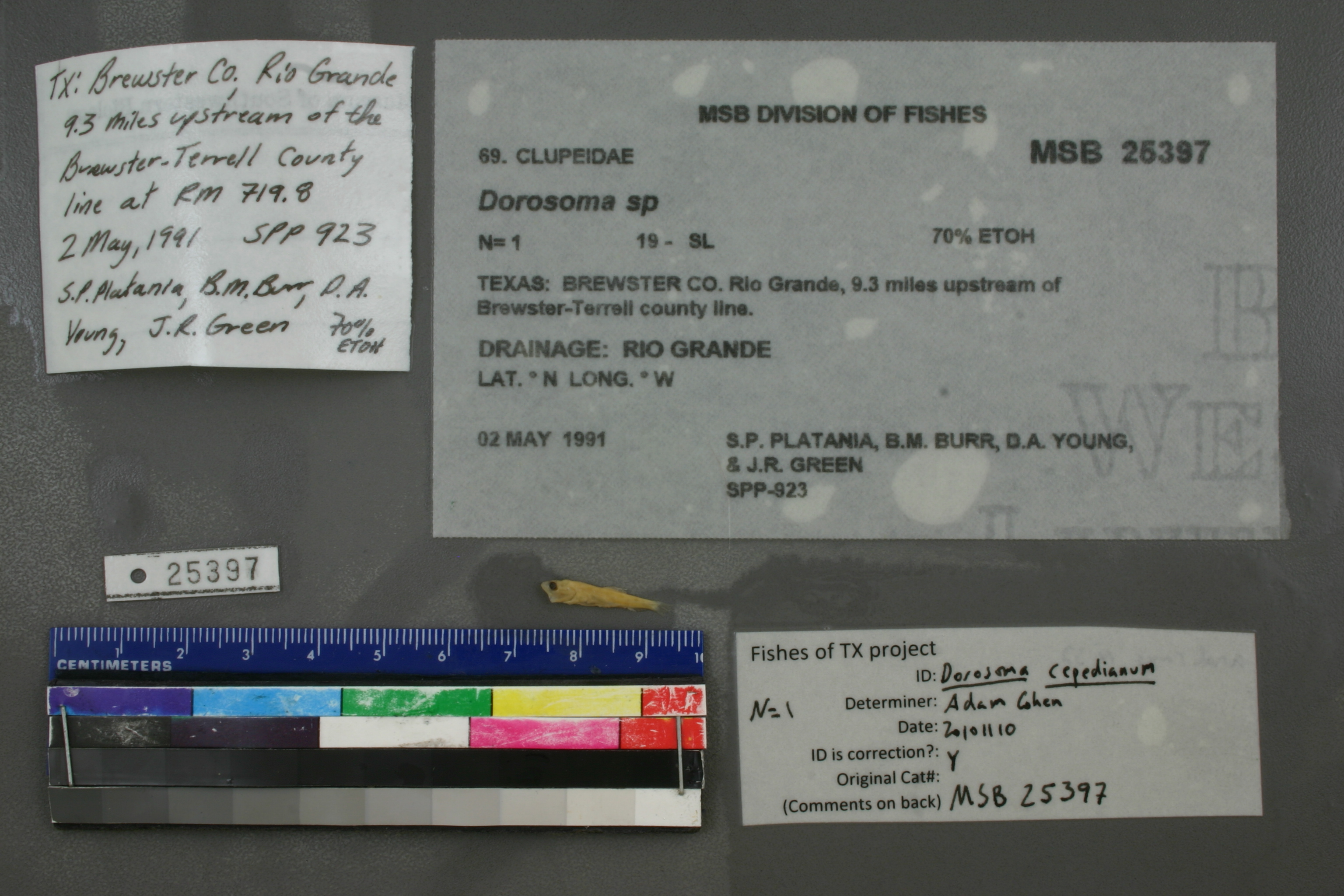
MSB_25397
Not suspect, examined
Gizzard Shad –
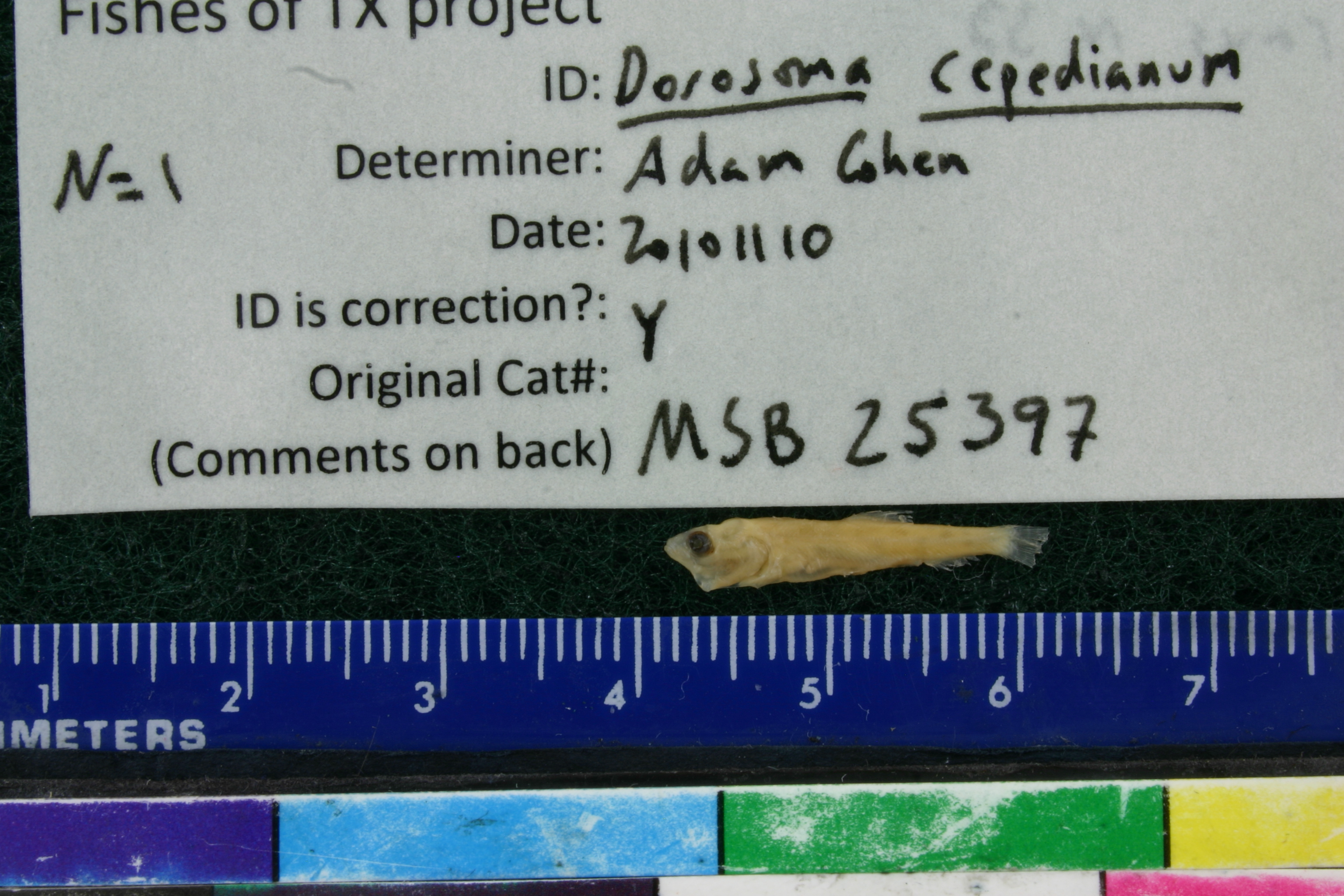
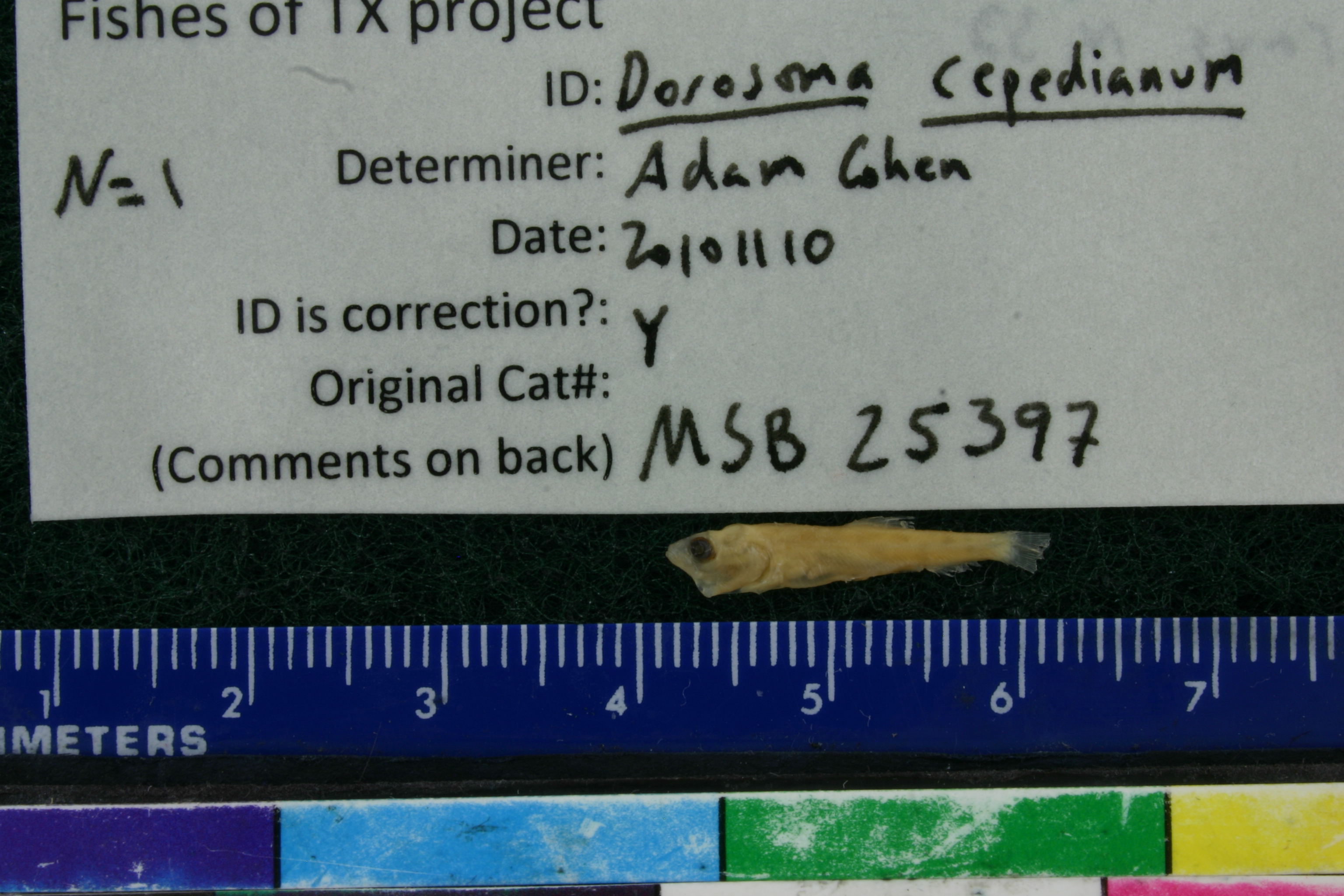
Dorosoma cepedianum
Photos
Map
Location
29.78790° N, 102.37941° W
(± 204.4
m)
Taxonomy
GenusDorosoma
Speciessp.
Specimen
Num Specimens1
Identification
DeterminerS.P. PLATANIA
Collection Event
CollectorS.P. PLATANIA, B.M. BURR, D.A. YOUNG, & J.R. GREEN
Collected Date1991.5.2
Geography
DrainageRIO GRANDE
CountryUnited States
StateTexas
CountyBrewster
LocalityRio Grande, 9.3 miles upstream of Brewster-Terrell county line.
Record Source
Source
Museum of Southwestern Biology
(type: specimens)
Institution
Museum of Southwestern Biology
(type: museum)
Curator
Thomas F. Turner
Record Added
May 13, 2010
Record Last Modified
July 27, 2022
Data Processing Track
Track 2
From Data Set Received
04/2009 to 10/2010
Identification
Suspect Notes
None
Count
1
Current Determination
Determiner
Adam Cohen
Determination Date
Nov. 10, 2010
Determination Type
specimen examination
Identification Comments
ID complete | anal rays 33
Identification Confidence
High
Collecting Event
Collected
May 2, 1991
Collector(s)
Collecting Event ID
7486
Field Notes
There are no field notes available.
Locality
Region
Trans Pecos
Jurisdiction
Acuna, Coahuila
Name
Rio Grande, 9.3 miles upstream of Brewster/Terrell County Line
Hydrography
USGS HUC
Rio Grande Region
Rio Grande-Amistad
Rio Grande-Amistad
Reagan-Sanderson
Shafter Canyon-Rio Grande
Panther Gulch-Rio Grande
HydroBASINS
7521
752173
75217370
7521737000
752173700000
Captive
no
Locality Photos
No locality photos available.
flag (suspect/examine)
suspect: FALSE
flag (suspect/examine)
suspect: noexamination: yes
date
date_range: 5/2/1991-5/2/1991
collectors
collectors: Platania, Steven P. Burr, Brooks M. Young, D.A. Green, J.R.
staff comment
ID Status: Specimen examined and ID'ed for FoTX projectID Comments: anal rays 33Georef Remark: Measured by streamID Confidence: high
collectors
collectors: Steven P. Platania, Brooks M. Burr, D.A. Young, J.R. Green
date
date_range: 5/2/1991-5/2/1991
georeference
Error: 204.386687999123Remarks: Measured by streamLocality: Rio Grande River, 9.3 miles upstream of Brewster/Terrell County LineCoordinates: 29.787903912;-102.379405142Georeferencer: AECGeographic note: Inland USA Texas
Measured by stream
Comments On MSB_25397