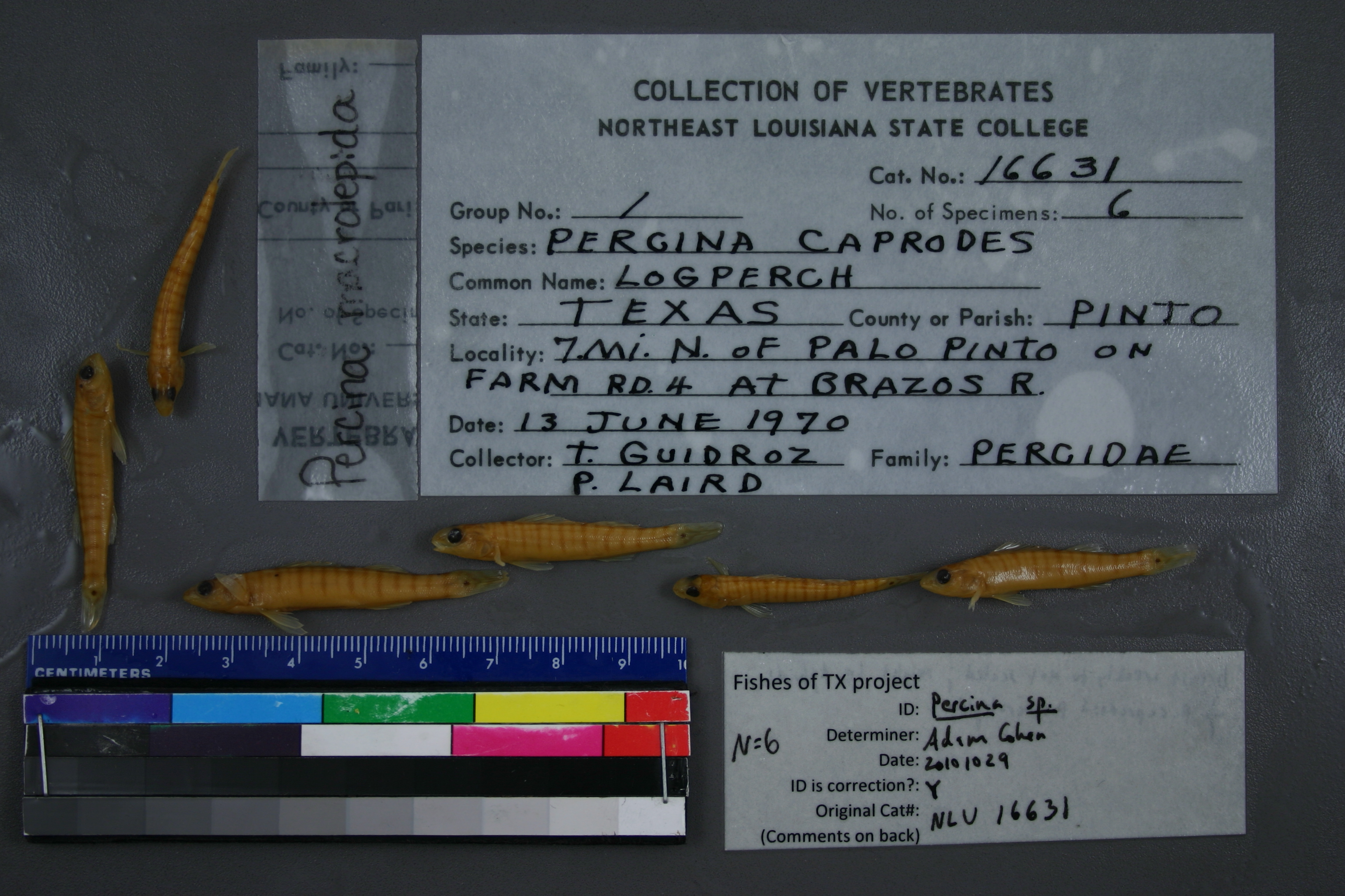
NLU_16631
Not suspect, examinedPhotos
Map
Location
32.86286° N, 98.30244° W
(± 43.6
m)
Taxonomy
GenusPERCINA
SpeciesCAPRODES
Specimen
Num Specimens6
Collection Event
CollectorP. LAIRD
Collected Date1970.6.13
Geography
DrainageBRAZOS RIVER
CountryUnited States
StateTexas
CountyPalo Pinto
LocalityWATERBODYBRAZOS RIVER,7 MI N OF PALO PINTO ON FARM RD 4 AT BRAZOS RIVER
Record Source
Source
University of Louisiana at Monroe
(type: miscellaneous)
Institution
University of Louisiana at Monroe
(type: university)
Curator
Unknown
Record Added
May 13, 2010
Record Last Modified
June 22, 2022
Data Processing Track
Track 1
From Data Set Received
11/1997 to 05/2006
Identification
Suspect Notes
None
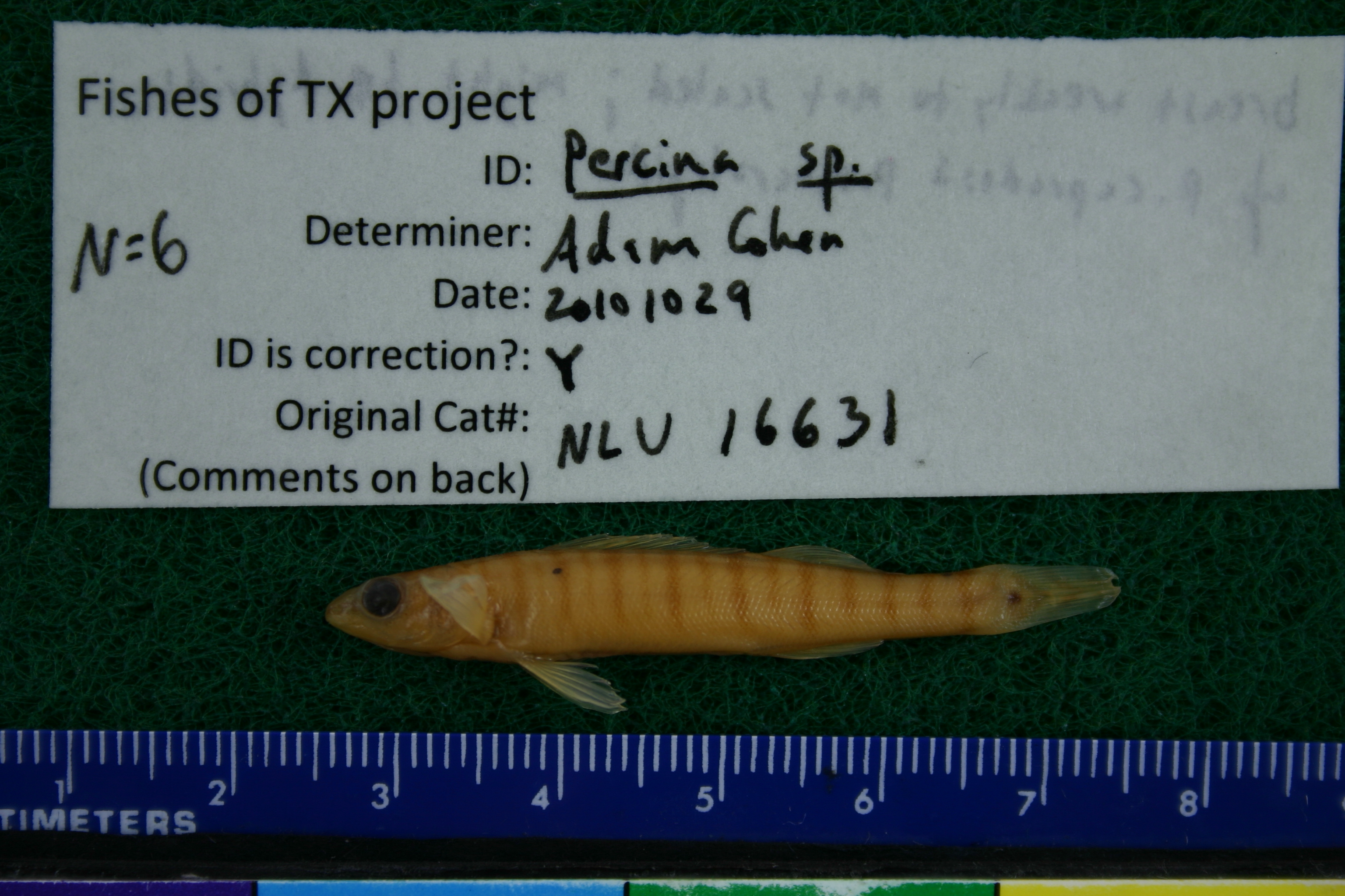
Count
6
Current Determination
Determiner
Unknown
Determination Date
July 11, 2022
Determination Type
taxonomic adjustment
Identification Comments
Determination found in FoTX database and determined to be the most recent determination. However, since the date of determination is not recorded in the database we hereby assign the date of our determination reconciliation effort, which makes it the most recent determination for this record.
Identification Confidence
Unknown
Previous Determination
Determiner
Adam Cohen
Determination Date
Oct. 29, 2010
Determination Type
specimen examination
Identification Comments
ID complete | breast weakly to not scaled; might be hybrids of P. caprodes by P. macrolepida
Identification Confidence
Medium
Collecting Event
Collected
June 13, 1970
Collector(s)
Collecting Event ID
6078
Field Notes
There are no field notes available.
Locality
Region
Rolling Plains
Jurisdiction
Palo Pinto, Texas
Name
Brazos River at FM 4
Hydrography
Texas-Gulf Region
Middle Brazos
Middle Brazos-Bosque
Middle Brazos-Palo Pinto
Ioni Creek-Brazos River
Little Keechi Creek-Brazos River
Captive
no
Locality Photos
No locality photos available.
flag (suspect/examine)
suspect: noexamination: yes
date
date_range: 6/13/1970-6/13/1970
collectors
collectors: Laird, P.
collectors
collectors: P. Laird
date
date_range: 6/13/1970-6/13/1970
staff comment
ID Status: Specimen examined and ID'ed for FoTX projectID Comments: breast weakly to not scaled; might be hybrids of P. carbonaria by P. macrolepidaGeoref Remark: N of Palo PintoID Confidence: medium
georeference
Error: 43.643Remarks: N of Palo PintoLocality: Brazos River at FM 4Coordinates: 32.862858556;-98.302440782Georeferencer: GLMGeographic note: Inland USA Texas
N of Palo Pinto
Comments On NLU_16631