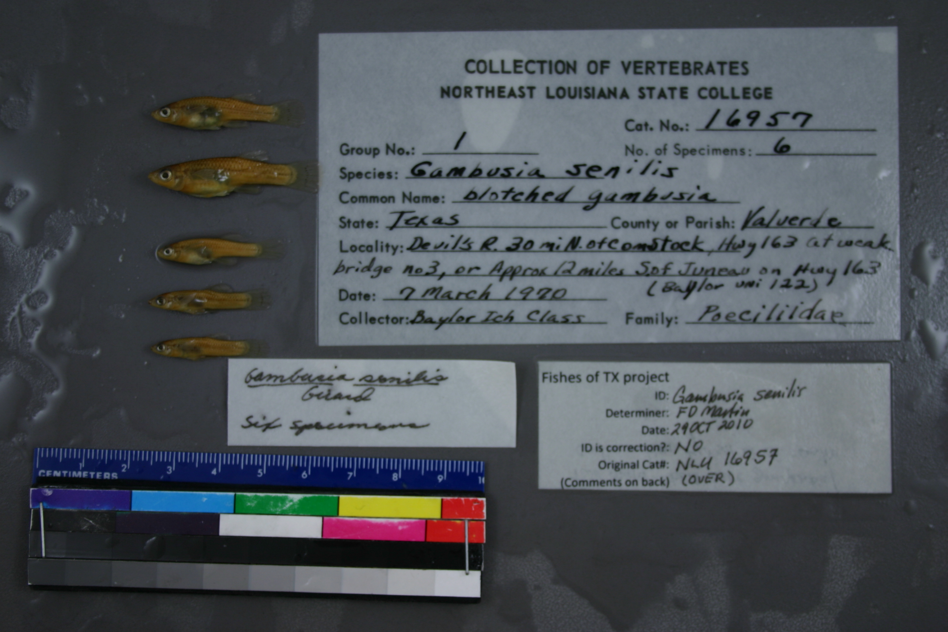
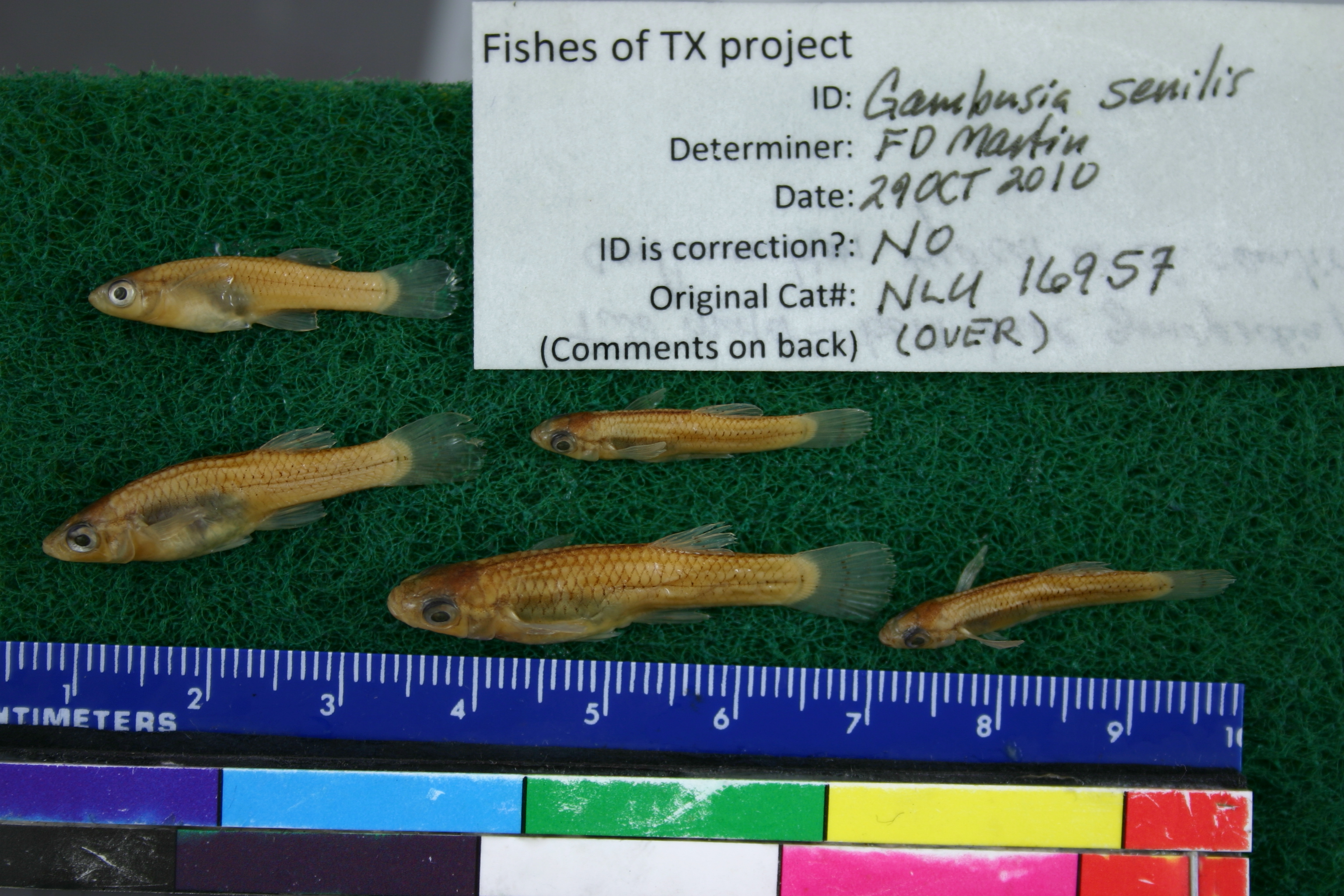
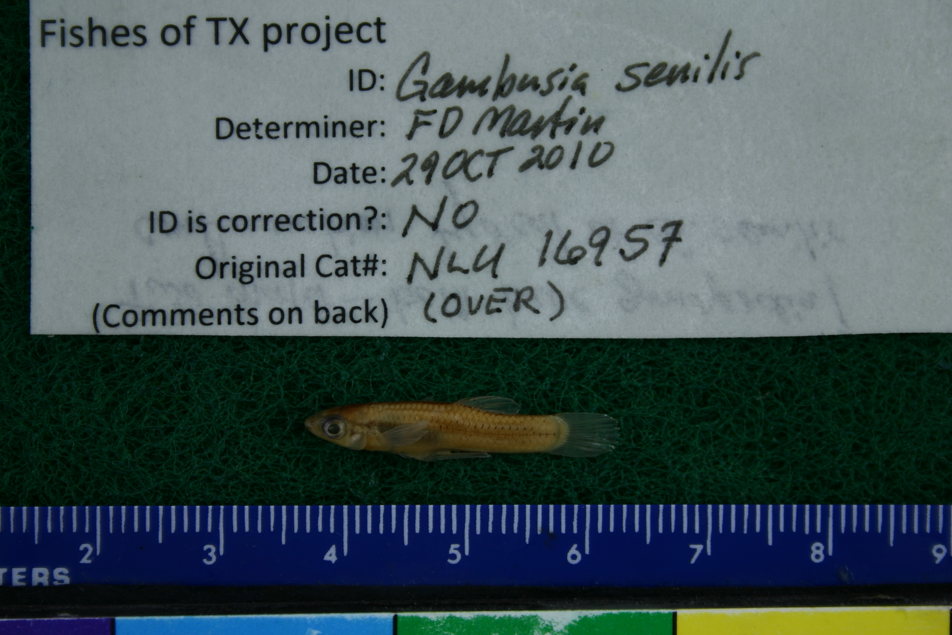
NLU_16957
Not suspect, examinedPhotos
Map
Location
29.96511° N, 101.14724° W
(± 43.7
m)
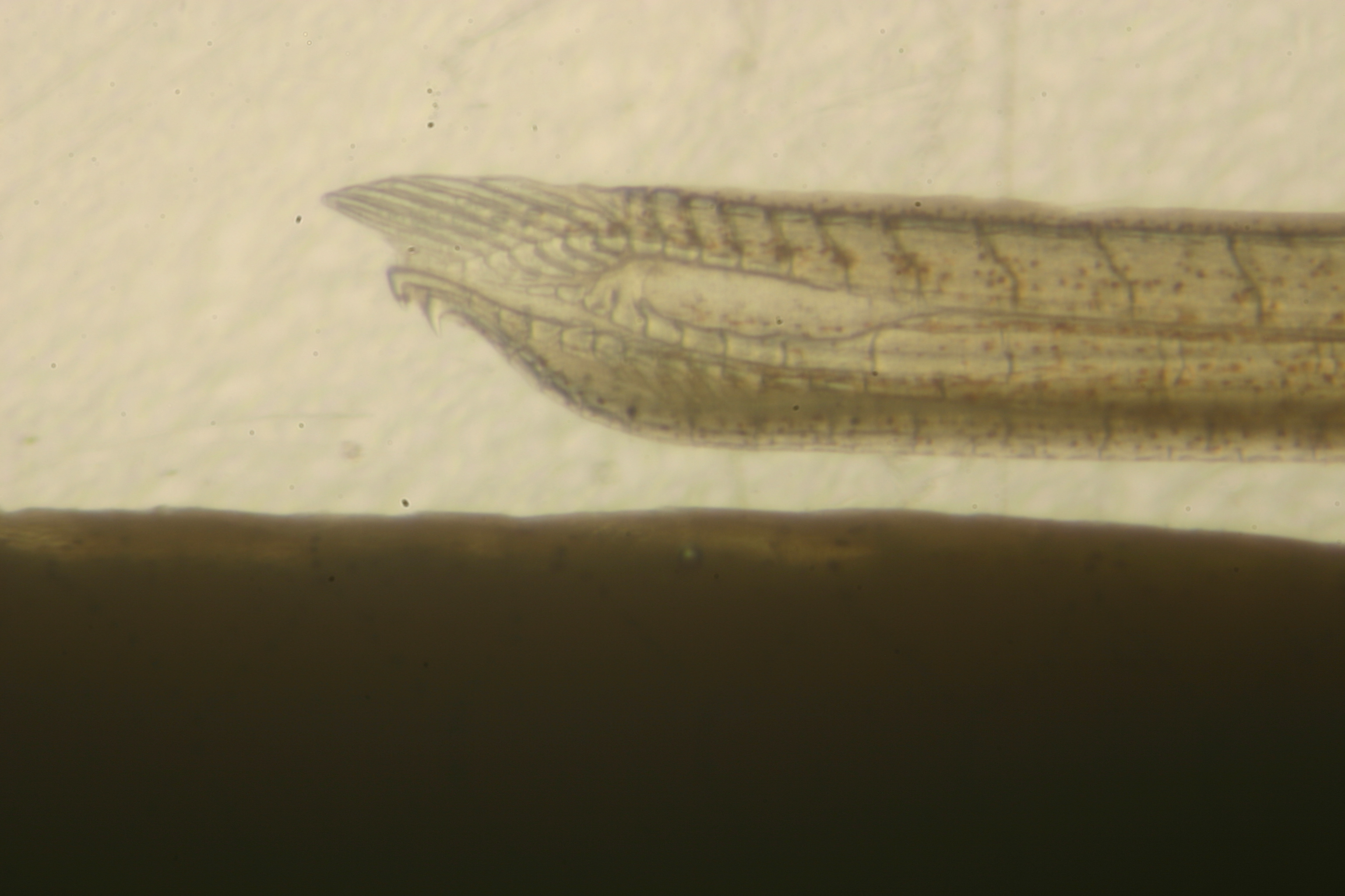
Taxonomy
GenusGAMBUSIA
SpeciesSENILIS
Specimen
Num Specimens6
Collection Event
CollectorBAYLOR ICH CLASS
Collected Date1970.3.7
Geography
DrainageDEVIL'S RIVER
CountryUnited States
StateTexas
CountyVal Verde
LocalityWATERBODYDEVIL'S RIVER,30 MI N OF COMSTOCK, ON HWY 163 AT NO 3 WEAK BRIDGE, OR APPROX 12 MI S OF JUNEAU ON HWY 163
Record Source
Source
University of Louisiana at Monroe
(type: miscellaneous)
Institution
University of Louisiana at Monroe
(type: university)
Curator
Unknown
Record Added
May 13, 2010
Record Last Modified
June 22, 2022
Data Processing Track
Track 1
From Data Set Received
11/1997 to 05/2006
Identification
Suspect Notes
None
Count
6
Current Determination
Determiner
Adam Cohen
Determination Date
Nov. 15, 2019
Determination Type
specimen examination
Identification Comments
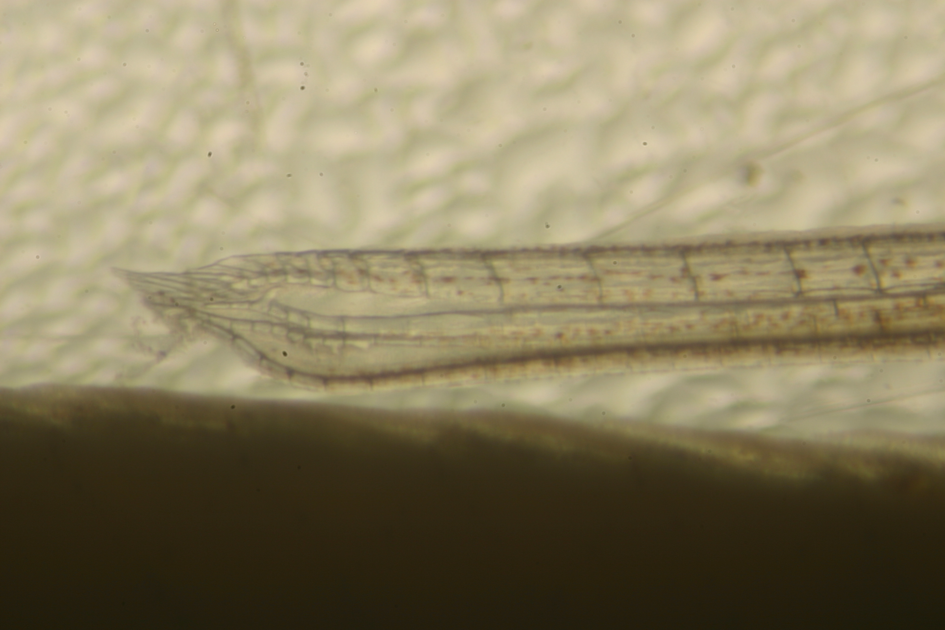
ID complete | Verified by GPG, ID based on gonopodia
Identification Confidence
High
Previous Determination
Determiner
Floyd Douglas Martin
Determination Date
Oct. 29, 2010
Determination Type
specimen examination
Identification Comments
ID complete | two males - both have gonopodial configurations typical of G. senilis
Identification Confidence
High
Collecting Event
Collected
March 7, 1970
Collector(s)
Collecting Event ID
6095
Field Notes
There are no field notes available.
Locality
Region
Edwards Plateau
Jurisdiction
Val Verde, Texas
Name
Devils River at Bakers Crossing, SH163
Hydrography
Rio Grande Region
Rio Grande-Amistad
Devils
Lower Devils
Deaton Draw-Devils River
Brushy Draw-Devils River
Captive
no
Locality Photos
No locality photos available.
flag (suspect/examine)
suspect: noexamination: yes
date
date_range: 3/7/1970-3/7/1970
collectors
collectors: Ichthyology Class (Baylor)
collectors
collectors: Ichthyology Class (Baylor)
date
date_range: 3/7/1970-3/7/1970
staff comment
ID Status: Specimen examined and ID'ed for FoTX projectID Comments: two males - both have gonopodial configurations typical of G. senilisID Confidence: high
georeference
Error: 43.662Locality: Devils River at Bakers Crossing, SH163Coordinates: 29.965111083;-101.147244916Georeferencer: BJLGeographic note: Inland USA Texas
Comments On NLU_16957