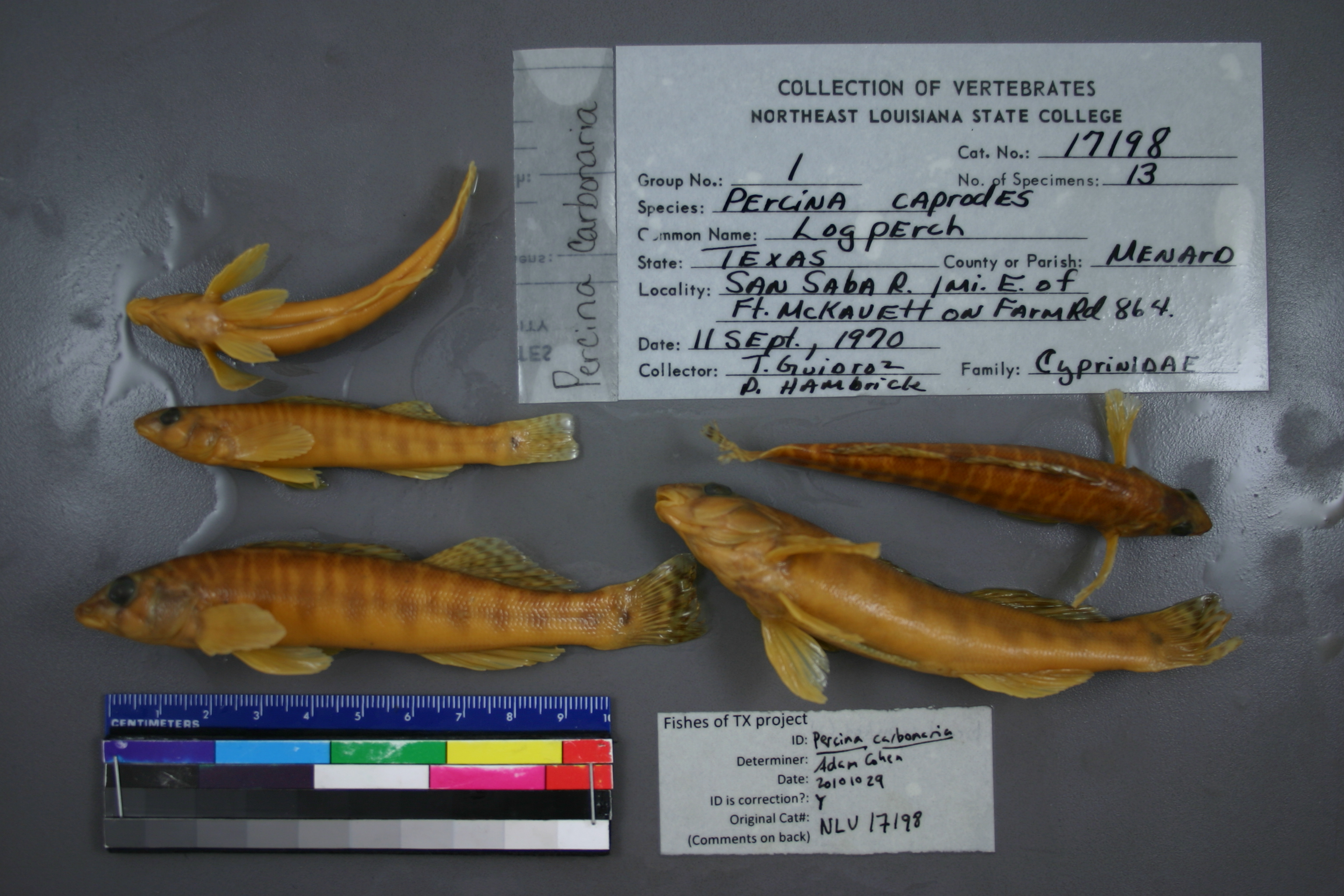
NLU_17198
Not suspect, examinedPhotos
Map
Location
30.83462° N, 100.09372° W
(± 43.7
m)
Taxonomy
GenusPERCINA
SpeciesCAPRODES
Specimen
Num Specimens13
Collection Event
CollectorT. GUIDROZ & P. HAMBRICK
Collected Date1970.9.11
Geography
DrainageCOLORADO RIVER
CountryUnited States
StateTexas
CountyMenard
LocalityWATERBODYSAN SABA RIVER,1 MI E OF FT MCKAUETT ON FARM RD 864.
Record Source
Source
University of Louisiana at Monroe
(type: miscellaneous)
Institution
University of Louisiana at Monroe
(type: university)
Curator
Unknown
Record Added
May 13, 2010
Record Last Modified
June 22, 2022
Data Processing Track
Track 1
From Data Set Received
11/1997 to 05/2006
Identification
Suspect Notes
None
Count
13
Current Determination
Determiner
Unknown
Determination Date
Oct. 29, 2010
Determination Type
specimen examination
Identification Comments
ID complete | breast is naked in all three
Identification Confidence
Unknown
Collecting Event
Collected
Sept. 11, 1970
Collector(s)
Collecting Event ID
6251
Field Notes
There are no field notes available.
Locality
Region
Edwards Plateau
Jurisdiction
Menard, Texas
Name
San Saba River at SH 864 (first crossing north-northeast of Fort McKavett)
Hydrography
Texas-Gulf Region
Lower Colorado-San Bernard Coastal
Middle Colorado-Concho
San Saba
Rocky Creek-San Saba River
Headwaters San Saba River
Captive
no
Locality Photos
No locality photos available.
flag (suspect/examine)
suspect: noexamination: yes
date
date_range: 9/11/1970-9/11/1970
collectors
collectors: Guidroz, T. Hambrick, P. Mtn Field Biology Class
collectors
collectors: T. Guidroz, P. Hambrick, Mtn Field Biology Class
date
date_range: 9/11/1970-9/11/1970
staff comment
ID Status: Specimen examined and ID'ed for FoTX projectID Comments: breast is naked in all threeGeoref Annotation: Should be SH 864 not ranch road 824
georeference
Error: 43.656Remarks: Should be SH 864 not ranch road 824Locality: San Saba River at SH 864 (first crossing north-northeast of Fort McKavett)Coordinates: 30.834615346;-100.093721001Georeferencer: AECGeographic note: Inland USA Texas
Should be SH 864 not ranch road 824
Comments On NLU_17198