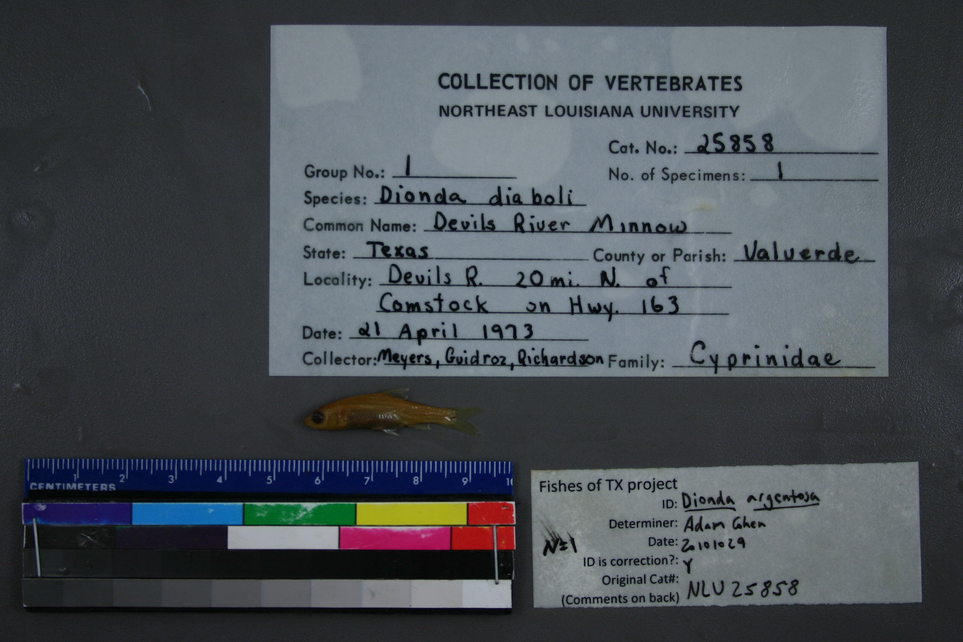
NLU_25858
Not suspect, not examinedPhotos
Map
Location
29.96511° N, 101.14724° W
(± 43.7
m)
Taxonomy
GenusDIONDA
SpeciesDIABOLI
Specimen
Num Specimens1
Collection Event
CollectorMYERS, GUIDROZ, RICHARDSON
Collected Date1973.4.21
Geography
DrainageDEVIL'S RIVER
CountryUnited States
StateTexas
CountyVal Verde
LocalityWATERBODYDEVIL'S RIVER,HWY 163, 20 MI N OF COMSTOCK.
Record Source
Source
University of Louisiana at Monroe
(type: miscellaneous)
Institution
University of Louisiana at Monroe
(type: university)
Curator
Unknown
Record Added
May 13, 2010
Record Last Modified
June 22, 2022
Data Processing Track
Track 1
From Data Set Received
11/1997 to 05/2006
Identification
Suspect Notes
None
Count
1
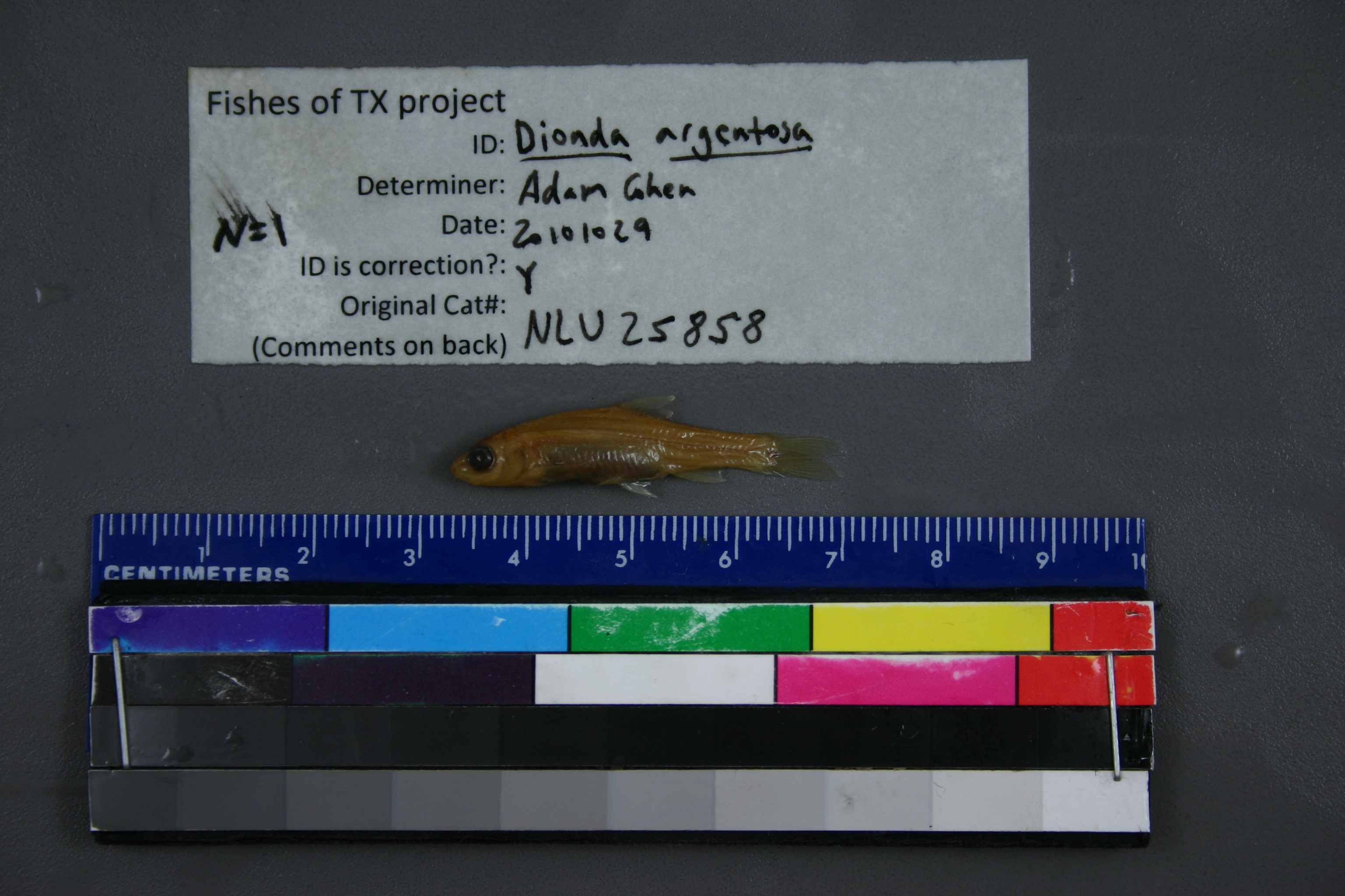
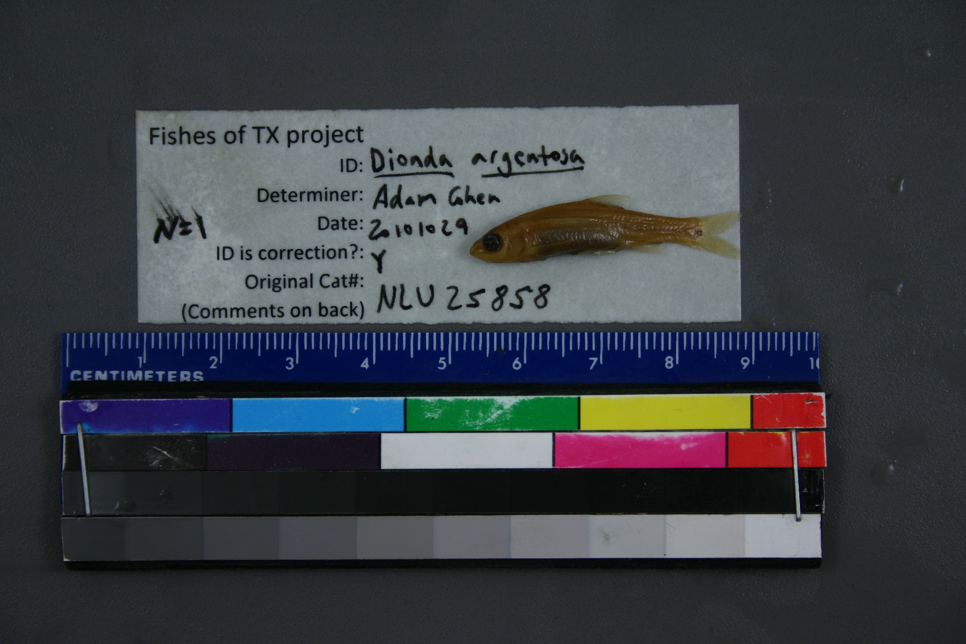
Current Determination
Determiner
Adam Cohen
Determination Date
Oct. 29, 2010
Determination Type
specimen examination
Identification Comments
ID complete
Identification Confidence
High
Collecting Event
Collected
April 21, 1973
Collector(s)
Collecting Event ID
6099
Field Notes
There are no field notes available.
Locality
Region
Edwards Plateau
Jurisdiction
Val Verde, Texas
Name
Devils River at Bakers Crossing, SH163
Hydrography
Rio Grande Region
Rio Grande-Amistad
Devils
Lower Devils
Deaton Draw-Devils River
Brushy Draw-Devils River
Captive
no
Locality Photos
No locality photos available.
flag (suspect/examine)
suspect: noexamination: no
date
date_range: 4/21/1973-4/21/1973
collectors
collectors: Myers, Guidroz, T. Richardson
collectors
collectors: Myers, T. Guidroz, Richardson
date
date_range: 4/21/1973-4/21/1973
staff comment
ID Status: Specimen examined and ID'ed for FoTX projectID Confidence: high
georeference
Error: 43.662Locality: Devils River at Bakers Crossing, SH163Coordinates: 29.965111083;-101.147244916Georeferencer: BJLGeographic note: Inland USA Texas
Comments On NLU_25858