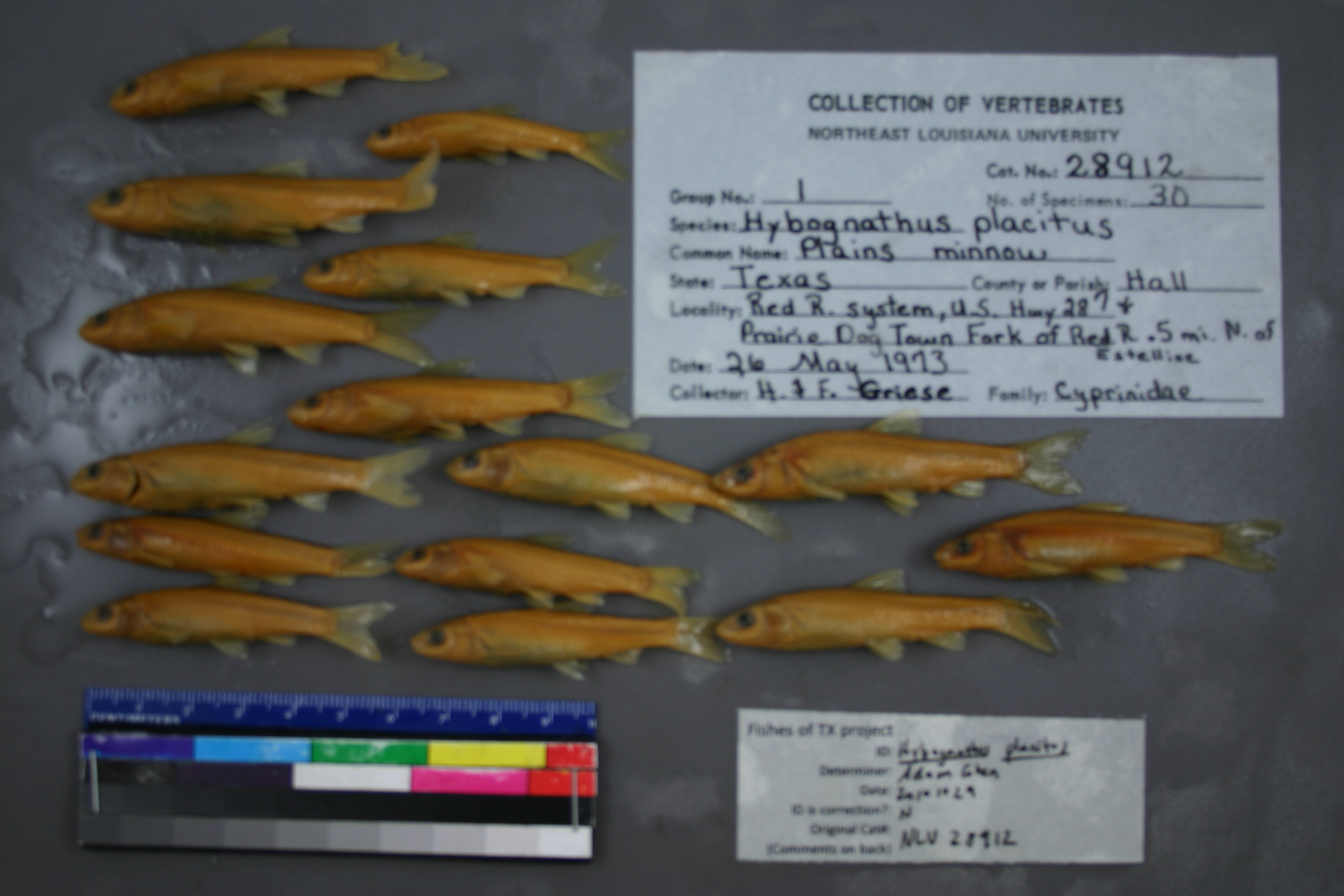
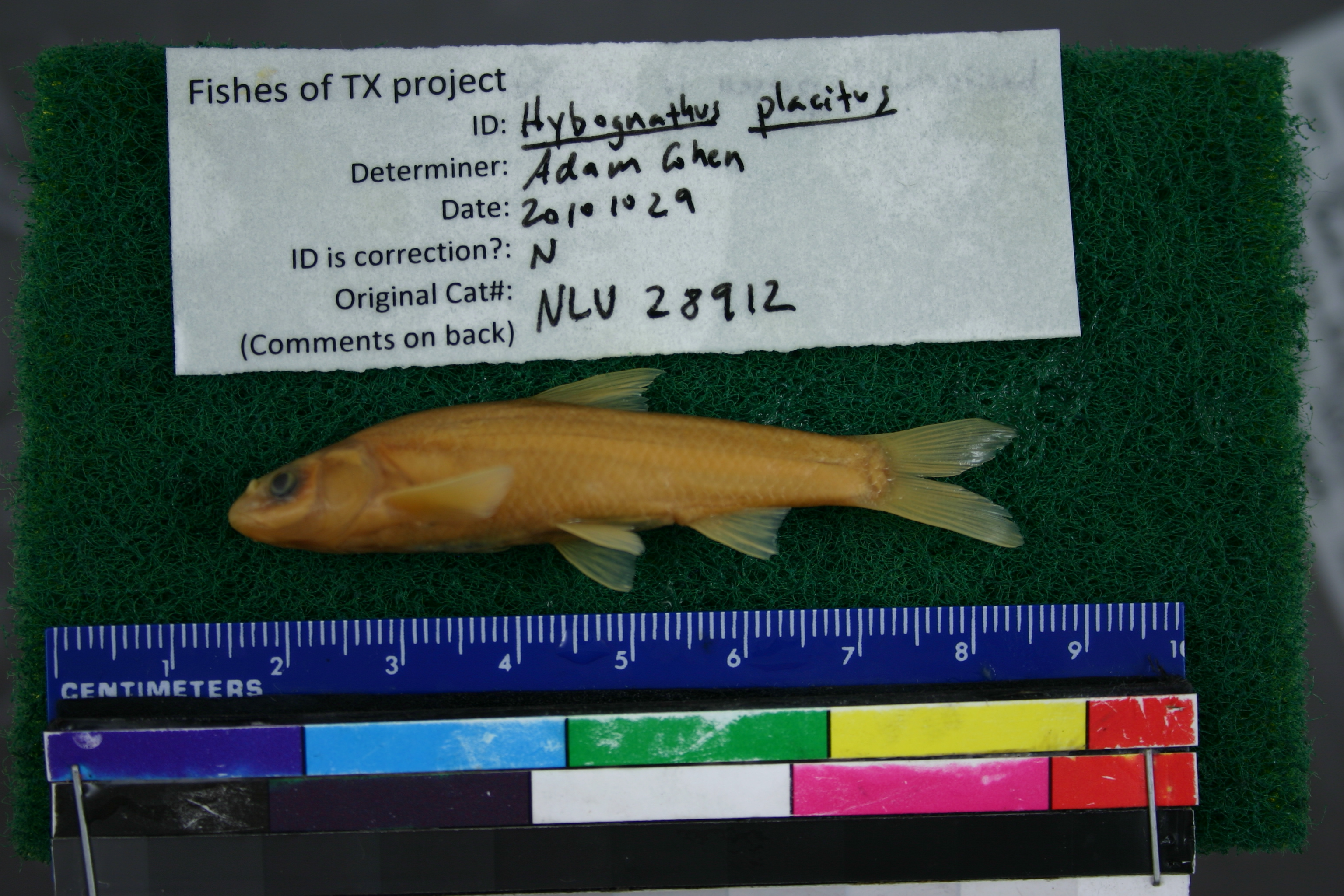
NLU_28912
Not suspect, examinedPhotos
Map
Location
34.57170° N, 100.43718° W
(± 91818.5
m)
Taxonomy
GenusHYBOGNATHUS
SpeciesPLACITUS
Specimen
Num Specimens30
Collection Event
CollectorMYERS, GUIDROZ, RICHARDSON
Collected Date1973.5.26
Geography
DrainageMISSISSIPPI RIVER
CountryUnited States
StateTexas
CountyHall
LocalityWATERBODYRED RIVER,US HWY 287 & PRAIRIE DOG TOWN FORK OF RED RIVER, 0.5 MI N OF ESTELLINE
Record Source
Source
University of Louisiana at Monroe
(type: miscellaneous)
Institution
University of Louisiana at Monroe
(type: university)
Curator
Unknown
Record Added
May 13, 2010
Record Last Modified
June 22, 2022
Data Processing Track
Track 1
From Data Set Received
11/1997 to 05/2006
Identification
Suspect Notes
None
Count
30
Current Determination
Determiner
Adam Cohen
Determination Date
Oct. 29, 2010
Determination Type
specimen examination
Identification Comments
ID complete | basioccipital process is peg-like
Identification Confidence
High
Collecting Event
Collected
May 26, 1973
Collector(s)
Collecting Event ID
6216
Field Notes
There are no field notes available.
Locality
Region
Rolling Plains
Jurisdiction
Hall, Texas
Name
Prairie Dog Town Fork Red River at US 287
Hydrography
Arkansas-White-Red Region
Red Headwaters
Prairie Dog Town Fork Red
Lower Prairie Dog Town Fork Red
Little Red River-Prarie Dog Town Fork Red River
Hulver Cemetery-Prarie Dog Town Fork Red River
Captive
no
Locality Photos
No locality photos available.
flag (suspect/examine)
suspect: noexamination: yes
date
date_range: 5/26/1973-5/26/1973
collectors
collectors: Myers, Guidroz, T. Richardson
collectors
collectors: Myers, T. Guidroz, Richardson
date
date_range: 5/26/1973-5/26/1973
staff comment
ID Status: Specimen examined and ID'ed for FoTX projectID Comments: basioccipital process is peg-like
Georef Remark: Point is placed on the main channel and extent covers the width of the braided channel.
ID Confidence: high
georeference
Error: 91818.4771707673
Remarks: Point is placed on the main channel and extent covers the width of the braided channel.
Locality: Prairie Dog Town Fork Red River at US 287Coordinates: 34.571698178;-100.437182485Georeferencer: AECGeographic note: Inland USA TexasPoint is placed on the main channel and extent covers the width of the braided channel.
Comments On NLU_28912