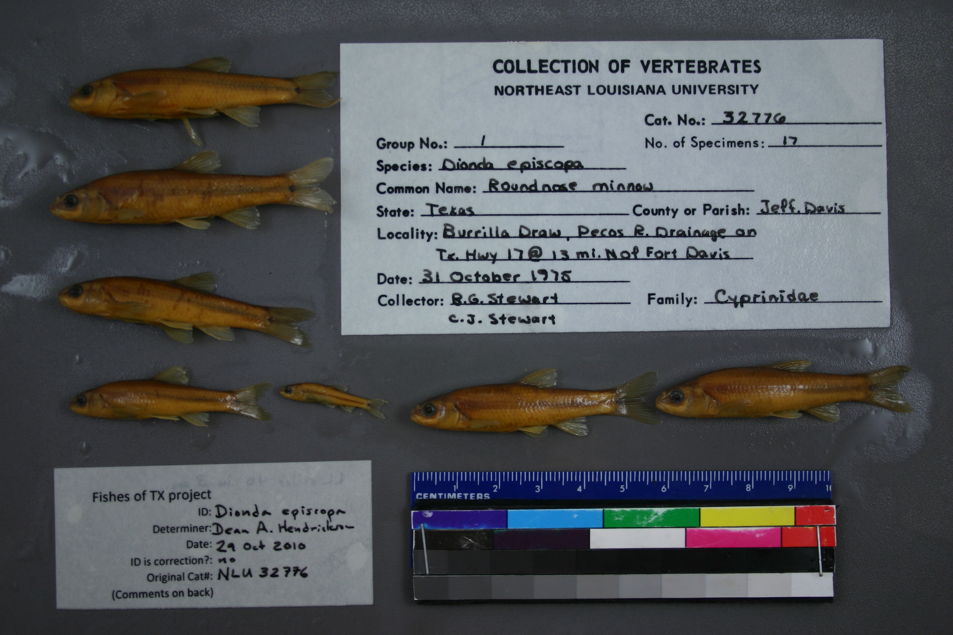
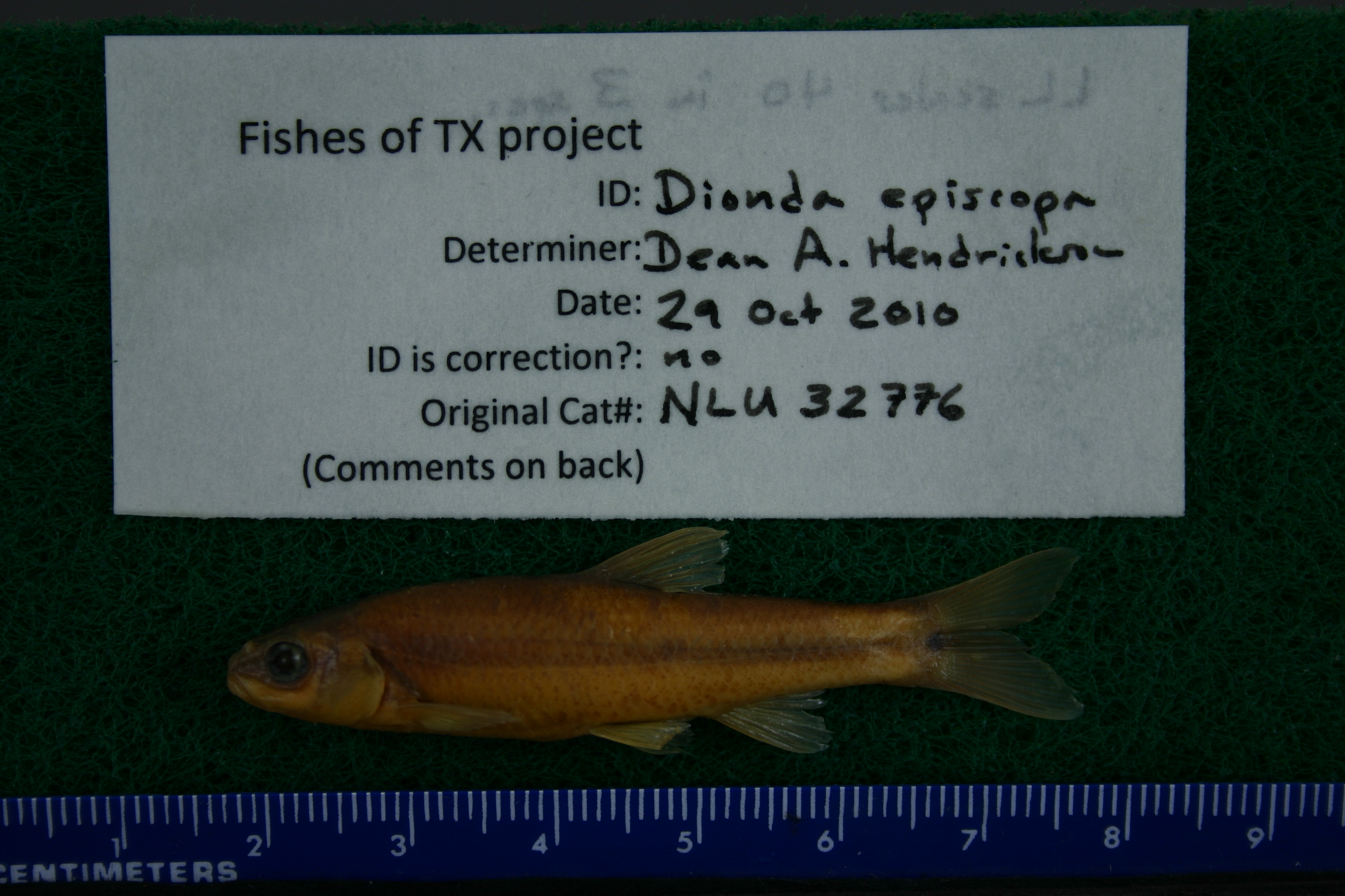
NLU_32776
Not suspect, not examinedPhotos
Map
Location
30.72730° N, 103.78537° W
(± 4519.0
m)
Taxonomy
GenusDIONDA
SpeciesEPISCOPA
Specimen
Num Specimens17
Collection Event
CollectorE. BEENE
Collected Date1975.10.31
Geography
DrainagePECOS RIVER
CountryUnited States
StateTexas
CountyJeff Davis
LocalityWATERBODYBURRILLA DRAW,ON TX. HWY 17 @ 13 MI N OF FORT DAVIS.
Record Source
Source
University of Louisiana at Monroe
(type: miscellaneous)
Institution
University of Louisiana at Monroe
(type: university)
Curator
Unknown
Record Added
May 13, 2010
Record Last Modified
June 22, 2022
Data Processing Track
Track 1
From Data Set Received
11/1997 to 05/2006
Identification
Suspect Notes
None
Count
17
Current Determination
Determiner
Dean Hendrickson
Determination Date
Oct. 29, 2010
Determination Type
specimen examination
Identification Comments
ID complete | LL scales 40 in 3 specimens
Identification Confidence
High
Collecting Event
Collected
Oct. 31, 1975
Collector(s)
Collecting Event ID
6080
Field Notes
There are no field notes available.
Locality
Region
Trans Pecos
Jurisdiction
Jeff Davis, Texas
Name
Fort Davis, 13 mi N of on SH 17
Hydrography
Rio Grande Region
Lower Pecos
Lower Pecos
Barrilla Draw
Cienega Creek-Limpia Creek
Short Canyon-Limpia Creek
Captive
no
Locality Photos
No locality photos available.
HUC 12
130700050106
Georeferencing Remarks
Measured by road
Georeferencing Annotation
Unable to find location of \"Burilla Draw\" (which I believe should be Barilla Draw), so georeferenced as distance along road, from Ft. Davis
Has not been Georeferenced because
—
flag (suspect/examine)
suspect: noexamination: no
date
date_range: 10/31/1975-10/31/1975
collectors
collectors: Beene, E.
collectors
collectors: E. Beene
date
date_range: 10/31/1975-10/31/1975
staff comment
ID Status: Specimen examined and ID'ed for FoTX projectID Comments: LL scales 40 in 3 specimensGeoref Remark: Measured by roadID Confidence: high
Georef Annotation: Unable to find location of 'Burilla Draw' (which I believe should be Barilla Draw), so georeferenced as distance along road, from Ft. Davis
georeference
Error: 4519.03795198061
Remarks: Measured by road Unable to find location of 'Burilla Draw' (which I believe should be Barilla Draw), so georeferenced as distance along road, from Ft. Davis
Locality: Fort Davis, 13 mi N of on SH 17Coordinates: 30.727301159;-103.785370705Georeferencer: MJCGeographic note: Inland USA TexasMeasured by road Unable to find location of 'Burilla Draw' (which I believe should be Barilla Draw), so georeferenced as distance along road, from Ft. Davis
Comments On NLU_32776