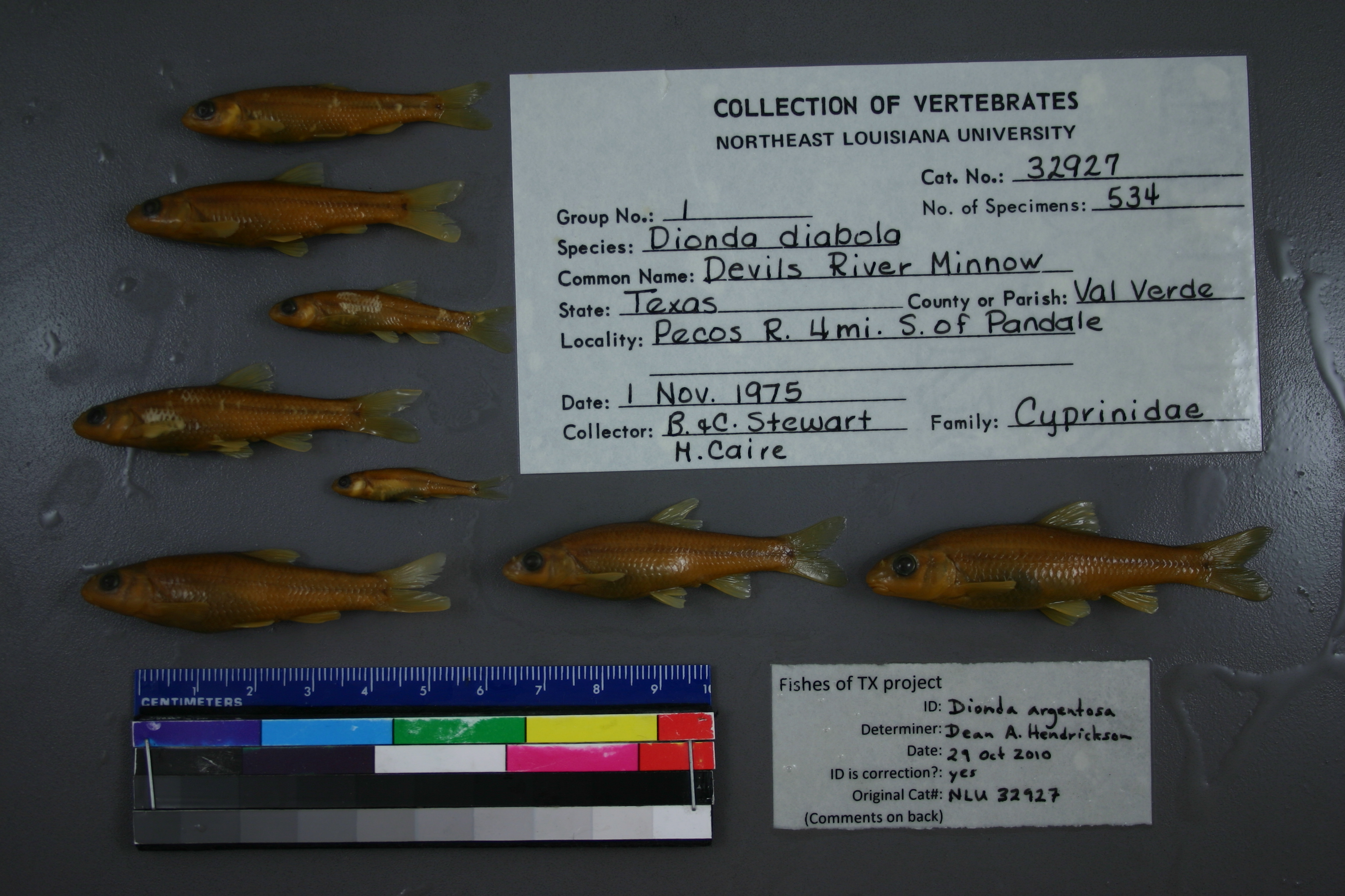
NLU_32927
Not suspect, not examinedPhotos
Map
Location
30.14900° N, 101.57604° W
(± 4068.4
m)
Taxonomy
GenusDIONDA
SpeciesDIABOLI
Specimen
Num Specimens534
Collection Event
CollectorB.&C.STEWART, M.CAIRE
Collected Date1975.11.1
Geography
DrainagePECOS RIVER
CountryUnited States
StateTexas
CountyVal Verde
LocalityWATERBODYPECOS RIVER,4 MI S OF PANDALE.
Record Source
Source
University of Louisiana at Monroe
(type: miscellaneous)
Institution
University of Louisiana at Monroe
(type: university)
Curator
Unknown
Record Added
May 13, 2010
Record Last Modified
June 22, 2022
Data Processing Track
Track 1
From Data Set Received
11/1997 to 05/2006
Identification
Suspect Notes
None
Count
534
Current Determination
Determiner
Dean Hendrickson
Determination Date
Oct. 29, 2010
Determination Type
specimen examination
Identification Comments
ID complete
Identification Confidence
High
Collecting Event
Collected
Nov. 1, 1975
Collector(s)
Collecting Event ID
6204
Field Notes
There are no field notes available.
Locality
Region
Trans Pecos
Jurisdiction
Val Verde, Texas
Name
Pecos River, 4 miles south of Pandale
Hydrography
Rio Grande Region
Lower Pecos
Lower Pecos
Lower Pecos
Big Fielder Draw-Pecos River
Little Fielder Draw-Pecos River
Captive
no
Locality Photos
No locality photos available.
flag (suspect/examine)
suspect: noexamination: no
date
date_range: 11/1/1975-11/1/1975
collectors
collectors: Stewart, B.G. Stewart, C.J. Caire, M.
collectors
collectors: B.G. Stewart, C.J. Stewart, M. Caire
date
date_range: 11/1/1975-11/1/1975
staff comment
ID Status: Specimen examined and ID'ed for FoTX project
Georef Remark: Measured by SH 1024 and point placed on river at nearest point. Distance from this point to measurement by stream is added to starting extent.
ID Confidence: high
georeference
Error: 4068.42163198254
Remarks: Measured by SH 1024 and point placed on river at nearest point. Distance from this point to measurement by stream is added to starting extent.
Locality: Pecos River, 4 miles south of PandaleCoordinates: 30.149003965;-101.576036267Georeferencer: AECGeographic note: Inland USA TexasMeasured by SH 1024 and point placed on river at nearest point. Distance from this point to measurement by stream is added to starting extent.
Comments On NLU_32927