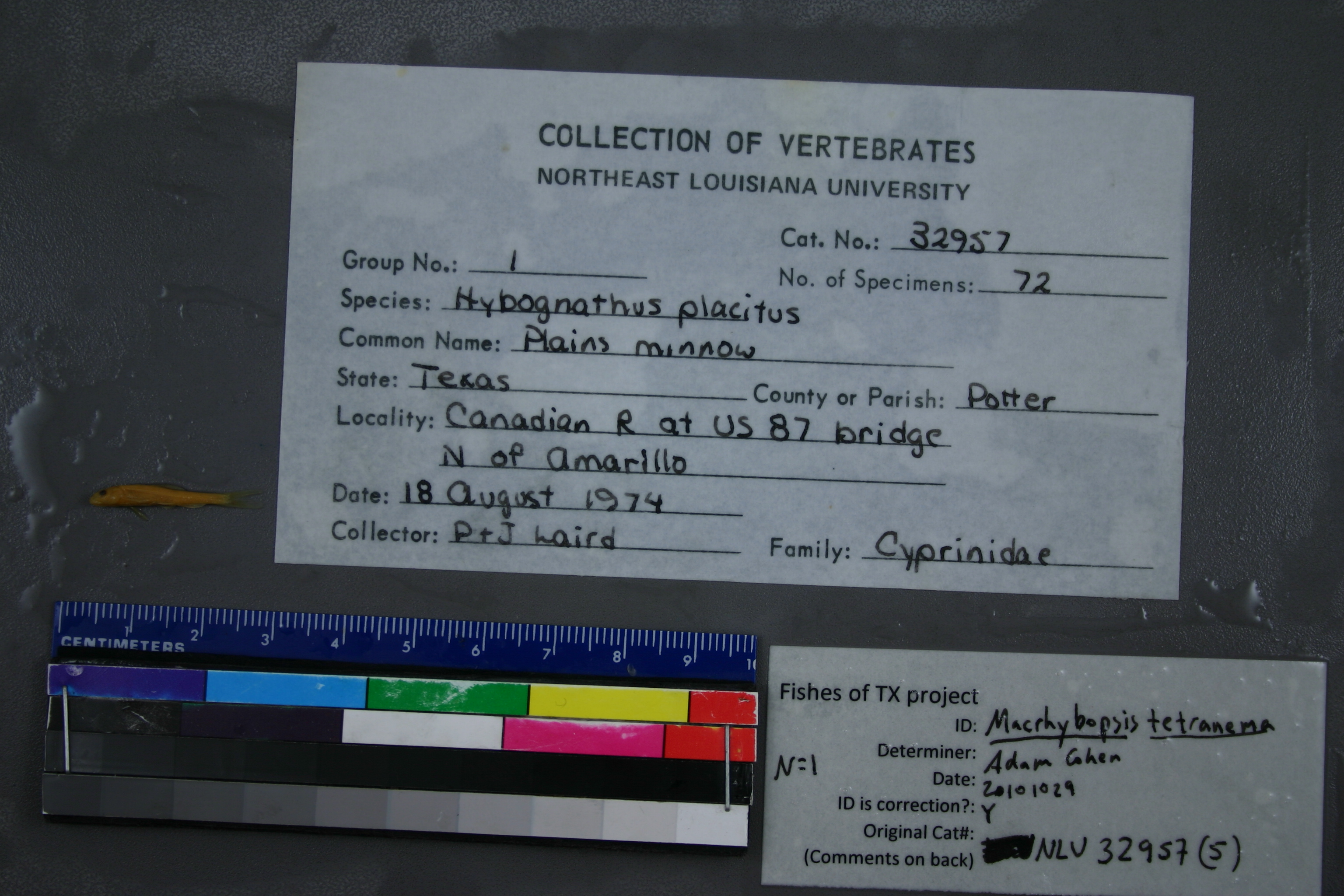
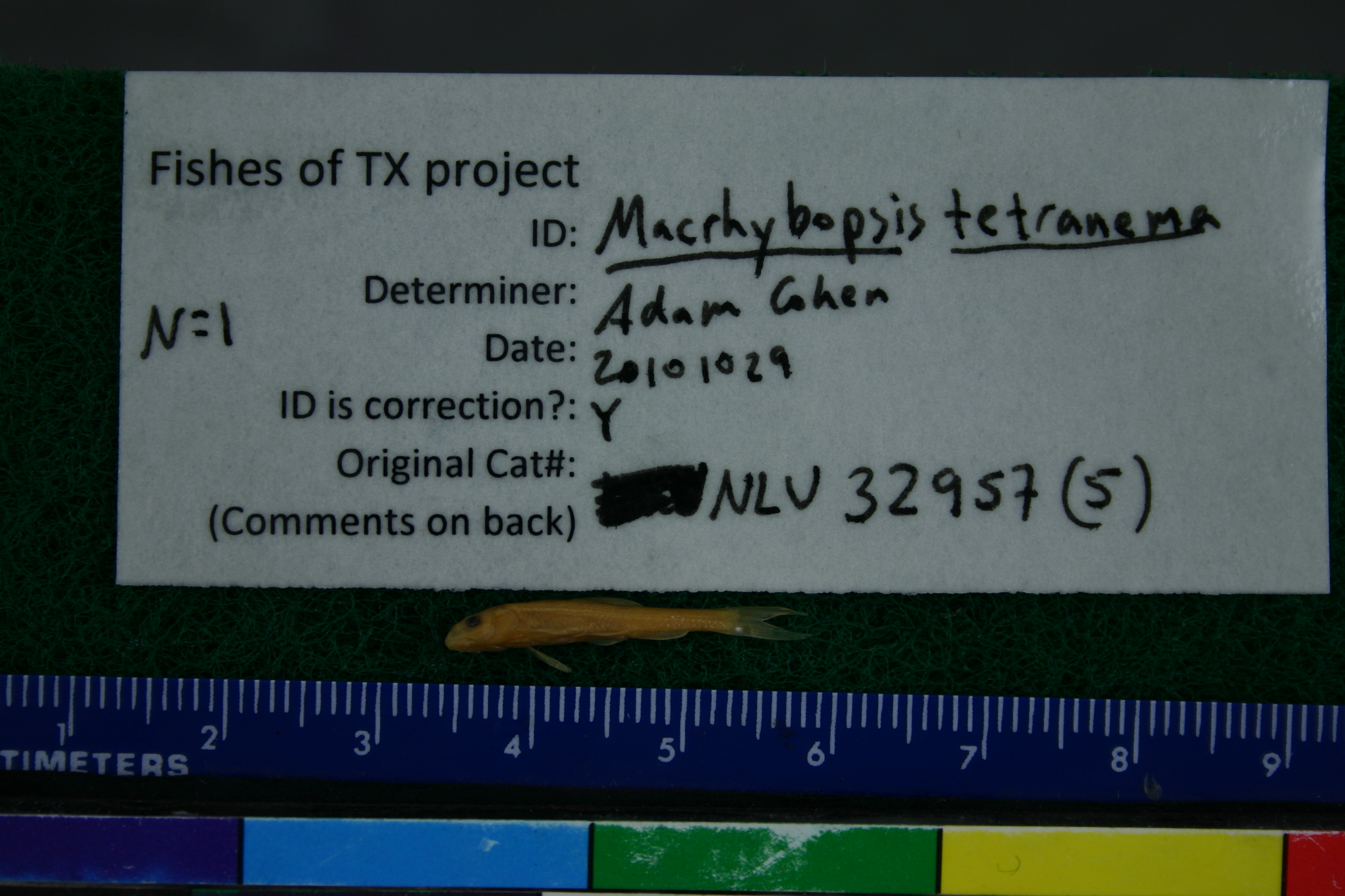
NLU_32957(5)
Not suspect, examinedPhotos
Map
Location
35.46982° N, 101.87964° W
(± 43.6
m)
Taxonomy
GenusHYBOGNATHUS
SpeciesPLACITUS
Specimen
Num Specimens72
Collection Event
CollectorP.LAIRD, J.LAIRD
Collected Date1974.8.18
Geography
DrainageCANADIAN RIVER
CountryUnited States
StateTexas
CountyPotter
LocalityWATERBODYCANADIAN RIVER,AT US 87 BRIDGE N OF AMARILLO
Record Source
Source
University of Louisiana at Monroe
(type: miscellaneous)
Institution
University of Louisiana at Monroe
(type: university)
Curator
Unknown
Record Added
June 22, 2011
Record Last Modified
June 22, 2022
Data Processing Track
Track 1
From Data Set Received
11/1997 to 05/2006
Identification
Suspect Notes
None
Count
72
Current Determination
Determiner
Adam Cohen
Determination Date
Oct. 29, 2010
Determination Type
specimen examination
Identification Comments
ID complete | removed from NLU32957
Identification Confidence
High
Collecting Event
Collected
Aug. 18, 1974
Collector(s)
Collecting Event ID
6086
Field Notes
There are no field notes available.
Locality
Region
Rolling Plains
Jurisdiction
Potter, Texas
Name
Canadian River at US287/US87
Hydrography
Arkansas-White-Red Region
Lower Canadian
Middle Canadian
Lake Meredith
East Amarillo Creek-Canadian River
Rosita Creek-Canadian River
Captive
no
Locality Photos
No locality photos available.
flag (suspect/examine)
suspect: noexamination: yes
collectors
collectors: Laird, P. Laird, J.
staff comment
ID Status: Specimen examined and ID'ed for FoTX projectID Comments: removed from NLU32957ID Confidence: high
date
date_range: 8/18/1974-8/18/1974
collectors
collectors: P. Laird, J. Laird
georeference
Error: 43.625Locality: Canadian River at US287/US87Coordinates: 35.4698223;-101.879644401Georeferencer: BJLGeographic note: Inland USA Texas
Comments On NLU_32957(5)