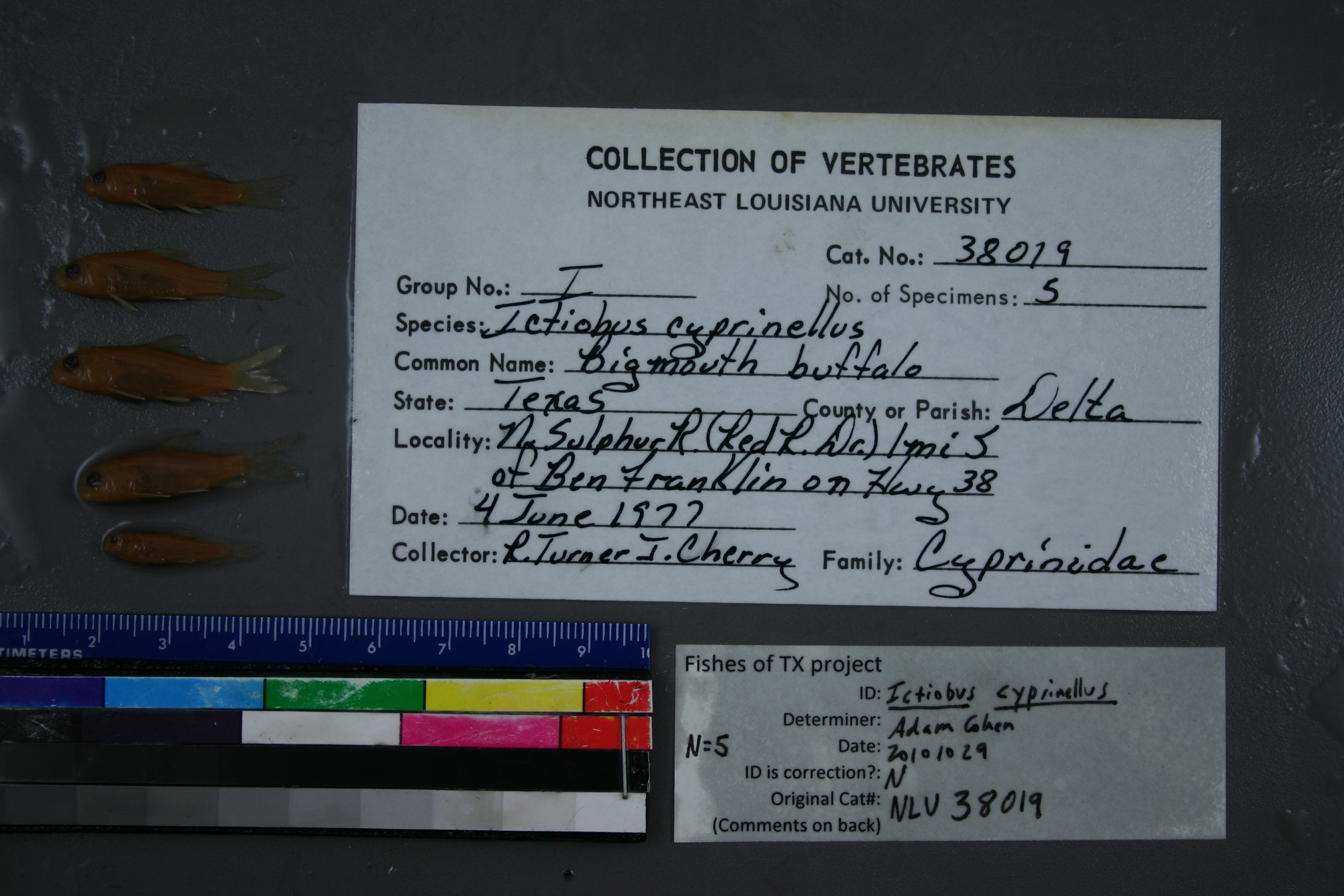
NLU_38019
Not suspect, examinedPhotos
Map
Location
33.48640° N, 95.77405° W
(± 650.7
m)
Taxonomy
GenusICTIOBUS
SpeciesCYPRINELLUS
Specimen
Num Specimens5
Collection Event
CollectorR.TURNER, J.CHERRY
Collected Date1977.6.4
Geography
DrainageRED RIVER
CountryUnited States
StateTexas
CountyDelta
LocalityWATERBODYNORTH SULPHUR RIVER,1 MI S OF BEN FRANKLIN ON HWY 38
Record Source
Source
University of Louisiana at Monroe
(type: miscellaneous)
Institution
University of Louisiana at Monroe
(type: university)
Curator
Unknown
Record Added
May 13, 2010
Record Last Modified
June 22, 2022
Data Processing Track
Track 1
From Data Set Received
11/1997 to 05/2006
Identification
Suspect Notes
None
Count
5
Current Determination
Determiner
Adam Cohen
Determination Date
Oct. 29, 2010
Determination Type
specimen examination
Identification Comments
ID complete
Identification Confidence
High
Collecting Event
Collected
June 4, 1977
Collector(s)
Collecting Event ID
6187
Field Notes
There are no field notes available.
Locality
Region
Blackland Prairies
Jurisdiction
Delta, Texas
Name
North Sulphur River at SH 38
Hydrography
Arkansas-White-Red Region
Red-Sulphur
Big Cypress-Sulphur
Sulphur Headwaters
North Sulphur River
Rowdy Creek-North Sulphur River
Captive
no
Locality Photos
No locality photos available.
flag (suspect/examine)
suspect: noexamination: yes
date
date_range: 6/4/1977-6/4/1977
collectors
collectors: Turner, R. Cherry, J.
collectors
collectors: R. Turner, J. Cherry
staff comment
ID Status: Specimen examined and ID'ed for FoTX projectGeoref Remark: Point is on channelized river and extent covers original river route.ID Confidence: high
date
date_range: 6/4/1977-6/4/1977
georeference
Error: 650.670885602603Remarks: Point is on channelized river and extent covers original river route.Locality: North Sulphur River at SH 38Coordinates: 33.486395859;-95.774045829Georeferencer: AECGeographic note: Inland USA Texas
Point is on channelized river and extent covers original river route.
Comments On NLU_38019