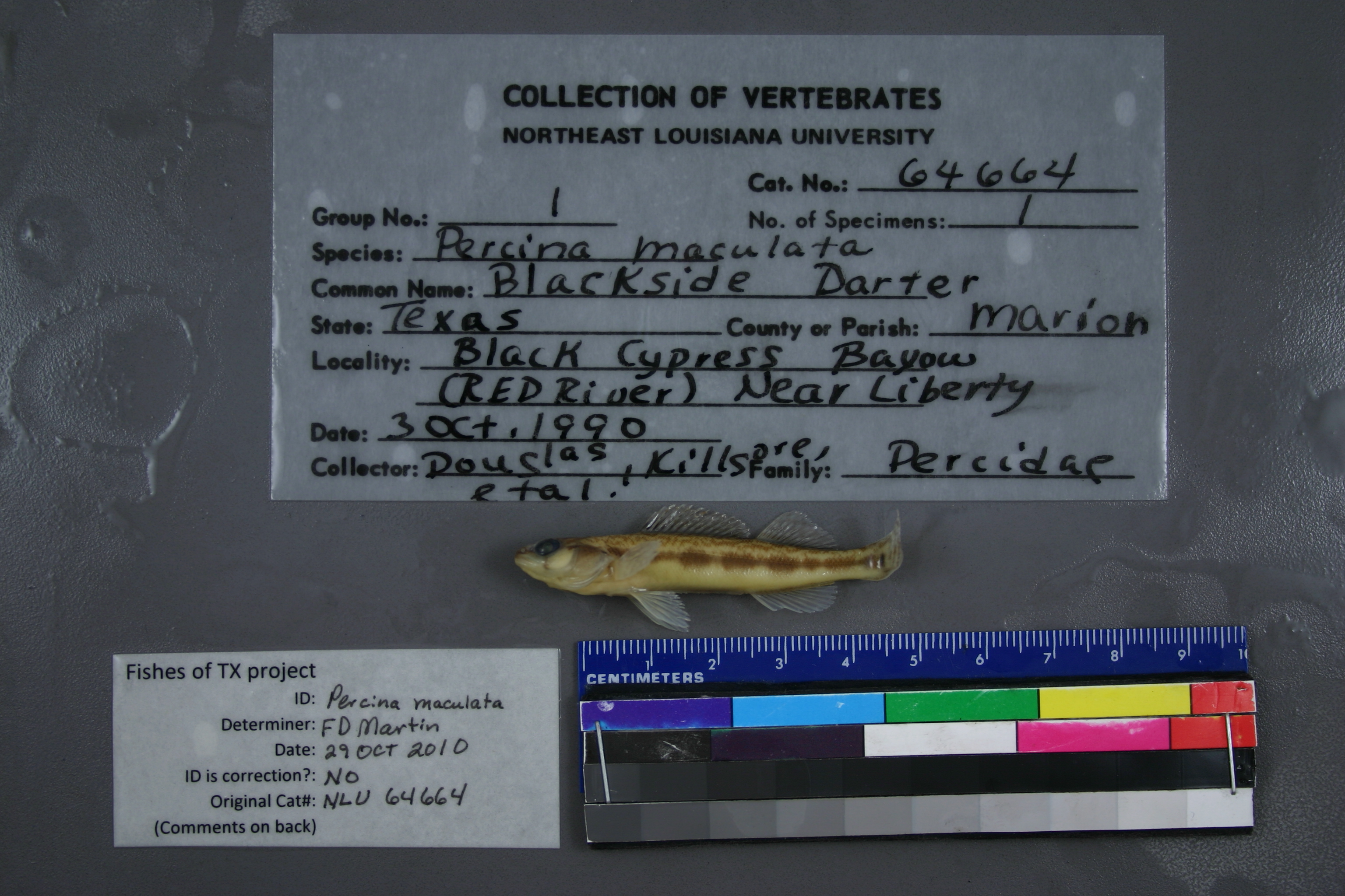
NLU_64664
Not suspect, examinedPhotos
Map
Location
32.86279° N, 94.43002° W
(± 2024.6
m)
Taxonomy
GenusPERCINA
SpeciesMACULATA
Specimen
Num Specimens1
Collection Event
CollectorDOUGLAS, KILLGORE, ET AL
Collected Date1990.10.3
Geography
DrainageRED RIVER
CountryUnited States
StateTexas
CountyMarion
LocalityWATERBODYBLACK CYPRESS BAYOU,NEAR LIBERTY
Record Source
Source
University of Louisiana at Monroe
(type: miscellaneous)
Institution
University of Louisiana at Monroe
(type: university)
Curator
Unknown
Record Added
May 13, 2010
Record Last Modified
June 22, 2022
Data Processing Track
Track 1
From Data Set Received
11/1997 to 05/2006
Identification
Suspect Notes
None
Count
1
Current Determination
Determiner
Floyd Douglas Martin
Determination Date
Oct. 29, 2010
Determination Type
specimen examination
Identification Comments
ID complete
Identification Confidence
High
Collecting Event
Collected
Oct. 3, 1990
Collector(s)
Collecting Event ID
6069
Field Notes
There are no field notes available.
Locality
Region
Piney Woods
Jurisdiction
Marion, Texas
Name
Black Cypress Bayou near Liberty
Hydrography
Arkansas-White-Red Region
Red-Sulphur
Big Cypress-Sulphur
Caddo Lake
Black Cypress Creek-Black Cypress Bayou
Cattail Creek-Black Cypress Bayou
Captive
no
Locality Photos
No locality photos available.
flag (suspect/examine)
suspect: noexamination: yes
date
date_range: 10/3/1990-10/3/1990
collectors
collectors: Douglas, Neil H. Killgore, K. Jack
collectors
collectors: Neil H. Douglas, K. Jack Killgore
date
date_range: 10/3/1990-10/3/1990
staff comment
ID Status: Specimen examined and ID'ed for FoTX project
Georef Remark: Reach runs from county line downstream to a point halfway between Liberty and Barea.
ID Confidence: high
georeference
Error: 2024.55475199131
Remarks: Reach runs from county line downstream to a point halfway between Liberty and Barea.
Locality: Black Cypress Bayou near LibertyCoordinates: 32.862794749;-94.430019138Georeferencer: AECGeographic note: Inland USA TexasReach runs from county line downstream to a point halfway between Liberty and Barea.
Comments On NLU_64664