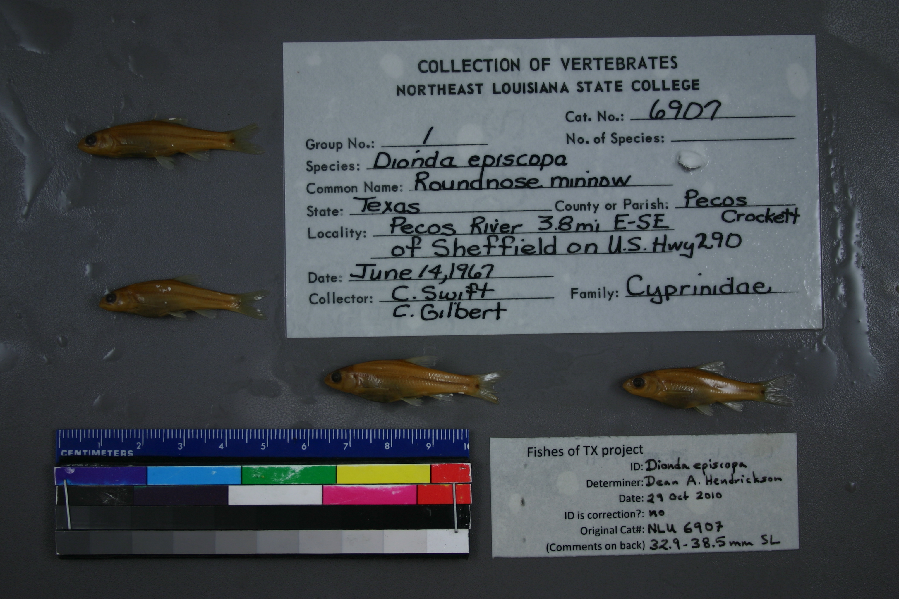
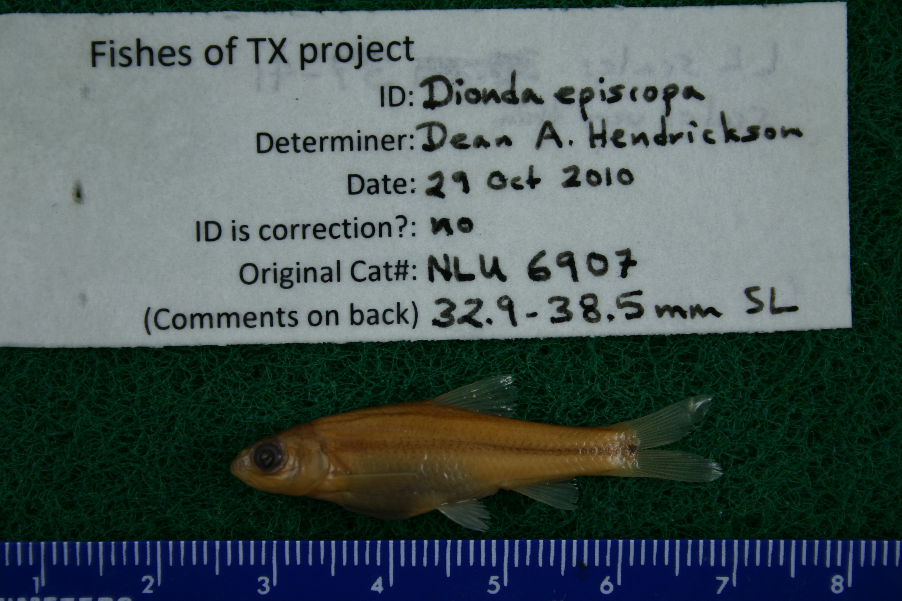
NLU_6907
Not suspect, not examinedPhotos
Map
Location
30.65964° N, 101.77003° W
(± 43.7
m)
Taxonomy
GenusDIONDA
SpeciesEPISCOPA
Collection Event
CollectorC SWIFT C GILBERT
Collected Date1967.6.14
Geography
DrainagePECOS RIVER
CountryUnited States
StateTexas
CountyPecos
LocalityWATERBODYPECOS RIVER,3.8 MI ESE OF SHEFFIELD ON US HWY 290
Record Source
Source
University of Louisiana at Monroe
(type: miscellaneous)
Institution
University of Louisiana at Monroe
(type: university)
Curator
Unknown
Record Added
May 13, 2010
Record Last Modified
June 22, 2022
Data Processing Track
Track 1
From Data Set Received
11/1997 to 05/2006
Identification
Suspect Notes
None
Count
No data
Current Determination
Determiner
Unknown
Determination Date
July 11, 2022
Determination Type
taxonomic adjustment
Identification Comments
Determination found in FoTX database and determined to be the most recent determination. However, since the date of determination is not recorded in the database we hereby assign the date of our determination reconciliation effort, which makes it the most recent determination for this record.
Identification Confidence
Unknown
Previous Determination
Determiner
Dean Hendrickson
Determination Date
Oct. 29, 2010
Determination Type
specimen examination
Identification Comments
ID complete | 32.9-38.5 mm SL; LL scales 37-41; scales fvery thin
Identification Confidence
High
Collecting Event
Collected
June 14, 1967
Collector(s)
Collecting Event ID
6203
Field Notes
There are no field notes available.
Locality
Region
Trans Pecos
Jurisdiction
Pecos, Texas
Name
Pecos River at US 290
Hydrography
Rio Grande Region
Lower Pecos
Lower Pecos
Pecos
Sheffield Draw-Pecos River
130700080604
Captive
no
Locality Photos
No locality photos available.
flag (suspect/examine)
suspect: noexamination: no
date
date_range: 6/14/1967-6/14/1967
collectors
collectors: Swift, Camm C. Gilbert, Carter R.
collectors
collectors: Camm C. Swift, Carter R. Gilbert
date
date_range: 6/14/1967-6/14/1967
staff comment
ID Status: Specimen examined and ID'ed for FoTX projectID Comments: 32.9-38.5 mm SL; LL scales 37-41; scales fvery thinID Confidence: high
georeference
Error: 43.657Locality: Pecos River at US 290Coordinates: 30.65963689;-101.77003286Georeferencer: AECGeographic note: Inland USA Texas
Comments On NLU_6907