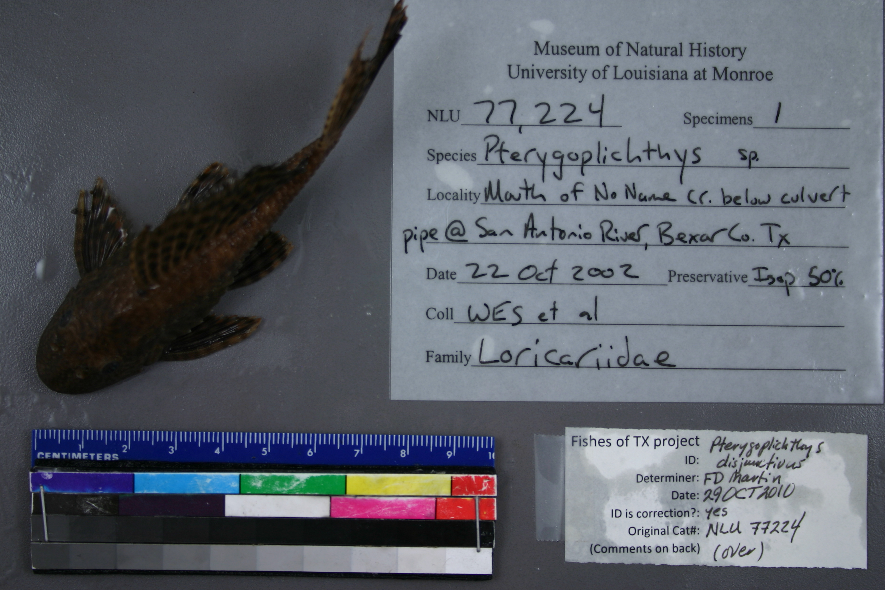
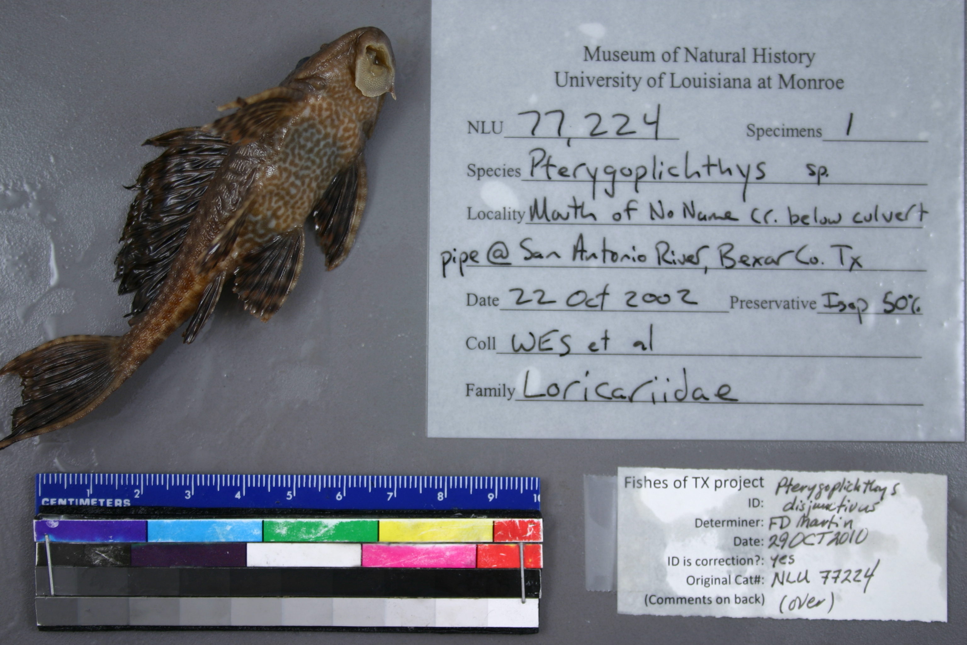
NLU_77224
Not suspect, examinedPhotos
Map
Location
29.33765° N, 98.45813° W
(± 43.5
m)
Taxonomy
GenusPTERYGOPLICHTHYS
SpeciesSP.
Specimen
Num Specimens1
Collection Event
CollectorNHD, SGG, BRL, JJH, CEM, HT, WES
Collected Date2002.10.22
Geography
CountryUnited States
StateTexas
CountyBexar
LocalityWATERBODYSAN ANTONIO RIVER,MOUTH OF NO NAME CREEK BELOW CULVERT PIPE
Record Source
Source
University of Louisiana at Monroe
(type: miscellaneous)
Institution
University of Louisiana at Monroe
(type: university)
Curator
Unknown
Record Added
May 13, 2010
Record Last Modified
June 22, 2022
Data Processing Track
Track 1
From Data Set Received
11/1997 to 05/2006
Identification
Suspect Notes
None
Count
1
Current Determination
Determiner
Floyd Douglas Martin
Determination Date
Oct. 29, 2010
Determination Type
specimen examination
Identification Comments
ID complete | 12 dorsal rays; belly with dark spots forming a vermiculated pattern
Identification Confidence
High
Collecting Event
Collected
Oct. 22, 2002
Collecting Event ID
6244
Field Notes
There are no field notes available.
Locality
Region
Blackland Prairies
Jurisdiction
Bexar, Texas
Name
Mouth of No Name Creek
Hydrography
Texas-Gulf Region
Central Texas Coastal
San Antonio
Upper San Antonio
Headwaters San Antonio River
Salado Creek-San Antonio River
Captive
no
Locality Photos
No locality photos available.
flag (suspect/examine)
suspect: noexamination: yes
date
date_range: 10/22/2002-10/22/2002
collectors
collectors: Douglas, Neil H. S.G.G., B.R.L., JJH, C.E.M., H.T., W.E.S., W.E.L.
collectors
collectors: Neil H. Douglas, S.G.G., B.R.L., JJH, C.E.M., H.T., W.E.S., W.E.L.
date
date_range: 10/22/2002-10/22/2002
staff comment
ID Status: Specimen examined and ID'ed for FoTX projectID Comments: 12 dorsal rays; belly with dark spots forming a vermiculated pattern
Georef Remark: Can't find no Name Creek. Used coordinates provided in locality description from a different record.
ID Confidence: high
georeference
Error: 43.4736240001739
Remarks: Can't find no Name Creek. Used coordinates provided in locality description from a different record.
Locality: Mouth of No Name CreekCoordinates: 29.337647839;-98.458125603Georeferencer: AECGeographic note: Inland USA TexasCan't find no Name Creek. Used coordinates provided in locality description from a different record.
Comments On NLU_77224