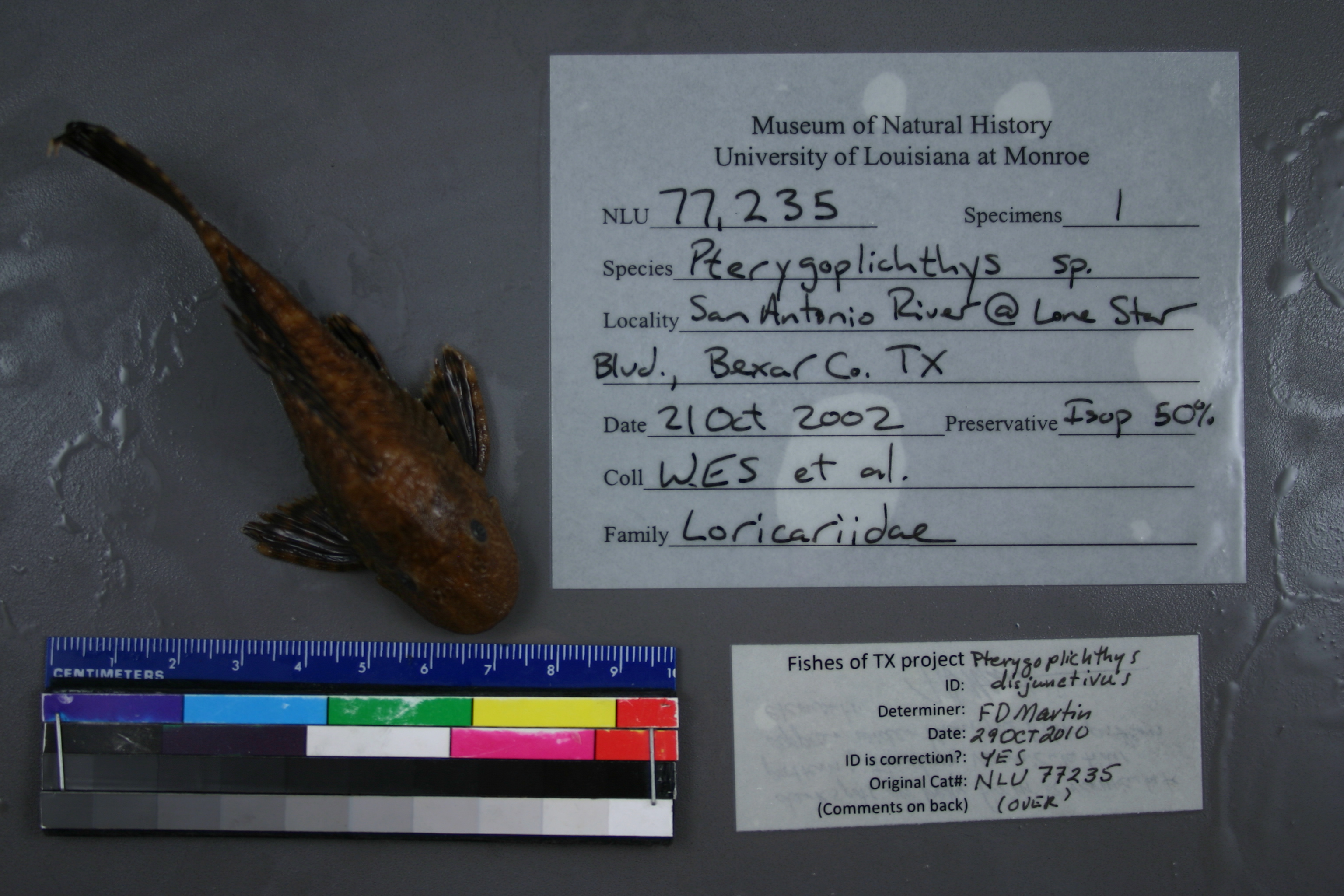
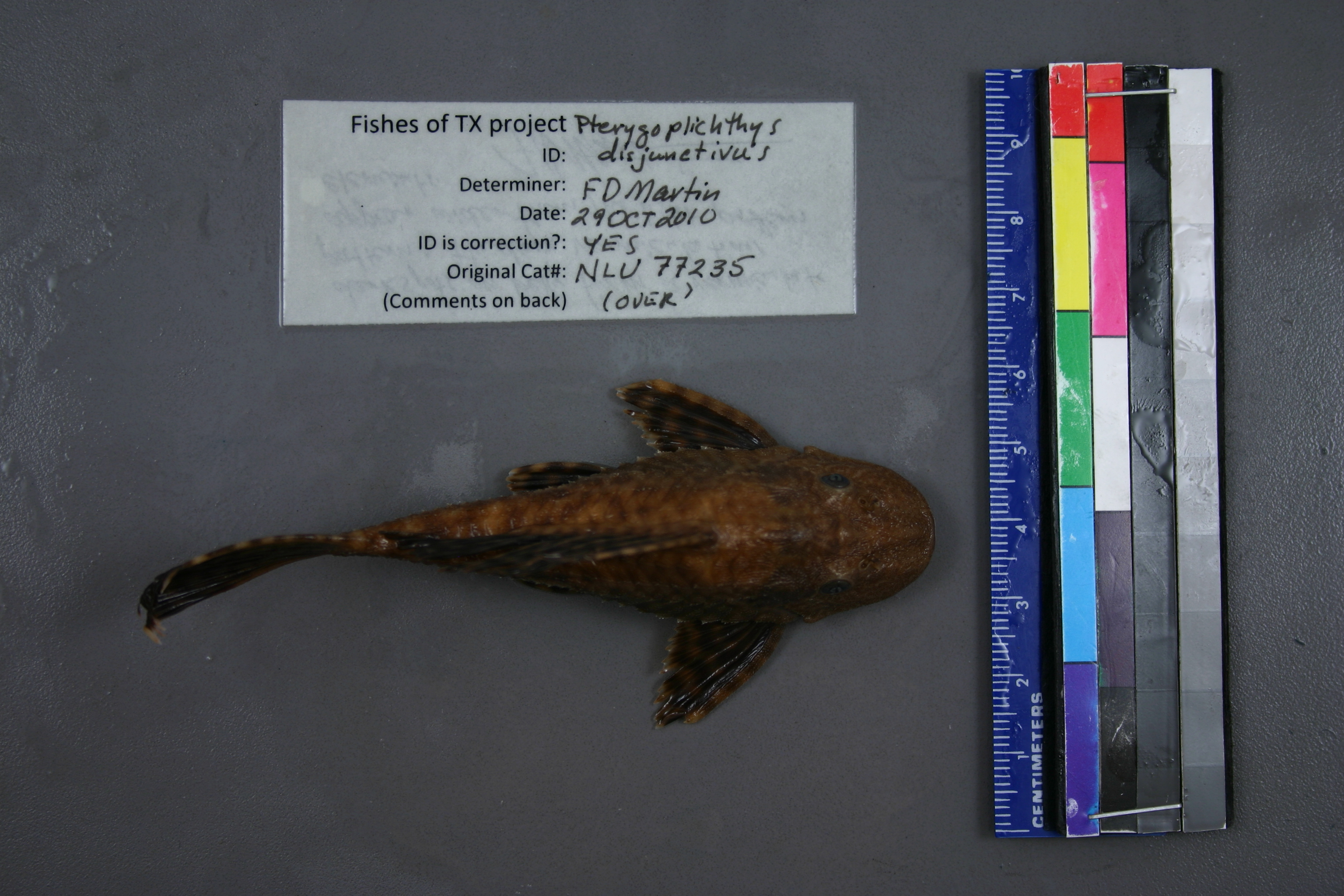
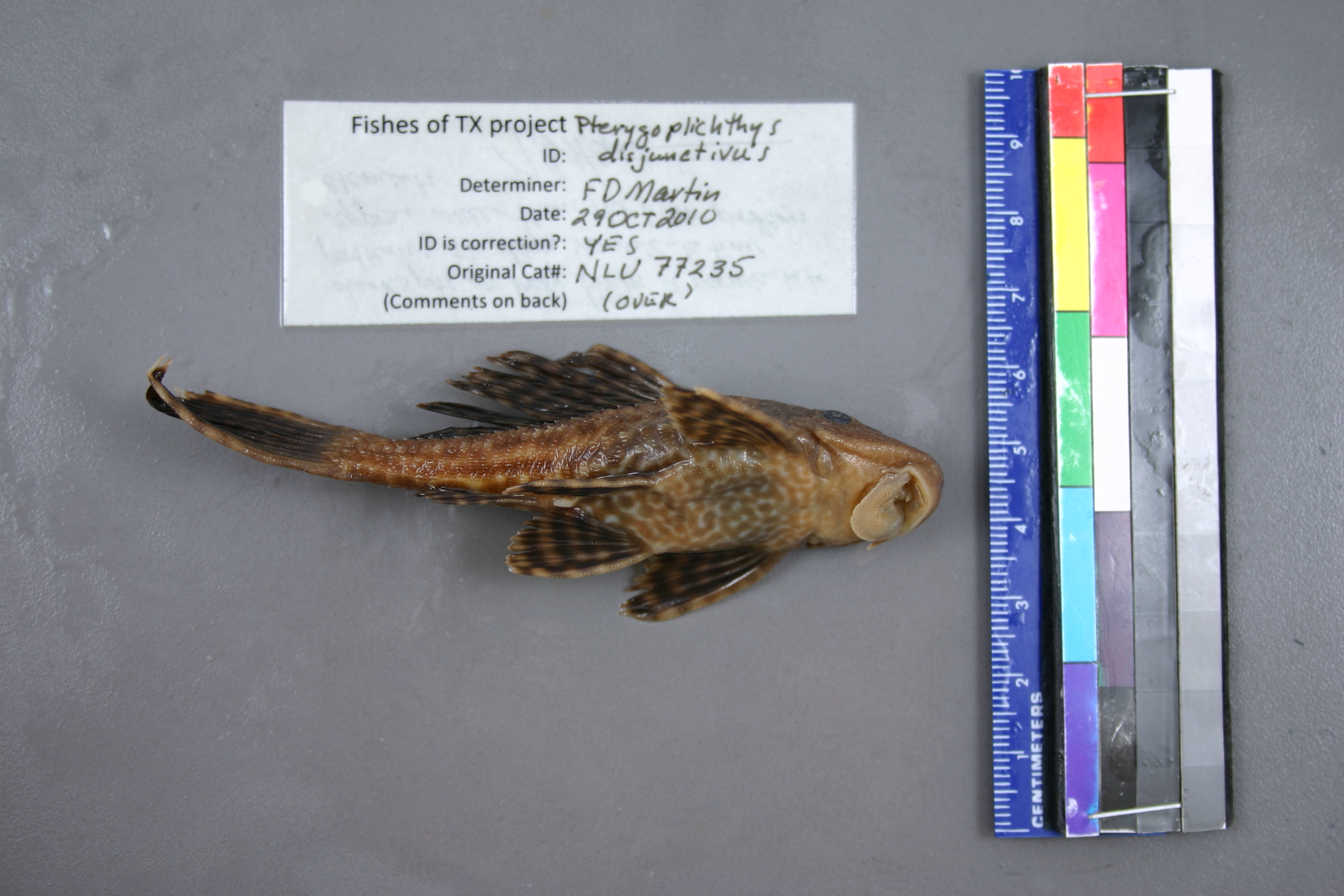
NLU_77235
Not suspect, examinedPhotos
Map
Location
29.40191° N, 98.48785° W
(± 43.7
m)
Taxonomy
GenusPTERYGOPLICHTHYS
SpeciesSP.
Specimen
Num Specimens1
Collection Event
CollectorBRL, SGG, CEM, JJH, WES
Collected Date2002.10.21
Geography
CountryUnited States
StateTexas
CountyBexar
LocalityWATERBODYSAN ANTONIO RIVER,SAN ANTONIO RIVER AT LONE STAR BLVD. (ABOVE WEIRS) 29.40123 N, 98.48890 W
Record Source
Source
University of Louisiana at Monroe
(type: miscellaneous)
Institution
University of Louisiana at Monroe
(type: university)
Curator
Unknown
Record Added
May 13, 2010
Record Last Modified
June 22, 2022
Data Processing Track
Track 1
From Data Set Received
11/1997 to 05/2006
Identification
Suspect Notes
None
Count
1
Current Determination
Determiner
Floyd Douglas Martin
Determination Date
Oct. 29, 2010
Determination Type
specimen examination
Identification Comments
ID complete | dark spots on belly form a vermiculate pattern; the dark vermiculations appear wider than the light pattern elements
Identification Confidence
High
Collecting Event
Collected
Oct. 21, 2002
Collecting Event ID
6246
Field Notes
There are no field notes available.
Locality
Region
Blackland Prairies
Jurisdiction
Bexar, Texas
Name
San Antonio River at Lone Star Blvd.
Hydrography
Texas-Gulf Region
Central Texas Coastal
San Antonio
Upper San Antonio
Headwaters San Antonio River
Olmos Creek-San Antonio River
Captive
no
Locality Photos
No locality photos available.
Comments On NLU_77235